


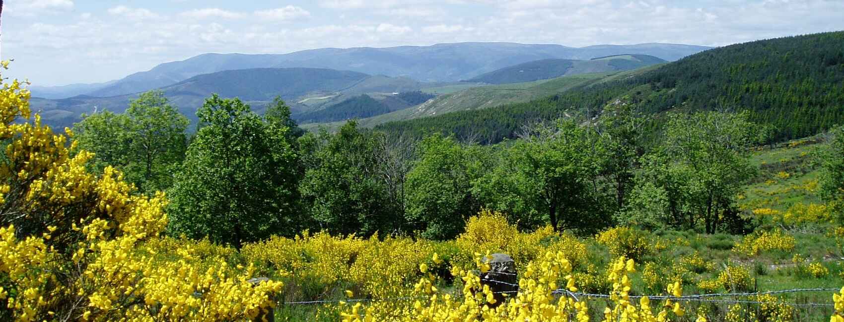
« What other region offers the traveler as many natural beauties, as many lessons from history, and as many chances for peace? » — André Chamson
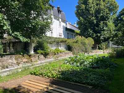
We depart from La Bastide-Puylaurent, perched at an altitude of 1,016 meters, with our starting point at the L'Étoile Guest House. Philippe Papadimitriou always offers a warm, genuine welcome there. The quaint village, peaceful on the banks of the Allier River, slowly fades away as we follow the markers for the GR®7 and GR®72. To the east, these trails would lead us to the Abbey of Notre-Dame-des-Neiges, but we choose to bypass it for now, preferring to carefully save this discovery for our return. We quickly leave the red-and-white markers to climb to the summit of La Felgère, at 1,225 meters. From up there, the panorama opens up towards Luc, our next destination, while the rugged relief of the upcoming stages unfolds in the distance. Captivating perspectives await us.
Our forest path heads east, closely following the ridge to a veritable crossroads of trails. A new view allows us to glimpse the last stages through the relief of the Ardèche mountains, promising both intense efforts and numerous pleasures. We now join the Tour du Tanargue, following its yellow-and-red markers. This path continues to wind under the beeches of Moure de Manibles before descending towards Laveyrune. There, we cross the GR®70, the famous Stevenson Path, which we follow in reverse to our stop.
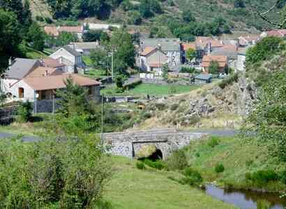
A short paved section takes us through the village and along the D906, winding by the Allier. We quickly leave the road to climb towards Luc, a small village hanging on the valley slope. The place is charming: a beautiful Romanesque church stands in the heart of the hamlet, while the ruins of a medieval castle dominate the hill, overlooked by an imposing statue of the Virgin. It is here that we take a well-deserved break on the sunny terrace overlooking the Allier.
After a hearty meal, we enjoy a leisurely digestion in the tranquility of the Gardille forest, by a charming little lake. We brush past Les Pradels, as dark clouds gather on the horizon, then we cross the deep Langouyrou valley, where a quick descent to the stream is followed by a steep climb to reach the final hill. We finally arrive at the picturesque village of Cheylard-l'Évêque.
As light mists float over the hilltops, a still shy sun makes its appearance, dissipating the memories of yesterday's storm. Can one really tire of these early morning departures, imbued with freshness and promise? We set off, light-hearted, eager for new landscapes...
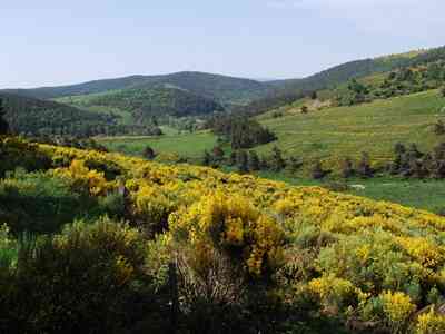
This stage promises a long, hilly forest hike across the Moure de la Gardille and the Montagne du Goulet. Significant elevation changes and vast horizons await us.
We begin with a pleasant and gentle ascent through the vast forest of Mercoire. The trail, from the Valley and Gorges of the Allier, is discreet, yet the route is clear to reach the heather moorland that surrounds Moure de la Gardille, the highest point at 1,503 meters. This summit neighbors the sources of the Allier and the Chassezac, like a natural water tower. We join the GR®7, whose markers will guide us to the next stage.
Now, a long descent allows us to cross the wide plain that borders the Chassezac. Just after Les Chazeaux, the big challenge of the day looms: the ascent to the mountain of Goulet. This final climb is steep but allows us to reach the summit (1,497 m), where we enjoy a moment of tranquility in the heart of the forest. After a busy morning, the afternoon offers us a peaceful stroll on the southern slope of Goulet. We leisurely descend through the undergrowth as September begins its decline on the fireweeds. Before us rises the Lozère massif, our playground for the days to come. Today, we descend into the still fresh Lot Valley to reach Le Bleymard.
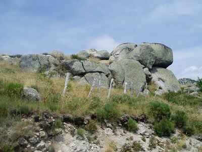
Many regions remain unexplored, so many trails remain unknown. Yet, I never tire of traversing the Massif Central, returning to the wild spaces of Mont Lozère, exploring the ancient drovers' roads (drailles) and trails winding through the Cévennes hills.
This corner of France preserves its identity, its austere soul. Resistance, isn’t that the very nature of the Cévenols? A centuries-old struggle to shape this harsh land and survive; a fierce resistance against the dragoons of Louis XV, the Nazi occupier, and the uniformity of modernism. André Chamson, in L'Esprit des Cévennes, perhaps enlightens us: more than the beauties of nature and the lessons of history, what is offered to us in these valleys and hillsides, on these slopes and summits, is a quality of silence, a chance for peace almost unfindable nowadays. The spirit of the Cévennes is perhaps the conquest of inner serenity amid the tumults of nature and history.
I feel a deep attachment to the high, arid lands of the Causses and those surrounding the Mont Lozère massif: a rugged granite plateau, a labyrinth of valleys, islands of hamlets nestled in the infinite undulations of the ridges. I traversed them in spring, when winter unfurls its last throes; I remember an unexpected awakening in Barre-des-Cévennes, buried under a blanket of snow. I also admired the spring brilliance of gorse and the splendor of carpets of daffodils. More recently, I discovered the decline of summer there, as autumn begins to color the chestnut trees gold.
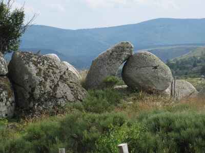
Today, we begin our wanderings in the Mont Lozère massif. A day is enough to make a North-South crossing, but having already done so, we wish to explore this vast mountain from East to West. This morning, we approach it with a circular route: with the GR®44 and GR®68, we follow the foothills of the Lot. The few hamlets become increasingly rare, like Orcières and Lozerette. We cross a ravine, deep and wild, to reach Oultet, perched on the ridge of the cliff, where a few sturdy houses with slate roofs stand proudly. It is better not to get lost here in fog or snow. The end of our stage leads us to the southern slope of the massif. Shortly after the memorial cross of the tragically lovesick shepherd, the path leads us to the hamlet of Les Laubies. An old church, a welcoming inn, and a few houses nestled at the foot of a granite scree await us. On the terrace of the inn, we enjoy an aperitif facing a pastoral landscape, embracing the pyramid of Cham des Bondons and the cliffs of Causse Méjean.
The beautiful weather continues, it is Indian summer at its peak. We therefore resume our way, joyful and light, to frolic on the ridges of Mont Lozère. Leaving Les Laubies, we ascend the southern slope of the massif. A brief forest crossing leads us to the "Route des Chômeurs" (Road of the Unemployed), at the foot of the Roc des Laubies (1,562 m). We make our way through the pastures, in the company of red cows and the wind. Under a blue sky, we walk as a sea of fog engulfs the Tarn Valley below. Soon, we leave the pastoral path to cut through the fields towards the Signal des Laubies (1,657 m). A path marked by modest cairns guides us through the undulations of the mountain, a most pleasant course on the humped back of the massif. I thank the gods of Mont Lozère who have always blessed me with this clear sky.
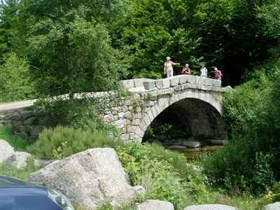
The summit of Finiels (1,699 m) is the highest point of the massif, a natural lookout dominating the valleys and ridges that outline the tormented physiognomy of Lozère. It is not surprising that this department is the least populated in France; it is also not surprising that this desert is a true paradise for hikers! Beyond the band of coniferous forest and clusters of deciduous trees, we discover a fascinating mineral universe. Finiels is just a few steps away, but the landscape there is pleasantly harsh and wild, crushed by the heat. We take a well-deserved break on the edge of the hamlet, in the heart of a granite chaos, between rolled blocks and remnants of monumental erosion.
The path resolutely heads South, weaving between meager pastures where cows are scattered among the rocks. We cross the Rieumalet stream and plunge into its ravine, experiencing its pleasing coolness. There is no rush: the afternoon sparkles and the end of our journey is very near. We only have to descend to Le Pont-de-Montvert, nestled on the banks of the Tarn. The village seems to be entering a languorous late-day sleep.
In Le Pont-de-Montvert, we are truly in Protestant territory. The temple testifies to this: its austere architecture reflects the Cévenol soul, just like the nobility of the wood-carved pulpit, a heavy legacy of the Camisards' spirituality. Neither the king's dragoons nor his galleys have ever been able to uproot the Reformed faith from these hills. This village was indeed the cradle of the Camisard war, which bled and burned the Cévennes in the early 18th century.
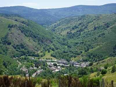
It is here that a group of Protestants, led by Pierre Séguier (nicknamed "Esprit"), assassinated Abbé du Chayla, the leader of the fight against the Reformed faith. However, the royal troops quickly captured the rebel leader. Justice was swift: Pierre Séguier was tried in Florac and executed at Le Pont-de-Montvert, at the foot of the Clock Tower, which still stands proudly near the old bridge.
Here begins a long and magnificent stage, undeniably one of the highlights of our hike. It starts, however, with a stretch of asphalt, but this quiet little road along the Tarn makes for a very pleasant morning warm-up. We quickly leave the D998 to climb towards Le Merlet, thus returning to the stony paths of Mont Lozère. At Felgerolles, we find the markers for GR®72 and begin a rocky ascent through a granite chaos: a setting that is both harsh and profoundly wild.
On the banks of the Tarn, the landscape begins to open up to the vast desert expanse of the southern slope. What follows is a tranquil stroll along the river, now calmed after its spring vigor. The site of Pont du Tarn retains all its romantic charm. The beautiful Romanesque arches of the old bridge span the crystalline waters dotted with granite blocks, evoking the peaceful history of the transhumant shepherds who once stopped there in the benevolent shade of the pines.
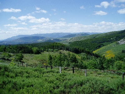
We continue our march eastward. The GR®72 grazes the forest before returning to the stony moorland where the sources of the Tarn spring forth. The hamlet of Bellecoste, in poor condition, silently testifies to the agony of these sturdy granite buildings. The Lozère massif gradually returns to the tranquility of the desert. Even the transhumant herds seem to be scarce here. Yet, a young couple is busy restoring one of the houses, no doubt seeking the solitude of a peaceful summer residence. But as they say, "one swallow does not make a spring!"
The dirt road winds below Pic Cassini (1,680 m), the second highest peak of the massif. We re-enter the forest before reaching Mas de la Barque (1,420 m). The lodging is situated in the heart of a sunny glade, invitingly urging us to enjoy a cold beer. The sandwiches, also generously portioned, prove to be particularly delicious.
The afternoon promises to be quiet: the guidebook indicates 11 km to Villefort (via the Régordane Way GR®700 or Chemin de St-Gilles), at the bottom of the valley, with an 800-meter negative elevation. But beware of hasty judgments! Certainly, we descend through the forest, twirling around until we lose our bearings, but the route also holds some steep climbs, like on this rocky ridge leading to Le Bousquillou (1,115 m).
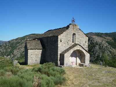
There, we finally leave the cover of the underbrush to regain broad horizons. And what horizons! To the west, Mont Lozère stretches its spine above the meager hamlets. To the east, the Ardèche mountains exhibit their jagged relief, promising days without the slightest boredom. Come on, we have already seen magnificent landscapes. Let’s first relish the pleasure of walking along the panoramic ridge of Plo de la Voulp before finally plunging down towards Villefort.
The night promises to be restless: the next day, the town organizes a hikers' event. The lodging is packed with cheerful walkers noisily celebrating their feats… in advance.
This new day constitutes a transition stage between the Lozère massif and the Vivarais Cévennes. Moreover, a good part of the morning will have no other appeal than the tranquility of the forested hills, contrasting with the close quarters of the lodging. As soon as we exit Villefort, the GR®44 climbs into the forest and lingers there for a long time, without offering the slightest visual escape towards the valleys barely discernible on either side of the ridge.
Let’s be fair: we fully enjoy the shade and coolness of the underbrush, as the sun is still very ardent. Who could complain? The locals, no doubt, overwhelmed by long months of drought!
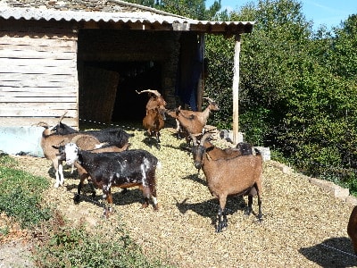
The morning is already well underway when we leave the forest at Croix de la Rousse to tackle the rocky ridge of Serre de Barre. The walking becomes chaotic: we literally scramble over this jagged and bushy ridge. You'd think we had taken to the maquis.
But what a breathtaking landscape awaits us this time!
To the right, the Cévennes ridges undulate infinitely towards Mont Aigoual; to the east, our gaze soars over the Ardèche plateau to the bluish horizon where the profile of Mont Ventoux is drawn. This famous viewpoint allows us to embrace an incredibly vast horizon! We thus treat ourselves to a well-deserved panoramic snack.
At the southern spur of Serre de Barre, we begin a very long descent. The old rocky path, sometimes bordered by low walls, tumbles through the bushes of the slope. A brief pause on the road, and we plunge back towards Brahic, where the hamlet dozes in a peaceful Sunday nap. The beneficial fountain calls to us, and we take refuge for a moment in the cool shadow of the old church with its comb-like steeple.
There are still 300 meters to descend through the rubble to reach Les Vans (crossroads of GR®4, GR®44, and the Le Cévenol trail). Vineyards at the foot of the hills, plane trees lining the streets: no doubt, we are indeed in the South of France (le Midi). The town savors the end of the weekend on its lively terraces. We look a bit "masochistic" carrying our heavy gear like this, but we have treated ourselves to pleasures far more intense than sipping a drink at a table!
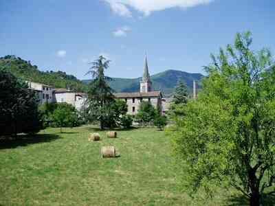
We begin by lingering on the banks of the Chassezac, beyond Chambonas and its elegant castle, then we return to the hills following Le Cévenol. The ascent begins gently, without any brutality. We climb slightly along good paths with a pronounced Mediterranean character, winding along a large ravine, crossing sparse pine underbrush, with some vineyards nestled near the peaceful hamlets we brush by. "Too late for the harvest!" a farmer amicably calls out to us. Yet, a few deliciously sweet bunches have survived for our greatest pleasure.
After Les Aliziers, the trail becomes seriously tougher. The stony paths begin to climb steep wooded hills. Barely have we tumbled down a ravine than we must climb back up vigorously. We chain the ascents only to almost immediately lose the hard-won altitude. In this exhausting roller coaster game, one ends up wondering when we will finally reach the 900 m of the Vivarais Cévenol cornice. We conclude a heavy morning scrambling through the rubble, wedged between dilapidated low walls. The soft rustling of dead chestnut leaves mingles with the sharp clatter of our boots on the stones.
We take our midday break in Saint-Jean-de-Pourcharesse. The small square, serving as a forecourt to the old Romanesque church (also endowed with a beautiful comb-like steeple), will do perfectly. Not a soul in sight. In the neighboring house, the sound of the radio or television drowns out the presence of the occupants: no matter how much we knock on the door and shutters, to no avail. In the end, not the slightest fountain on the horizon to fill up with fresh water! Fortunately, from this terrace, the landscape is much more generous than the inhabitants.
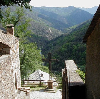
The afternoon reserves another tough piece for us: a new series of roller coasters where the ascent eventually takes precedence over the descent. The old rocky path mercilessly guides us through the bushy hills. At the lost hamlet of Dépoudent (700 m), we still have a solid effort to put in to reach the 865 m of Peyre. The midday sun floods these rocky hills, cruelly stingy with shade. Yet, the striking beauty of the landscape more than compensates for the fatigue: as we descend a path, we literally dive into the scenery, discovering the long spine overlooking the Chassezac ravine—a splendid retrospective look at our previous stage. And suddenly, at the bend of a hairpin, the tiny hamlet of Thines reveals itself, the long-anticipated end of this grueling day. This stage will undoubtedly mark our memories for a long time, with Thines desperately clinging to its rocky spur, sheer above a dizzying ravine.
The hamlet itself? A mere handful of old schist houses with slate roofs, closely clustered around a Romanesque church completely unexpected in this isolated corner of the Ardèche Cévennes.
At the heart of these wild hills stands indeed a pure masterpiece of Romanesque architecture: a perfect harmony of forms and a subtle arrangement of materials, alternating gray, pink, and white stones in an extremely refined mosaic. By what miracle did the builders of the Middle Ages, in the 12th century, manage to construct this work of art in such solitude? Did this lost hamlet once experience significant economic activity to allow the construction of such a religious monument? Today, the place is losing its workforce and its soul, as foreigners buy these old buildings for top dollar, making them inaccessible to the locals. The irremediably closed shutters of the freshly restored homes sink into the long sleep typical of dying villages. How many times have we crossed, on the causses, on the slopes of Mont Lozère, or in the lost valleys of Hérault and Drôme, these sad vestiges of a vanished rural civilization?
This stage will undoubtedly remain engraved in our hiking memories as one of the wettest and most tumultuous we have ever experienced. My memories today boil down to a frantic rush through fog thick enough to cut with a knife, the driving rain drumming heavily on our capes, while the storm resonated its blind fury right above our heads. Instead of the majestic landscapes promised by the guidebook—which proudly claimed the presence of "magnificent views"—I only retained the violence of the elements, brutal but strangely captivating sensations. Was it really reasonable to stroll on this desolate ridge, skirting the tall pylons of a high-voltage line, feet soaked by a torrent of mud, surrounded on all sides by the deluge and sporadically illuminated by lightning? But what else could I do in this immense solitude, with our lodging booked for the evening... and that unfailing streak of recklessness that continues to inhabit us, despite the weight of the years?
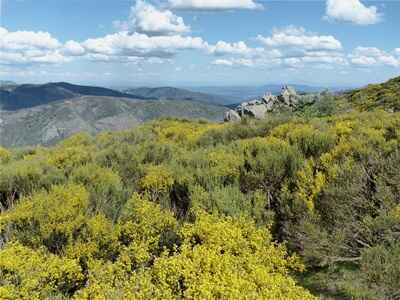
It certainly takes a touch of madness to agree to leave one's cozy cocoon and frolic like this on trails battered by the weather. We were in search of authentic emotions, those raw surprises that modern, sanitized life denies us. Along the way, we crossed paths with a quartet of imprudent souls, also seeking an illusory aquatic escape under the same deluge.
Fortunately, this stage was the shortest of our circuit. I had initially planned a small detour off the beaten path to take the panoramic trail that circles the Prataubériat massif... but ultimately, we wisely decided to stay on the classic route. A bit crazy, certainly, but not completely insane! We thus escaped the worst of the storm's fury, although it did not protect me from one final electric shock: here I am, dripping with water and half-blinded, rushing headlong into an electrified fence at the entrance to Loubaresse. A rather striking sensation, I assure you!
My worried gaze scanned the horizon, searching for a glimmer of hope. The village was drowned in fog, engulfed in a gloomy procession of low clouds. But we’ve seen worse, and the rain fortunately eventually subsided. This heavy sky, where large veils of mist floated, enveloped the moor of the Col de Prataubériat in an uncertain, almost desolate atmosphere.
We then crossed a dense forest leading to Les Chambons. It was at that moment a choice presented itself: should we take the rugged ridge route of the GR®7 or the GR®72, which more wisely follows the Borne valley? Having already been well spoiled with panoramas, and facing still uncertain weather conditions, we opted for the GR®72. A wise choice, as this path quickly proved to be wild and highly picturesque.
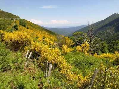
Barely had we traveled a short stretch of asphalt, flanked by thick mulberry bushes—a beautiful green setting concealing a dizzying precipice—when the stony path began to wind along a ravine. Below, the Borne river rumbled, tumultuous, swollen to the brim by the previous day's deluge. The switchbacks descended abruptly into the canyon, offering spectacular views of the torrent at every turn. An old ruined tower even added to the scene, breathing a welcome touch of romance into the decor. The hamlet of Borne, for its part, only prolonged this timeless atmosphere. Only a handful of houses and a few ruins remained, silent witnesses to a past one could guess was glorious. A superb granite porch, discreetly adorned with an enigmatic word and a venerable date, "1667," forcefully recalled these bygone times.
The path then delved under a thick cover of greenery, fording small, agitated streams, tributaries of the Borne, before reaching the impressive ruined houses of Conches. I learned later, during our next stop, that an old lady had clung to these ruins, living there alone until her recent death. But how did these lost souls manage to survive in this environment so rocky and fiercely wild? While our opulent society panics over minor financial trifles, these inhabitants most likely led a rudimentary, laborious existence, hard-won from nature. These paths, which offer us sometimes spectacular changes of scenery, also plunge us deeply into the history of these men and women, prompting our reflection... and, who knows, perhaps our wisdom?
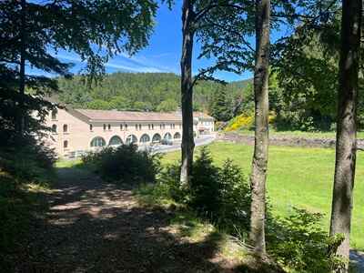
Then, the path led us away from the deep ravine of the Borne, suddenly regaining altitude before dropping sharply towards Saint-Laurent-les-Bains. A pretty town, proud of its small church with bright, modern stained-glass windows. Here, spa-goers flock every year to enjoy the healing virtues of the thermal springs, whose water, naturally bubbling up at 53°C, is reputed to be miraculous against rheumatism. Fortunately, we are not yet in need of such medicines, vastly preferring to apply a well-known hikers' adage: "One day on the trail, eight days of health!" Quickly, upon leaving the town, we faced a positive elevation change of 350 meters to overlook the high tower of Saint-Laurent and finally reach the Croix du Pal. We set a brisk pace, as the thunder grumbled again in the distance and the sky darkened dangerously.
Hurtling down the verdant Rieufrais valley, we reached the Abbey of Notre-Dame-des-Neiges just before the first large drops began to fall.
Founded in the 19th century by courageous Cistercian Trappists, it had to be rebuilt after a terrible fire in 1912. It was in this place that Robert Louis Stevenson stopped during his famous journey through the Cévennes. But it is undoubtedly the figure of Charles de Foucauld that has left the most indelible mark on the history of this abbey. After his novitiate, he was ordained a priest there before embarking for the sands of the Sahara. During the dark hours of the Second World War, the community even heroically sheltered underground operatives, including the famous Robert Schuman. Today, the monks cultivate vines with passion and produce a very decent table wine there, made from grapes bursting with the Mediterranean sun.
Unfortunately, we could not linger at La Trappe: the rain did not seem to be a mere passing shower. It was just the "tail" of the storm, and we still had a good three kilometers left to definitively conclude our final stage. In a flash, we sped at full speed down the Rieufrais valley. L’Étoile was waiting patiently for us, as welcoming and comfortable as ever. Philippe Papadimitriou would undoubtedly be delighted to take us to La Trappe later for a tasting of the wines carefully crafted by the monks. A joyful crowning to beautifully close our great Cévennes adventure! Christian Lalanne