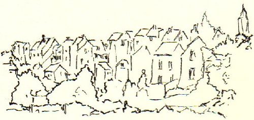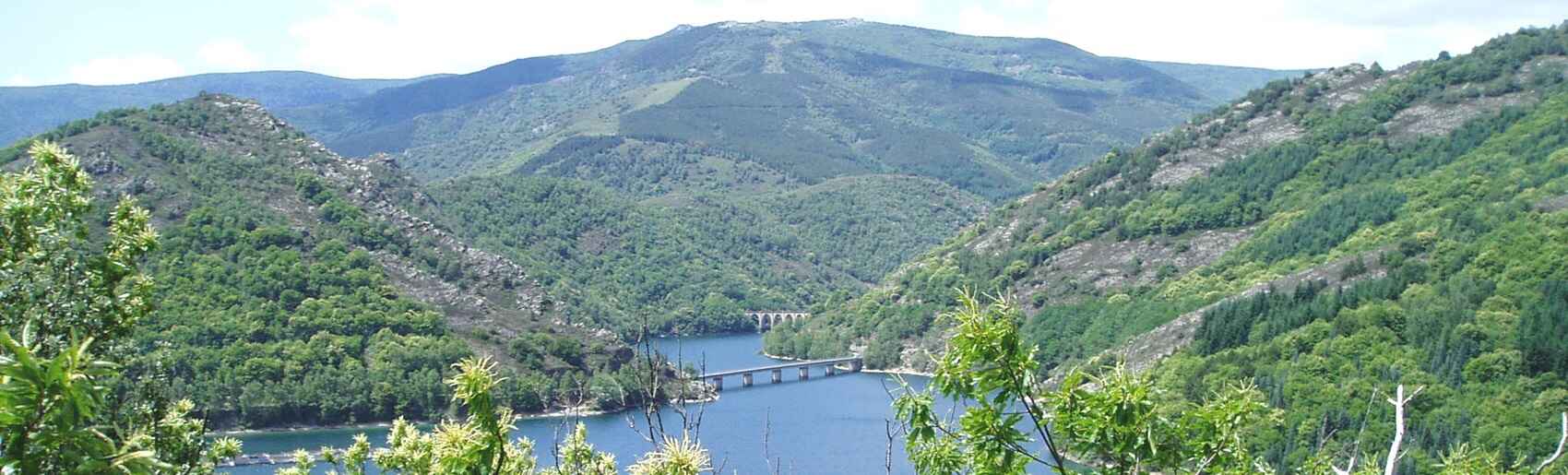
Thanks to its railway station, La Bastide-Puylaurent remains an ideal starting and returning point in northeastern Lozère, right on the Ardèche border. This peaceful holiday resort on the banks of the Allier River is located just 3 km from the Abbey of Notre-Dame-des-Neiges. It sits at the crossroads of several major long-distance hiking trails: the GR®70 (Stevenson Trail), the GR®700 (Voie Régordane), the GR®7, and the GR®72.
Access is made easy by direct trains from Paris via Clermont-Ferrand, and from Marseille via Nîmes on the famous "Cévenol" line. From the village of La Bastide-Puylaurent, we will head due south, following the ancient Route of the Arvernes, better known as the Voie Régordane or Saint-Gilles Trail, which shares its path here with the GR®72.
Along the way, we discover the Palet de Gargantua, a massive stone the legendary giant supposedly threw near the village of Le Thort. In reality, it is the impressive capstone of a dolmen. As for the name of the Voie Régordane, "reg" translates to river, and "ourdan" refers to a line or path. However, it took several centuries for the name "Régordane" to become universally adopted for this ancient route connecting the Languedoc to the Auvergne.
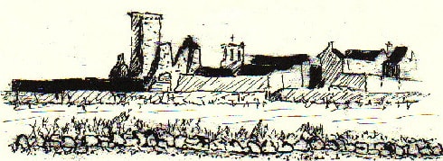
The sky grows vaster, the landscape stretches as far as the eye can see, and the colors become purer. To the east rise the peaks of the Vivarais, while to the west stretch the heights of Mont Lozère and the slopes of Le Goulet. It is a land of striking contrasts: the bright yellow of the broom mingles with the delicate purple of the heather. Soon, La Garde-Guérin appears on the horizon, its sturdy walls and defensive tower standing proudly amidst this wild expanse...
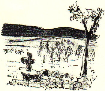
La Garde-Guérin, a small fortified village perched on the moor, stands proudly on the vast plateau. At the entrance to this medieval settlement, a simple stone cross facing the sweeping panorama welcomes the traveler.
A 12th-century document written in Late Latin mentions "castrum quod vocatur la Garda"—the stronghold called La Garde. It is not exactly known when the name Guérin was attached to La Garde. However, it is generally believed that the lords who settled there in the 12th century bore this name. "Guérin" was indeed a common surname among the three baronies of Randon, Apcher, and Tournel.
The existence of the Guérin family is attested in a deed of donation to the Abbey of Gellone (today Saint-Guilhem-le-Désert) dating back to 1054. It was a Guérin from Le Tournel who took charge of this castle, becoming its overlord. The Tournel family was, in fact, solidly established in Villefort and owned land in La Garde.
The Lords of Le Tournel were the masters of Mont Lozère and part of the Causse de Sauveterre. They maintained garrisons at several key strategic points and soon turned their full attention to this unique thoroughfare connecting Southern France to the Massif Central. In those days, travelers avoided the banks of the Rhône, which had always been a heavily guarded border.
The tall square tower is the last remaining vestige of the feudal castle that once dominated the village and the spectacular Chassezac gorges. The Route of the Arvernes, lined with granite blocks, runs right at the foot of La Garde-Guérin. From the 11th century onwards, the village emerged as a highly strategic location where the "parier" knights—equals in rights and duties—shared the castellanies and the lucrative toll revenues from the ancient Voie Régordane.
By 1965, La Garde-Guérin was an almost abandoned village, where only a few farmers struggled to survive. Yet, there was an incredibly rich architectural heritage waiting to be preserved. It was entirely possible to restore this unique village and recreate a thriving economic and social environment. Thanks to the intervention of the Architecture Directorate in Paris, La Garde-Guérin was selected as a pilot village and received significant subsidies for its rehabilitation.
The most beautiful view of La Garde-Guérin is arguably from the Château du Roure. "Everything is very beautiful on this limitless heath, which opens up to the blue mountains"... A true "castle of the soul or inner castle," to borrow the words of Saint Teresa of Ávila.
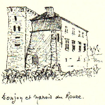
As the crow flies, the Château du Roure is just a stone's throw from La Garde-Guérin. However, they are separated by the deep, jagged, and spectacular Chassezac gorges, whose winding river flows towards the Ardèche.
The region offers numerous opportunities for loop hikes, swimming, canyoning, and climbing. A major tributary of the Ardèche, the Chassezac river carves dizzying granite gorges (up to 400 meters deep) below the medieval village of La Garde-Guérin, right in the heart of the Cévennes National Park, 35 km east of Mende and 40 km west-southwest of Aubenas.
Villefort has been an important market town since the Middle Ages. Nestled at the foot of Mont Lozère at an altitude of 580 meters, it lies in the narrow Devèze valley. In the 17th century, Villefort was still surrounded by ramparts, protective moats, and fortified gates. Among them were the Portalet gate to the north and the Clédon gate to the south, which opened the way toward the Cévennes.
The village was once crossed from end to end by the Régordane path. It has preserved its "Castel-Vieil" district, featuring old houses, 14th and 16th-century windows, the 14th-century Saint-Jean bridge, and many other traces of bygone times. Today, the town is very peaceful, perhaps even a bit sleepy outside the summer season.
The old main street of Villefort perfectly illustrates the characteristic architecture, aptly named "Régordane". Although it belonged to the Diocese of Uzès until the French Revolution, Villefort's history has always been deeply intertwined with that of the Gévaudan. Froidour, a high-ranking official under Colbert, came to inspect the Régordane in 1668. His writings emphasize that Villefort occupied a crucial strategic position between the cities of Alès and Langogne.
The GR®68 trail connects Villefort to Le Bleymard. In the past, this ancient mule track was the primary route from Villefort to Mende, the capital of the Gévaudan. As soon as it leaves Villefort, the path enters Gévaudan territory. Clinging to the foothills of Mont Lozère, it passes through a succession of picturesque hamlets—Bergognon, Pomaret, and others—before finally reaching Cubières.
In Cubières, the Altier—a river that rises on Mont Lozère at an altitude of 1,639 meters—swells the waters of the Chassezac at 350 meters, after tracing numerous meanders. Nestled on the slopes of Mont Lozère, Cubières leads a peaceful existence, paced by the life of its valleys.
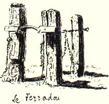
The rural heritage is still very present, as evidenced by the hoof-trimming crush, known as a "ferradou" in Occitan. This ingenious device was used to shoe oxen and cows. Farmers would systematically shoe a pair of cattle accustomed to working together, whether for hauling timber in the forest or for various demanding agricultural tasks. It is a moving testament to a time when agriculture was still largely non-mechanized.
At the foot of Mont Lozère, the vegetation is flourishing: deciduous oaks, elms, and linden trees... Interestingly, due to a changing climate, the Mediterranean holm oak did not grow as close to Mont Lozère in the past as it does today.
Human occupation led to the gradual clearing of the Cévennes starting in the Iron Age, and slightly later on the slopes of Mont Lozère. At the beginning of our era, local populations lost small bronze coins—Arvernian coins—which today allow archaeologists and scholars to reconstruct the names or monograms of Gallic chieftains, such as Epaenactus...
In the Mont Lozère massif, traditional architecture is deeply rooted in the earth, blending harmoniously into the grandiose landscapes and silent hamlets.
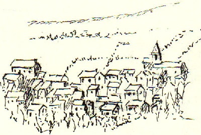
The stone chimney stack is characteristic: capped with a slate roof resting on 4 or 6 pillars, it is itself topped with a heavy stone to withstand the fierce winds. These architectural elements melt into the reflections of old, moss-worn roofs. Over time, the village of Le Bleymard settled in this valley, guarding its entrance.
Le Bleymard stretches along the Combe Sourde stream. It is one of those unspoiled places where travelers, in their growing quest for peace and quiet, will find the simple, authentic joys that nature generously offers.
"From Bleymard, in the afternoon, although it was already late, I set out to conquer a corner of Lozère. A poorly defined, stony cart path guided my steps. I encountered at least half a dozen ox-drawn carts descending from the woods, each loaded with a whole pine tree for winter heating." (Robert Louis Stevenson, Travels with a Donkey in the Cévennes).
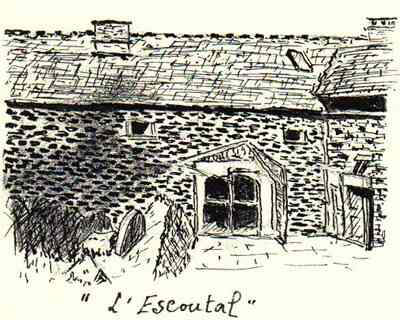
Leaving Le Bleymard—a former mining town of which few visible traces remain today—you climb a winding path through the thick Goulet forest massif, eventually reaching the hamlet of Bonnetès and Nathalie's welcoming hiker's lodge, L'Escoutal.
"Before me opened a shallow valley and, behind, the chain of the Lozère mountains, partially wooded, with fairly rugged slopes, yet overall of a dry and dreary configuration. Hardly any signs of cultivation.
Yet, around Bleymard, the road coming from Villefort via Altier to Bagnols-les-Bains and Mende crossed a series of meadows planted with tall poplars, everywhere resounding with the bells of sheep and herds... If the evening is beautiful and mild, there is nothing better in life than to stroll in front of the Inn's door..." (Robert Louis Stevenson).
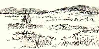
Around Belvezet, the landscape opens up as far as the eye can see onto a succession of mountain ranges and rolling hills... "If you climb a hill, it is only to see new lines of more distant peaks... And now, you must ask yourself if, when all is said and done, you wouldn't be better off sitting at home by the fire and being happy in your thoughts..." (Robert Louis Stevenson).
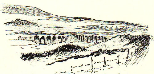
The journey ends at the picturesque Belvezet station, on the railway line connecting Mende to La Bastide-Puylaurent, via Allenc, Belvezet, and Chasseradès. This line is often blocked by snowdrifts in winter, which required the construction of protective snow sheds to ensure the trains' safety. It is an excellent, inexpensive, and highly enjoyable means of transport, truly unique in France. You can also board the train with your bicycle. Be careful, though: for the train to stop, it is absolutely necessary to signal your presence on the platform by waving clearly to the driver. by M. Pasquier