


 In the early 16th century, La Bastide was merely a small hamlet of seven or eight houses nestled on the right bank of the Allier river. In the ancient Gévaudan region, there was a prominent farm inhabited for several centuries by the Bastide family (who, according to some, gave their name to the village), also known as "Trouillas." To the south of La Bastide stood a modest chapel dedicated to Saint-Thomas de la Souche. Today, its historic location is marked only by a rustic cross standing opposite the current cemetery. This chapel was originally built to facilitate the religious practices of travelers walking the rugged Regordane road.
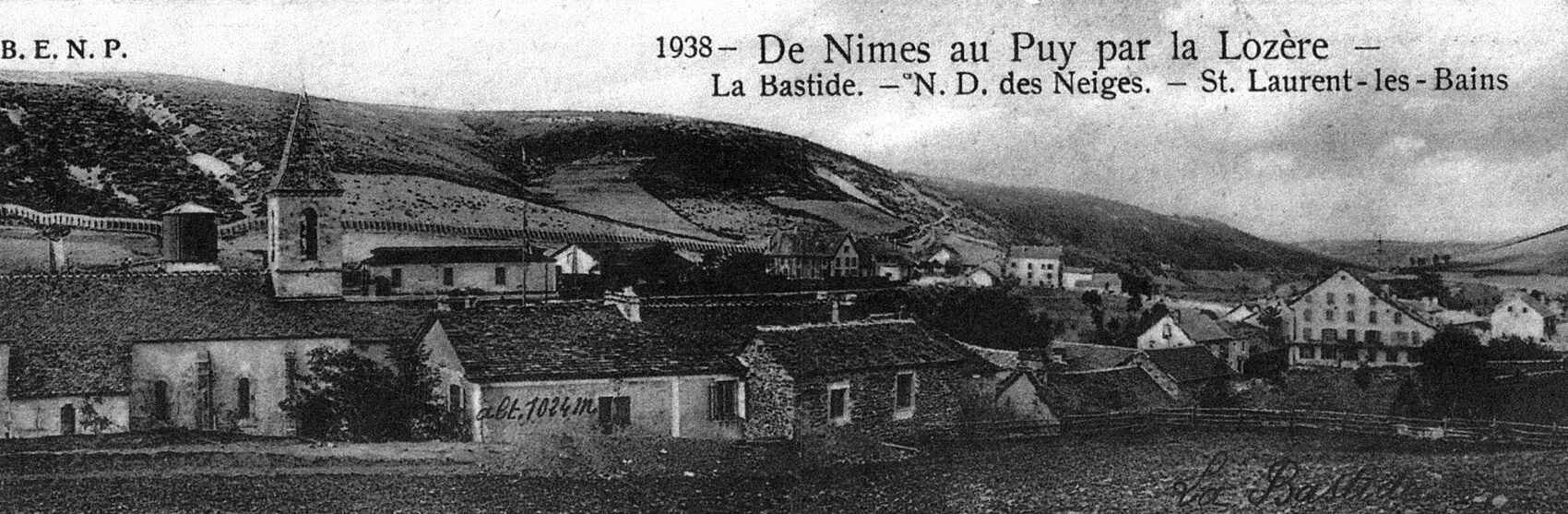
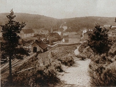
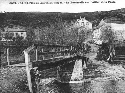
Near La Bastide, tucked within the picturesque Allier valley, one could find the "Métairie des Huttes," and along the valley of the Trappe stream, a few scattered farms and private homes. A welcoming farm-inn bearing the sign "La Grande-Halte" served as an essential relay for weary travelers, devout pilgrims, busy merchants, and transhumant shepherds following the famous Regordane route. The monumental arrival of the railway in 1870, soon followed by the founding of the Notre-Dame-des-Neiges monastery and the growing popularity of the thermal spa at Saint-Laurent-les-Bains, profoundly transformed the village. Evolving from a simple stopover, it blossomed into a delightful mountain tourist resort. Built entirely from scratch over the years, the village's atypical history explains its unique geographical position: resting directly on the border between Occitanie and Auvergne-Rhône-Alpes, bridging the departments of Lozère and Ardèche.
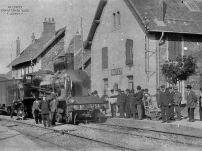
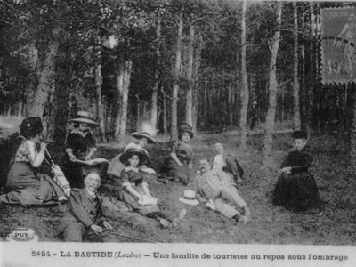
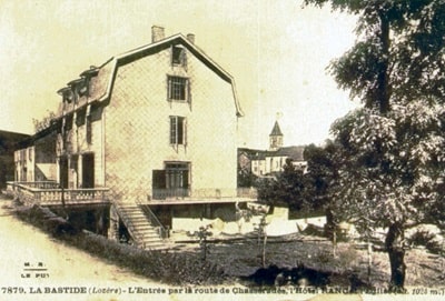 Situated at an altitude of 1,018 meters, La Bastide-Puylaurent (home to 1,289 inhabitants) boasts a well-connected SNCF railway station and regular buses leading to Saint-Laurent-les-Bains (Ardèche). Historically, the village's accommodation included the Hôtel des Pins (30 rooms), the Hôtel du Parc (currently the Maison d'hôtes L'Etoile, with 22 rooms), and the Terminus at the station (20 rooms). As a beloved summer resort frequented by families from the South of France, it sits peacefully by the nascent Allier river, nestled in a valley of lush meadows near the rounded, bald peaks of the Cévennes ridge. These peaks, heavily snow-covered in winter, now provide popular ski fields. Thanks to its significant altitude and unique location on the watershed line, La Bastide continually offers a deeply refreshing escape during the summer months.
Excursions around La Bastide-Puylaurent:
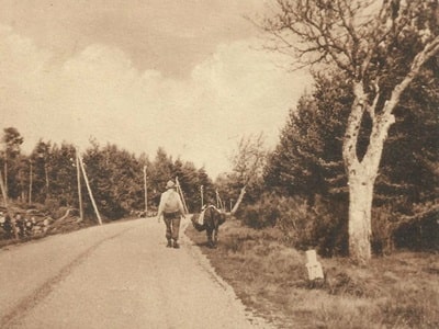
1° Sources of the Allier (to the West; 4 hours 30 minutes on foot). Take the train on the Mende line to the Chasseradès station. From there, a charming path heads northwest, leading in about 1 hour and 15 minutes to the very sources of the Allier, at the foot of the densely wooded slopes of the Moure de la Gardille (1,501 m). The summit can be climbed without difficulty in 45 minutes, rewarding hikers with a breathtaking view of Mont Lozère and the Causses. From the top, one can return directly to La Bastide by following an eastern ridge path at an altitude of 1,300 meters.
2° Palet du Thort (dolmen), located 4 km to the south, accessible via the scenic mountain ridges.
3° Trappe de Notre-Dame-des-Neiges (road 3.5 km East). A quiet path branches off 2.5 km down the road leading to Saint-Laurent-les-Bains and descends beautifully through a thick forest of pines, spruces, and beeches to the monastery (1,110 m). Originally founded in 1850 on the former abbey lands of Chambons, this monastery is nestled in a solitary, deeply peaceful valley whose stream joins the Allier at La Bastide. The monastery was tragically burned down in 1912 but has since been magnificently rebuilt.
 From the monastery, one can walk (3 km) to Saint-Laurent-les-Bains by climbing a gentle valley to the northeast. Passing near the old Felgère farm, travelers reach the Col du Pal and descend eastward, passing just to the left of the ancient ruined tower that overlooks Saint-Laurent-les-Bains.
From La Bastide to Mende (railway 48 km; road 49 km West-Southwest across the Montbel causse). After crossing the Allier, follow the C. 6 road to the left, which gently rises along the upper valley of the river for about 7 km. It then crosses a distinct threshold (at an altitude of 1,175 m) alongside the railway, taking travelers from the upper valley of the Allier directly into the valley of the Chassezac.
In Chasseradès (1,150 m), from where one can easily reach the source of the Allier in 1 hour and 15 minutes, visitors can admire a striking Romanesque church complete with a formidable defensive tower.
The road, steadily climbing towards Belvezet in the upper Chassezac valley, passes dramatically beneath the beautiful Mirandol viaduct. At 12.5 km, a small scenic road branches to the left, climbing through dense woods toward the Montagne du Goulet (1,499 m; 6.5 km to the road's terminus, followed by a 30-minute walk). At 16.5 km, one leaves Saint-Frézal-d'Albuges (featuring a lovely Romanesque church) to the right.
By 17.5 km, travelers reach Belvezet (1,197 m), a small village surrounded by cultivated valleys near the sparkling sources of the Chassezac. From here, an invigorating 1 hour and 33-minute ascent leads to the Moure de la Gardille (1,501 m). The road then continues its ascent onto the vast plateau. At 22.5 km, one enters Montbel (1,224 m, 399 inhabitants), resting squarely on the causse of the same name.
 The sweeping Montbel causse represents a sharp point of Jurassic rock pushed dramatically amidst the ancient, rugged rocks of Gévaudan. It is a causse still in its "first stage," where flowing waters have not yet fully carved out their deep underground galleries and steep canyons, though a few fascinating avens (sinkholes) can be found. Known as the "roof of France," the Montbel causse plays a highly crucial hydrographic role: its waters flow southeast towards the Chassezac and the Rhône, north towards the Allier and the Loire, and west towards the Lot, the Truyère, and the Garonne. This spectacular triple watershed is extended to the northeast and southeast by the Cévennes, and to the northwest by the Plateau du Roi and the rugged Margeride mountains. Characterized by a very harsh climate, its primary resources are pastoral: every year, 50,000 transhumant sheep travel from Languedoc along ancient "drailles" (herding trails) to graze on the fine, short, dry grass of these high plateaus.
West of Montbel, the C. 6 road merges (at 27 km) with the N. 88. At 28 km stands the Col de la Pierre Plantée (1,264 m). From here, Mende is just 22 km further via the N. 88 road.
 From La Bastide-Puylaurent to Les Vans (44 km road Southeast, highly picturesque and rugged; bus service available to Saint-Laurent). One leaves La Bastide via the N. 106 road heading southeast, and at 0.5 km, takes the D. 4 road to the left. This route climbs steadily eastward up the desolate ridges of the Cévennes, dramatically overlooking the deep, plunging ravines of the Borne. It offers magnificent, sweeping views of the wooded chestnut ridges and, far in the distance, the majestic Mont Lozère.
At 2.5 km, a quiet statue of the Virgin gracefully marks the entrance to the path leading to the Trappe de Notre-Dame-des-Neiges on the left. The road continues climbing to a threshold of 1,150 m, before descending for 5 km in large, winding loops deep into the breathtaking Borne valley.
At 8 km lies Saint-Laurent-les-Bains (840 m; buses to La Bastide-Saint-Laurent station; Grand Hôtel des Thermes, open June-Oct, 100 rooms). With 403 inhabitants, this unique thermal spa is tucked tightly into the gorge of a small tributary of the Borne, resting at the bottom of a true chasm, 500 meters deep, directly beneath the high crest of the Cévennes. The crumbling ruins of an ancient square tower crown a steep rock 110 meters above the valley floor. The highly celebrated thermal waters (53°C), naturally rich in sodium bicarbonate, are widely used against rheumatism: the "Grande Source" feeds both a lovely public fountain and the historic thermal establishment, where a true Roman pool still remains.
 From Saint-Laurent-les-Bains, hikers often ascend towards Trépaloup to the north (a 2-hour ascent, 1 hour 15 min descent). Following a traditional mule path to the west, one reaches the high ridge of the Cévennes and follows it northeast. From the summit of Trépaloup (1,408 m), the panorama is utterly spectacular: Mont Lozère, the Mézenc, and on very clear days, the distant Mont Ventoux. A superb circular hike returns via the Borne, following a highly picturesque trail along the very edge of the upper Borne gorges (about 4.5 hours in total).
A wildly beautiful road, 17 km to the east, makes a large detour to the south while hugging the very edge of the Liche-Chaude torrent gorges, elegantly connecting Saint-Laurent to Loubaresse on the road from Puy-en-Velay to Largentières.
Leaving Saint-Laurent-les-Bains, the D. 4 road plunges deep to cross the gorge of the Liche-Chaude torrent before rising sharply through dense, fragrant fir woods. It then descends for a long stretch at a much more moderate slope down the side of the Chassezac, winding through an incredibly wild and nearly deserted area.
At 29 km is Peyre, a crucial junction where one leaves the D. 4 to follow the D. 10 to the right, descending gracefully into the wide Chassezac valley.
At 42.5 km, travelers pass the village of Chambonas to their left. Tucked into a beautiful bend of the Chassezac, it is proudly dominated by a gorgeously restored feudal castle featuring a vast park attributed to Le Nôtre, and a historic Romanesque church containing a beautifully sculpted frieze. Here, the road crosses the Chassezac.
 Beyond La Bastide, the N. 106 road embarks on a winding, magnificent ascent up a high ridge. To the right, travelers can peer deep into the breathtaking valley of the Allier as it plunges westward. It is a truly superb route. The road eventually reaches 1,109 meters in altitude atop the crest of the Cévennes, passing decisively from the Loire basin into the Rhône basin. The descent leads into the valley of the Chassezac, a vital tributary of the Ardèche, which is reached at Prévenchères (850 m). Here, one can admire a beautiful 12th and 15th-century church shaded by a magnificent, ancient lime tree, and a hauntingly ruined castle. The road then faithfully follows the winding meanders of the Chassezac, running daringly along the high cliffs above the gorges where the torrent wildly plunges.
At 85 km lies La Garde-Guérin (875 m), a highly picturesque medieval hamlet perched dramatically at the northern edge of the plateau, dropping almost vertically down to the right bank of the Chassezac: the view is of unparalleled splendor.
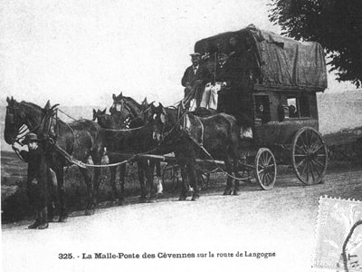
Centuries ago, this was the formidable seat of a highly curious community of twenty-seven noble "peers." Founded by the powerful bishops of Mende, their sworn duty was to officially escort and protect—for a strict toll—the many travelers navigating the GR®700 Voie Regordane. This ancient Gallic and Roman road started in Nîmes, crossed the steep hill of Villefort, passed the old hamlet of Bayard, climbed a very steep ramp, and traversed the windswept plateau known as the Serre des Mulets. Serving primarily as a major transhumance route towards Lozère and Aubrac, it remained the sole, vital line of communication between Languedoc and Auvergne throughout the entirety of the Middle Ages.
Today, La Garde-Guérin beautifully retains the imposing remains of the enclosure that once surrounded its twenty-seven fortified houses. A massive square tower from the ancient 10th and 11th-century castle still stands proudly at 21 meters high, alongside a beautifully restored small Romanesque church. The road, remaining extremely picturesque, now descends while closely following the very edge of the curious La Garde-Guérin plateau. It overlooks the stunning gorges of the Altier before making a wide, sweeping detour to the north to eventually regain its southern heading deep at the bottom of a ravine. Reaching the bottom of this thrilling descent, one emerges directly onto the left bank of the Altier, leaving the N. 101 road to the right—which famously passes beneath the beautiful Bayard viaduct. Standing 72 meters high with two grand levels of arcades, the viaduct carries the historic Nîmes railway line. Turning left, the road crosses the Altier via the elegant Louis-Philippe bridge and plunges through the 200-meter-long Bayard tunnel, bringing travelers safely into the lush valley of Palhères.