Around L'Etoile Guest House |

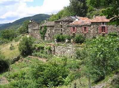
 The Cevennes, located across several departments (Lozere, Gard, Ardeche and a little of Herault), constitute an emblematic mountain range in the south of the Massif Central. These mountains, shaped by centuries of pastoralism and human history, are today protected by the Cevennes National Park, a natural area of rare diversity recognized as a Biosphere Reserve and listed as a UNESCO World Heritage Site for its cultural landscapes of Mediterranean agro-pastoralism.
 The peaks of the Cevennes, although modest in altitude (Mont Lozere peaks at 1,699 meters and Mont Aigoual at 1,567 meters), offer spectacular panoramas. These ridges, often arid and windy, are distinguished by their moors and rocky chaos. The causses, vast limestone plateaus such as the Causse Mejean or the Causse Noir, alternate with deep valleys, sculpted by rivers such as the Tarn and the Jonte. The steep valleys of the Cevennes, crossed by winding rivers such as the Gardon, are home to chestnut forests, cultivated terraces and typical villages. These landscapes tell the story of human work to tame an often harsh environment.
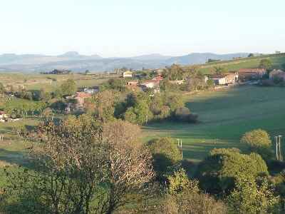
Margeride and Gevaudan, two emblematic regions of the Massif Central, are territories marked by the beauty of their landscapes, the richness of their heritage and the legends that surround them. Located mainly in Lozere, but spilling over into Cantal and Haute-Loire, these lands are distinguished by their rural character and their intimate connection with nature.
Margeride, a vast granite plateau extending between 800 and 1500 meters above sea level, is a wild and preserved region. Its landscapes, alternating pine forests, pastures and granite chaos, offer an ideal serenity for nature lovers. Margeride is a land of breeding, and its culinary specialties reflect its agricultural heritage. Dishes based on beef or lamb, mushrooms, and potatoes, the basic ingredient of aligot, are must-try. Gevaudan, a former historical province mainly corresponding to current Lozere, is best known for the legend of the Beast of Gevaudan.
The Aubrac plateau, located between 1,000 and 1,400 meters above sea level, is the result of ancient volcanic activity and glaciation that shaped its valleys and rocky chaos. This territory is distinguished by its open landscapes, dotted with granite blocks, small glacial lakes and dry stone walls. The vast meadows, used for cattle breeding, are one of the symbols of Aubrac. The seasons magnify this landscape: in winter, the plateau is covered in snow, while in spring, the meadows are tinged with the colors of wild flowers, especially daffodils and jonquils. Summer is marked by the summer pastures, when the Aubrac cows go up to the pastures, and autumn by mysterious mists and golden lights. Aubrac is a paradise for botany lovers, with endemic species such as the yellow gentian and wild daffodils. As for fauna, the plateau is inhabited by birds of prey, deer and, sometimes, wolves from neighboring regions.
 Tanargue, also nicknamed "the mountain of thunder" because of its name of Celtic origin (Tan, thunder, and Argo, mountain), is a mountain range located in the south of Ardeche. At the crossroads of the Cevennes and the Ardeche plateau, this territory is distinguished by its magnificent landscapes, its exceptional biodiversity and its rich cultural heritage. The massif is protected by the Monts d'Ardeche Regional Natural Park. Its particularly rich biodiversity includes a varied fauna (birds of prey, wild boars, deer, otters) and a diverse flora with endemic species.
 Vivarais, a former historical province of the Kingdom of France, today corresponds to part of Ardeche and the south of Haute-Loire. Nestled in the Massif Central, this territory is distinguished by its varied landscapes, ranging from volcanic plateaus to deep gorges, as well as by its rich historical and cultural heritage. It is a place where ancestral traditions, spirituality and unspoiled nature blend together. The Vivarais is dominated by high plateaus, such as the Vivarais-Lignon plateau, shared between the Haute-Loire and the Ardeche. These vast open spaces are punctuated by volcanic peaks, such as Mont Mezenc and Mont Gerbier de Jonc, the source of the Loire, which offer spectacular panoramas.
Forests cover a large part of the territory, with beech, oak and fir forests. On the plateaus, moors and pastures bear witness to pastoral activity. The Vivarais was a major center of the Protestant Reformation. The resistance of the Camisards in the 17th century, particularly in the nearby Cevennes, left a lasting spiritual and cultural mark.
The Allier Gorges, located between Haute-Loire and southern Auvergne, are one of the wildest and most spectacular landscapes in France. Carved by the Allier, one of the last wild rivers in Europe, they offer a diversity of panoramas, ecological richness and a remarkable cultural heritage. This natural setting is a popular destination for outdoor activities, wildlife observation and the discovery of authentic villages. The gorges extend over some sixty kilometers between Langeac and Prades. The river winds through basalt and granite cliffs, forming a deep, sometimes steep-sided canyon where the water has sculpted meanders and natural beaches.
The Chassezac Gorges, located in the south of France, are a spectacular and popular natural site, particularly in the Ardeche region. They are formed by the Chassezac River, a tributary of the Rhône, which winds through varied and impressive landscapes. The Chassezac Gorges are located mainly in the departments of Ardeche and Lozere. They extend over approximately 10 km, surrounded by limestone cliffs that can reach several dozen meters high. These gorges are surrounded by impressive rock formations, Mediterranean forests, and vegetation typical of the region, offering remarkable biodiversity.
Former holiday hotel with a garden along the Allier, L'Etoile Guest House is located in La Bastide-Puylaurent between Lozere, Ardeche, and the Cevennes in the mountains of Southern France. At the crossroads of GR®7, GR®70 Stevenson Path, GR®72, GR®700 Regordane Way, GR®470 Allier River springs and gorges, GRP® Cevenol, Ardechoise Mountains, Margeride. Numerous loop trails for hiking and one-day biking excursions. Ideal for a relaxing and hiking getaway.
Copyright©etoile.fr