


From L'Etoile, head toward the village center and follow the signs for Villefort straight ahead until you reach the Pradillou roundabout. Turn right and follow the D906 for 800 meters. Take the old abandoned road on your left for 5.7 km. Rejoin the D906 and follow it for 2.7 km. Turn left and follow this small road for 11.2 km through Planchamp and up to Pantostier. Turn left onto the D151 and ascend back to La Bastide-Puylaurent via Les Baumes, the Roujanel dam, Chalbos, and Alzons.
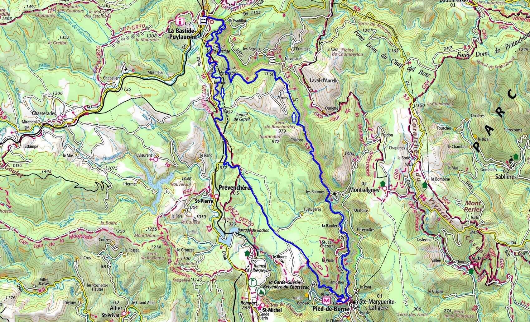
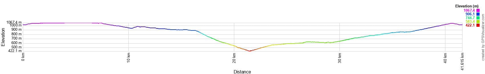
 Distance: 41.5 km
Maximum altitude: 1,086 m
Minimum altitude: 396 m
Total elevation gain: 1,321 m
IGN Maps: La Bastide-Puylaurent (2738E). Largentière, La Bastide-Puylaurent, Vivarais Cévenol (2838OT).
Print the route - Electric bike rental
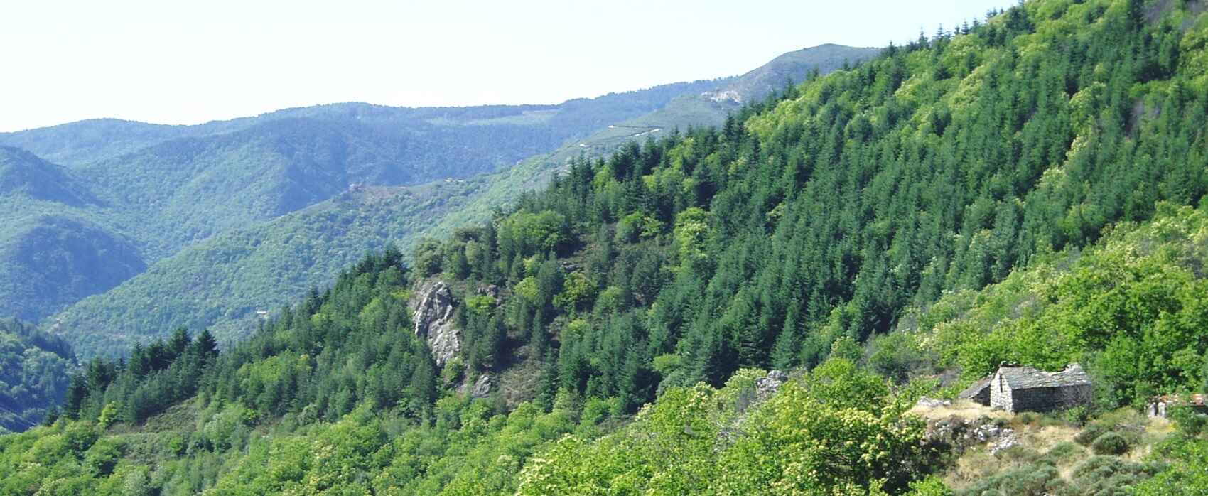
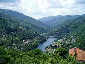
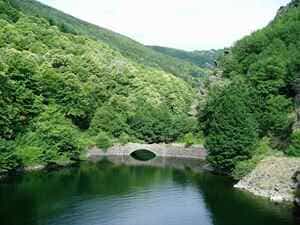
Nestled within the Mont Lozère massif, the Borne Valley is renowned for its steep gorges carved by the Borne River. The contrast between the sheer granite cliffs and the lush vegetation is striking. The river's elevation varies between 305 and 550 meters above sea level, while the surrounding plateau rises to around 1,000 meters. This granite massif boasts a unique geological history: it was separated from Mont Lozère by the Villefort fault, a major seismic event dating back 305 million years. This north-south fault created an exceptional landscape characterized by rugged terrain and impressive rock formations.
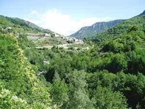
Historically, the Borne and Chassezac rivers separated the Vivarais region from Gévaudan. The hamlet of Pied-de-Borne was elevated to the status of a commune on September 29, 1964, following the merger of the Balmelles, Planchamp, and Saint-Jean-Chazorne municipalities during the hydroelectric development of the Chassezac. The deep Chassezac gorges are carved into the granite for over 4 km in a northwesterly direction up to La Garde-Guérin. Planchamp sits on a hillside overlooking the Chassezac, 9 km northeast of Villefort, and is home to the modern Barrot castle. Odilon Barrot was a prominent lawyer and politician during the Second Republic and the Second Empire. Nearby, the Sainte-Madeleine chapel rests on a rocky spur within a protected site. Pied-de-Borne lies at the confluence of three magnificent rivers: the Altier, the Borne, and the Chassezac.
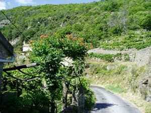
The construction of irrigation channels—particularly in the 18th century—and terraced farming (known locally as bancels) bear witness to a long agricultural heritage. The varied topography, featuring steep, rocky mountain slopes alongside the more uniform Roure plateau, gives the landscape a colorful patchwork of crops. The primary harvests remain cherries and chestnuts; the famous 'Sardoune' from La Borne is a delicious chestnut variety marketed by Fariborne, a local producers' cooperative that recently opened a new processing workshop in the commune.
This highly diverse environment features ancient beech forests, tall-herb mountain meadows (megaphorbs), rocky outcrops, purgative broom moorlands, and numerous watercourses. Along these streams, one can spot a rare dragonfly: the bidentate water strider (Cordulegaster bidentata), which is present in very small numbers in Ardèche and largely confined to the Ligne valley. While the local fauna remains somewhat under-documented, the flora and forest habitats have been thoroughly surveyed, revealing the presence of fascinating ecosystems and rare plants. The upper Borne valley is particularly unique due to its rugged relief and rich birdlife, encompassing the Bois de Bouquet.
These gorges, defined by their rugged terrain and numerous cliffs, are inhabited by birds of prey such as the peregrine falcon and the Eurasian eagle-owl. They also serve as a wintering site for the Alpine accentor and the wallcreeper, while the golden eagle occasionally nests here. The right bank is kept clear by pastoral farming and enjoys a warm microclimate (where daffodils bloom as early as February), whereas the opposite slope is covered by a climax beech-fir forest—an ecosystem that has reached its ultimate natural balance with the soil and climate, regenerating itself perpetually. This forest harbors subalpine botanical zones featuring remarkable plants like the Selaginella clubmoss and the clasping-leaved Streptopus.
Here, the silver fir rubs shoulders with the chestnut tree, which bears fruit at altitudes up to 950 meters. However, the peregrine falcon, Eurasian eagle-owl, and wallcreeper ignore these botanical contrasts, soaring freely across both slopes. The steep Pratazanier stream is as fascinating for its flora as it is for its fauna. An ancient beech grove shelters a patch of yellow Gagea, while the Ron Corbier cliff is frequented by rock-dwelling birds. The geographical orientation of the middle Borne valley, flowing from North/North-East to South/South-West, creates a distinct wooded environment where the geological transition from gneiss to schist plays a crucial role. In the absence of silver firs, and despite the conifer plantations covering the rocky inclines, beech forests thrive on the cooler slopes, oak woodlands colonize the sunnier sides, and chestnut groves dominate the valley floors.