


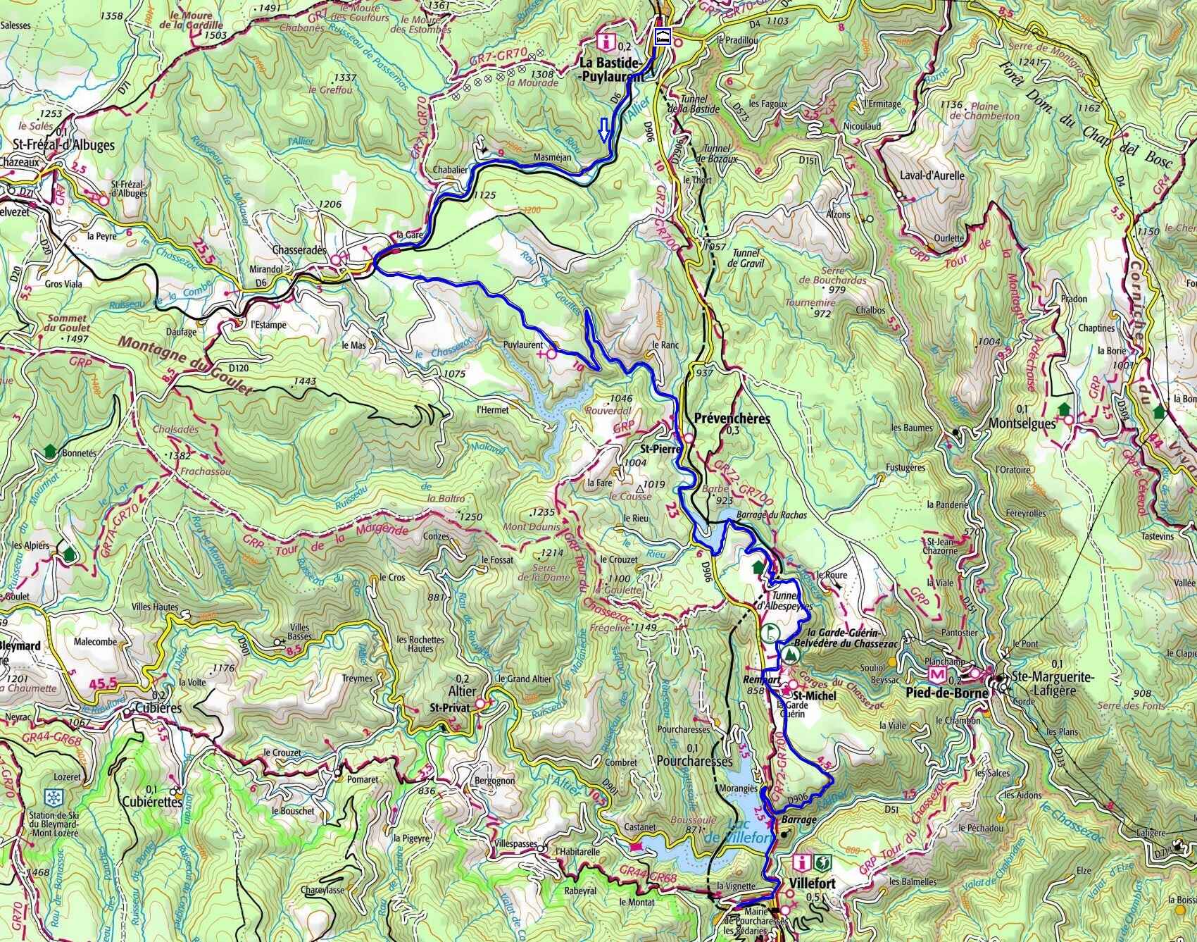
Take the D6 road along the Allier River via Les Huttes, Masméjean, the Château de Chabaleyret, Chabalier, and the Chasseradès train station. Continue 500 meters further, turn left, cross the railway tracks, and follow this small road for 10.3 km to Prévenchères via Grossefage and Puylaurent. Turn right onto the D906 and follow it for 3.2 km. Just after the Rachas dam, take a left toward Albespeyres via the greenway to La Garde-Guérin, located 6 km away. Rejoin the D906 and follow it all the way to Villefort. Take the street heading uphill on the right toward the train station. Return to La Bastide-Puylaurent by train (Train schedules).
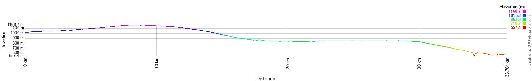


 Distance: 37 km
Maximum altitude: 1,162 m
Minimum altitude: 574 m
Total elevation gain: 491 m
IGN Maps: La Bastide-Puylaurent (2738E). Mont Lozère Florac PN des Cévennes (2739OT). Largentière, La Bastide-Puylaurent, Vivarais Cévenol (2838OT).
Print the route - Electric bike rental
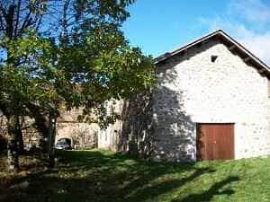
Is it Puylaurent or Saint-Laurent-du-Fraisse? Both names appear in ancient records, perhaps with a slight preference for Podium Laurentii. Over the centuries, Celts, Gauls, Romans, and Franks have all left their mark on the area. Closer to our era, various authorities succeeded or overlapped one another: the distant King, the Bishop, and powerful lords such as Randon de Châteauneuf, followed by Randon de Luc (who later became the Polignacs), and eventually the Morangies. A castle once existed here and is mentioned as early as 1265. By the 1600s, only the ruins of a tower remained. A priory of Benedictine monks, a branch of the great Abbey of Saint-Gilles, was established in Prévenchères, to which the modest priory of Puylaurent was attached. These lasting ties between the two parishes have profoundly shaped their history. After serving as an independent parish for a millennium and later as the center of a commune, Puylaurent is today a peaceful hamlet within the municipality of La Bastide-Puylaurent.
In the heart of these sun-drenched valleys, where the blue periwinkle blooms, lies Prévenchères—a verdant haven with Celtic roots. In ancient times, our ancestors believed the delicate periwinkle possessed healing powers, seeing a touch of magic in its azure petals. Trade along the Regordane Way was a vital pillar of the medieval economy. This historic route served as a major commercial artery between the north and south of France, facilitating the trade of wool, leather, salt, and spices. Positioned strategically on this route, Prévenchères was an essential crossing point for merchants. The region thrived on the economic activity and cultural exchanges generated by this steady flow of goods. Relays and inns provided merchants a place to rest, trade their wares, and exchange news and ideas.
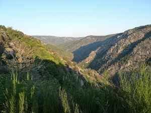
The Chassezac is a river that carves its way through the departments of Lozère, Gard, and Ardèche over a length of 84.6 kilometers. It originates in Lozère, about 20 km east of Mende, on the western flank of the Moure de la Gardille (1,503 m) in the Margeride mountains, within the commune of Saint-Frézal-d'Albuges. Its source lies near that of the Allier River, which flows toward the Atlantic from the eastern flank of the same mountain. The Chassezac initially flows southward, winding through Saint-Frézal-d'Albuges in a wide loop. It then forms the southern border with Belvezet for about 2.6 kilometers before adopting a general southeasterly course that it maintains until its confluence. Downstream, it crosses the communes of Chasseradès, Prévenchères, and Puylaurent. The impressive Mirandol railway viaduct stands just upstream of Chasseradès. Further along, the river meets the Puylaurent hydroelectric dam, shared by the communes of Prévenchères and La Bastide-Puylaurent. Its reservoir splits into two branches: the Chassezac arm arriving from the northwest, and the Malaval stream arm flowing from the south, located entirely within Prévenchères.
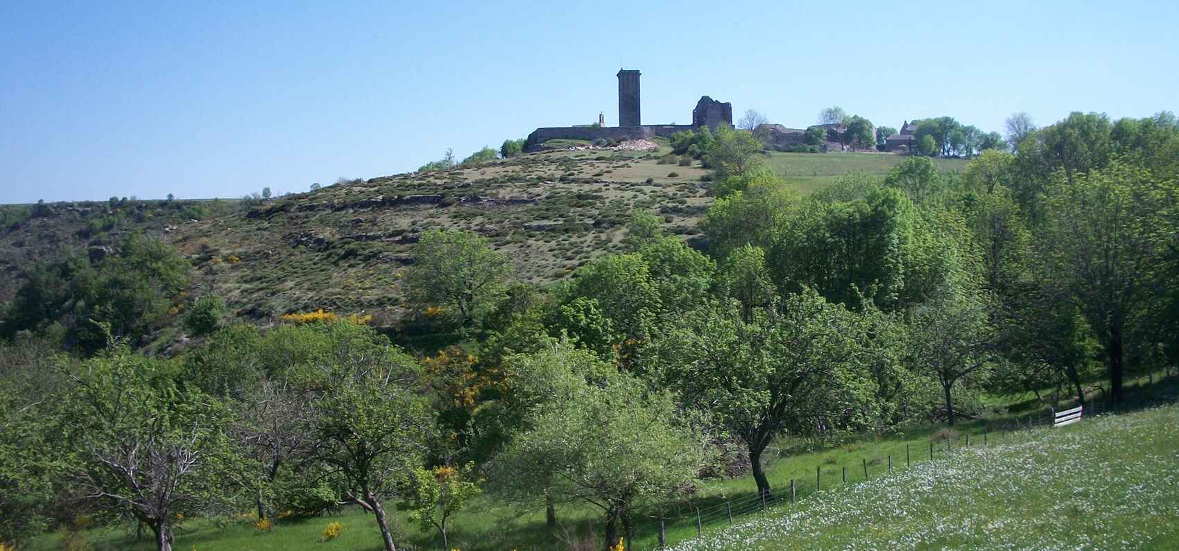
La Garde-Guérin is a remarkable fortified village in the Lozère department of the Occitanie region. Perched on a rocky plateau in a spectacular setting, it is one of the most captivating villages to explore in the Cévennes National Park. The village is traversed by the Regordane Way (GR®700), a historic and heavily traveled medieval route linking the Massif Central to the Mediterranean. Originally, this path was simply known as l'Estrade (from the Occitan estrada, meaning "main road", derived from the Latin strata). In the 12th century, at the behest of the Bishop of Mende, the village was established as a border post defended by a garrison tasked with ensuring the safety of travelers and goods along the Regordane. Throughout the 13th century, it was known simply as La Garde; the name Guérin did not appear until 1298. The fortified village, or castrum of La Garde, was held in co-seigneury by a community of knights known as les Pariers (Occitan for "the Equals", from the Latin pares). This economic and military brotherhood, inspired by the schools of chivalry flourishing in France from the 12th century onward, swore allegiance to the Bishop of Mende. Each parier owned a share, or parerie, for which he was responsible and from which he collected revenues: tolls, cartelage (a tax on grain measurement), fees for guiding and protecting travelers and goods, and pulvérage (a tax on the dust raised by passing herds).