


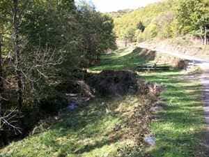
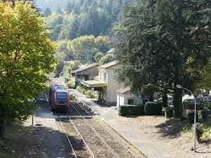
Take the D6 road along the Allier River, passing through Les Huttes, Masméjean, the Château de Chabaleyret, Chabalier, and the Chasseradès train station. Continue for 500 meters, turn left across the railway tracks, and follow this small road for 10.3 km to Prévenchères, passing through Grossefage and Puylaurent. Turn right onto the D906 and follow it for 3.2 km. Just after the Rachas dam, take a left toward Albespeyres via the greenway to La Garde-Guérin, 6 km away. Rejoin the D906 and follow it to Villefort. Ride through the town and head up to the roundabout. Take the D51 toward Saint-André-Capcèze, Vielvic, and Le Martinet. Turn right onto the D155 up to the Col de la Banlève, where you will reconnect with the D906 leading to Génolhac. The train station is located on the far side of the town. Return to La Bastide-Puylaurent by train (Train schedules).
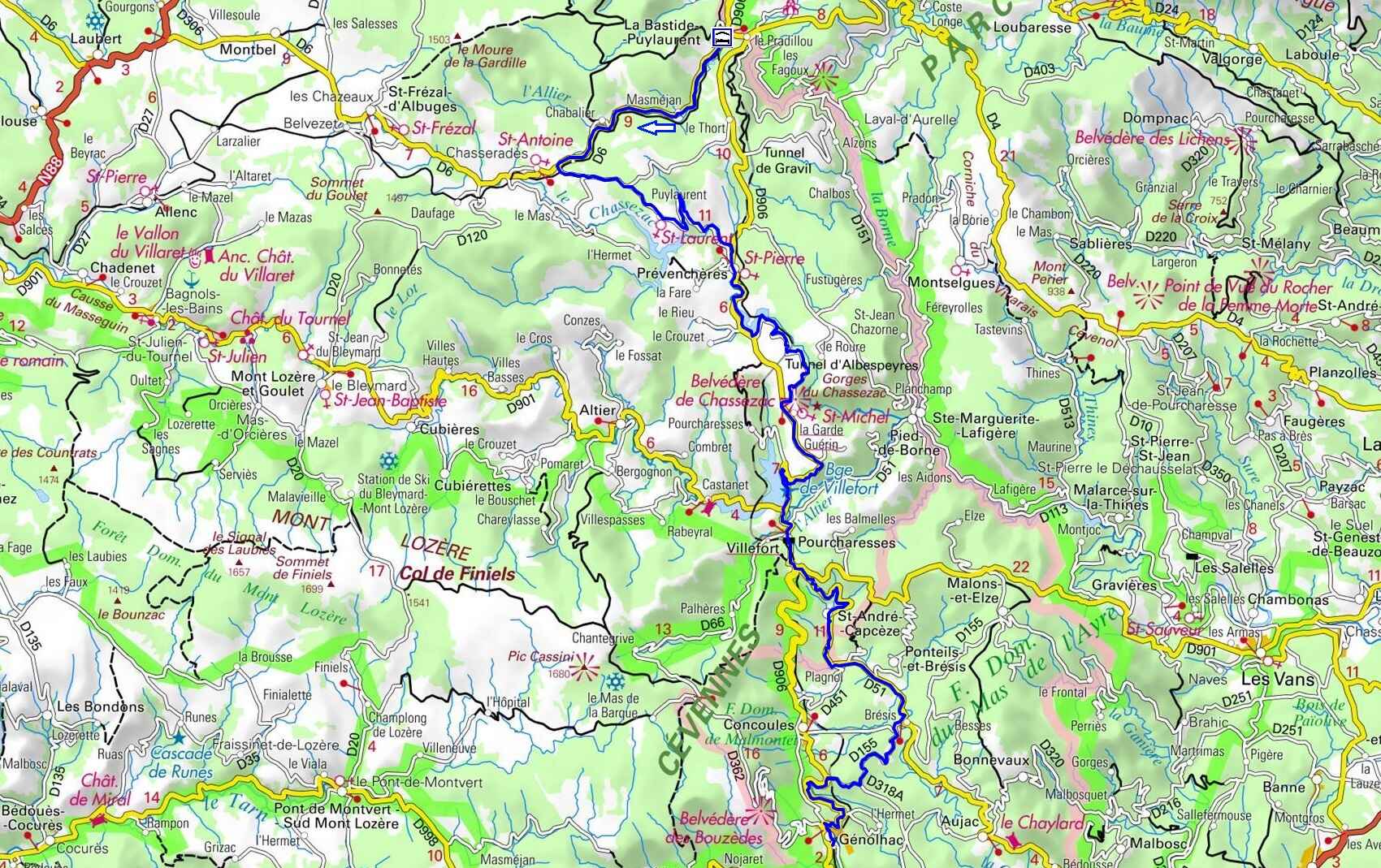
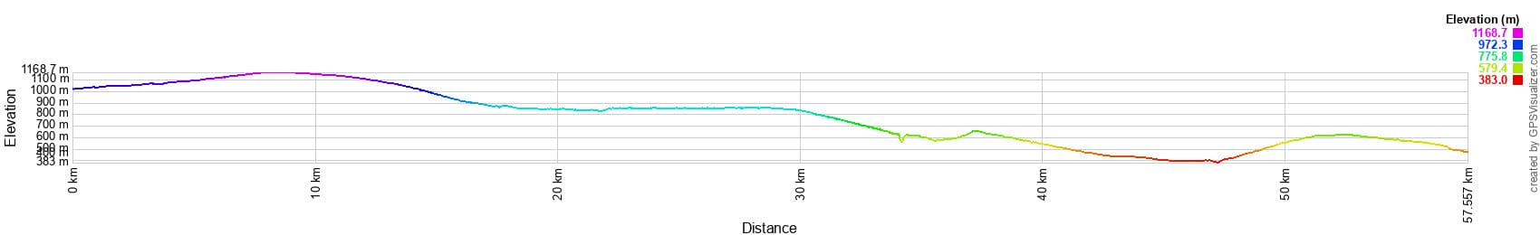
 Distance: 57.5 km. Maximum altitude: 1,172 m. Minimum altitude: 383 m. Total elevation gain: 829 m.
IGN Maps: La Bastide-Puylaurent (2738E). Mont Lozère Florac PN des Cévennes (2739OT). Largentière, La Bastide-Puylaurent, Vivarais Cévenol (2838OT). Bessèges Les Vans Vallée du Chassezac (2839OT).
Print the route - Electric bike rental
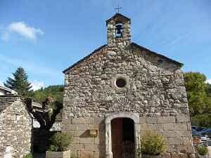
La Garde-Guérin is a remarkable fortified village in the Lozère department of the Occitanie region. Perched on a rocky plateau in a spectacular setting, it is one of the most captivating villages to explore in the Cévennes National Park. The village is traversed by the Regordane Way (GR®700), a historic and heavily traveled medieval route linking the Massif Central to the Mediterranean. Originally, this path was simply known as l'Estrade (from the Occitan estrada, meaning "main road", derived from the Latin strata). In the 12th century, at the behest of the Bishop of Mende, the village was established as a border post defended by a garrison tasked with ensuring the safety of travelers and goods along the Regordane. Throughout the 13th century, it was known simply as La Garde; the name Guérin did not appear until 1298. The fortified village, or castrum of La Garde, was held in co-seigneury by a community of knights known as les Pariers (Occitan for "the Equals", from the Latin pares). This economic and military brotherhood, inspired by the schools of chivalry flourishing in France from the 12th century onward, swore allegiance to the Bishop of Mende. Each parier owned a share, or parerie, for which he was responsible and from which he collected revenues: tolls, cartelage (a tax on grain measurement), fees for guiding and protecting travelers and goods, and pulvérage (a tax on the dust raised by passing herds).
Situated on the ancient Regordane Way, Villefort was once a stronghold of the Châteauneuf-de-Randon family, and later the barons of Tournel. As a vital crossroads, the town was fiercely contested during the French Wars of Religion. It oscillated between Protestant and Catholic control, frequently ransomed by one side or the other. Its close proximity to Mont Lozère made it the northernmost bastion of the Camisards. The architecture in Villefort's historic center is highly characteristic of the region. Many houses feature double-vaulted porches that once served as inns or merchants' workshops—one arch was used to store goods, while the other displayed them. The intricately sculpted lintels above doorways on Rue de l'Église and Rue de la Bourgade offer glimpses into the past lives of their inhabitants, and beautiful mullioned windows from the Renaissance era still adorn several facades.
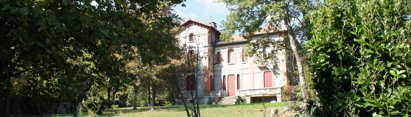
In the heart of Lozère, nestled within the lush, green folds of Pourcharesses, stands the Château de Castanet, a stunning 16th-century architectural jewel. Its history is deeply intertwined with the French countryside, where ancient chestnut trees reign supreme and seem to whisper secrets of the past. Perched on a promontory, the castle overlooks the Villefort region, an area that historically slipped from the grasp of Gévaudan to place itself under the protection of the Bishopric of Uzès. The lords of Castanet, whose lands stretched all the way to La Garde-Guérin, swore allegiance to the Bishop of Mende. The Castanet estate—named after the Occitan word for chestnut tree, chataîgner—served as a crucial resting place for pilgrims crossing the Massif Central via the Regordane Way to reach the Abbey of Saint-Gilles. It also formed a vital link between Mende and Villefort along the Soteirana route, winding gracefully through the Lot and Altier valleys.
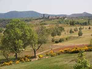
During the Belle Époque, vacationing in Génolhac became a highly popular pursuit for city dwellers seeking nature and tranquility. Situated in the heart of the Cévennes, the town provided an idyllic holiday setting with its mountainous landscapes, flowing rivers, and dense forests. Visitors could stay in grand hotels, charming guesthouses, or rent quaint holiday cottages. A variety of outdoor activities were available, from hiking and swimming to fishing, horseback riding, and canoeing. For urbanites, a holiday in Génolhac was a perfect way to recharge their batteries and reconnect with nature, while also discovering the rich culture and enduring traditions of the Cévennes.