
 While browsing the internet for information on the GR70 (the famous Stevenson Trail) that a friend had spoken of at length, I stumbled upon a page titled 'Unforgettable hike in the Cévennes' written by Gustave Testud. It specified that it was a '6-day loop hike through the Cévennes', a protected territory classified for its agropastoral cultural landscapes, followed by a detailed and very precise description of the route.
After discussing it with my wife, seduced by this appealing route, steeped in history, and above all 'ready to use', we decided to undertake this hike exactly as it was proposed to us. What an excellent decision! We spent a wonderful week there, especially since the beautiful weather accompanied us throughout: incredibly varied landscapes oscillating between granite ruggedness and the gentleness of the valleys, breathtaking panoramas, lush vegetation, and guesthouses with a real soul, run by people passionate about their region.
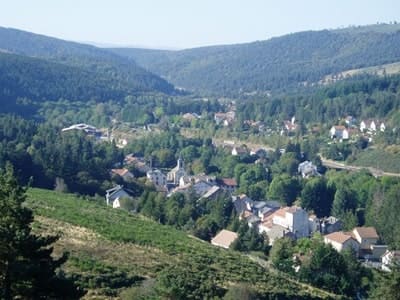
We first arrived at L'Etoile, a large guesthouse looking like an old 1920s holiday resort, ideally located on the banks of the Allier river, which here marks the natural border between Lozère and Ardèche. Its welcoming entrance hall opens onto a vast white-painted staircase, while a lush veranda allows you to sit and enjoy the last rays of sunshine before the meal. Philippe, the master of the house, offered us en-suite rooms overlooking the large wooded park.
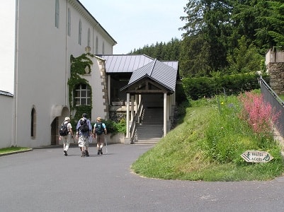 Warming up around the Abbey of Notre-Dame-des-Neiges
The very next day, we went on a 'warm-up' hike of about ten kilometers around the village, using one of the many routes marked on the IGN map graciously provided by Philippe. The radiant sun promised us an excellent day, and it was indeed the case in this abundant nature where common broom and heather mingle.
 We first climbed to the Cistercian abbey of Notre-Dame-des-Neiges, founded in 1859. We were a little surprised to discover a small chapel by the roadside reminding us that in these places, at the beginning of the 20th century, Father Charles de Foucauld (Brother Marie-Albéric) had done his novitiate and celebrated his first mass in 1890, before leaving for the Sahara. Then, by a winding path, we reached the cross of Pal, an old carved stone cross marking a historical crossroads. It is told with conviction that Roman armies would have passed through this strategic place during Julius Caesar's last campaign, on their way to Gaul. On our right, about a hundred meters into the moor, we also spotted an amazing watchtower topped with a statue of Saint-Laurent, silently watching over the valley.
From there, we followed the GR7 for some time until the Coulet de Pecoyol, before branching off towards Rogleton and the small village of Laveyrune, nestled near the source of the Allier. A little further on, a stony path led us to the summit of Espervelouze where we had a picnic. An exceptional panoramic view over the entire Allier valley was offered to us, with the slate roofs of the village of La Bastide-Puylaurent in the distance. In the afternoon, as the path ran alongside a high-voltage power line, we preferred to turn back to find the connecting trail between the GR7 and GR72, which is much wilder.
We quietly reached Rogleton to take the GR72 there. The latter brought us back to our starting point, offering us the olfactory and visual pleasure of admiring the countless wildflowers (purple foxgloves, fireweeds, and bellflowers) that dotted its path under the canopy of beech trees.
 On the mythical Stevenson trail
Reassured about our physical fitness and the reliability of our equipment, we left our car in the large shaded car park of L'Etoile and set off on Monday morning for a week of roaming, scrupulously following Gaston Testud's instructions.
Except for a short morning stretch on a small paved road undergoing repairs, the GR70 (the famous Stevenson trail, mapped by the Scottish writer Robert Louis Stevenson and his donkey Modestine in 1878) offered us a varied and magnificent route, alternating between coniferous forests and open pastures. The two pretty villages of Chasseradès and Mirandol are very picturesque, with this amazing railway line (the famous 'Cévenol') and its majestic stone viaduct playing hide-and-seek in the rugged landscape. As for wildlife, we were lucky enough to observe the gliding flight of several red kites and common buzzards above our heads.
In the evening, at the Alpiers gîte run by a very kind lady of Dutch origin who has managed to preserve the authenticity of this old building, we had the surprise of finding only walkers we had befriended the day before at L'Etoile. Suffice to say that at dinner time, good humor reigned around the large communal table, enhanced by the excellent local meal served to us in complete conviviality.
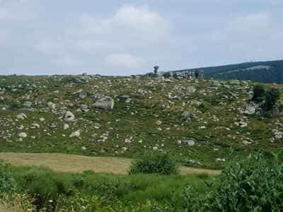 The ascent of Mont Lozère and the history of the Camisards
On Tuesday, we continued our journey on the Stevenson trail passing through the resort of Le Bleymard. Beautiful, progressive elevation gains were on the program to reach the bare ridges of the granite massif, but the weather was so mild and the landscapes so changing that no effort seemed insurmountable to us.
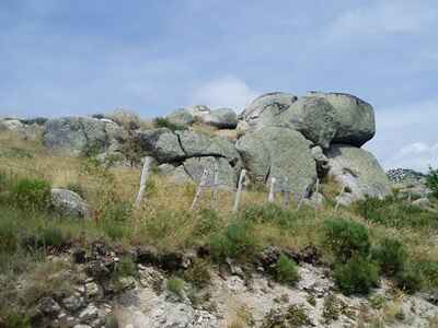
 From the Mont Lozère chalet to the summit of Finiels, the highest point of the Cévennes at an altitude of 1,699 meters, the panoramic view is permanent and unobstructed. Subalpine lawns, studded with granite chaos in mysterious shapes, gradually replace the forests. It is incredible what you can feel walking along these ridges, suspended between heaven and earth, breathing the pure and cold air of the summits.
The descent, on a very steep, stony path gullied by Cévennes rains, proved a bit more perilous and put our knees to a severe test. It finally led us into a greener universe, on the banks of the Rieussalet stream. We followed it sometimes on its right bank, sometimes on its left, stringing together a few acrobatic fordings on slippery stones before finally reaching the valley and Le Pont-de-Montvert.
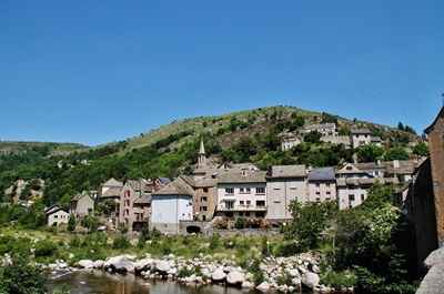
Quite surprisingly, the GR trail literally passes inside the communal gîte. Moreover, it is more of a basic mountain shelter: we would have lodgings for the night, but not board. Although a bit dark and spartan, the place is nevertheless well laid out for a walker's rest. Le Pont-de-Montvert is a charming village with granite houses, smiling by the Tarn river, but with a tumultuous past. It is here, indeed, that the bloody war of the Camisards broke out in July 1702, following the assassination of Abbé du Chayla, a ruthless inquisitor. Today, the atmosphere there is peaceful: restaurants, grocery store, bakery, bookshop, souvenirs... All services are gathered around the emblematic bridge, and we did not fail to take advantage of them to restock.
 On Wednesday morning, we bid farewell to the purist hikers who continued to follow Stevenson's footsteps southwards. We were indeed abandoning the GR70 to branch off onto the GR72, which was to gently bring us back to our starting point over the next few days.
From Le Pont-de-Montvert to the small village of Merlet, carefully restored and typical of local architecture, the path is most pleasant; however, as the red and white markings were sometimes anecdotal, the use of the detailed IGN map proved particularly useful so as not to lose the thread.
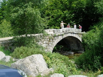
We then crossed a very well-marked area but literally drowned under forests of purgative gorse taller than us, perfuming the air with their sweet scent, before reaching an old massive stone dam built on the young course of the Tarn. From there, and up to the old Tarn bridge, stretches a dreamlike, almost magical route that we savored to its true value.
We subsequently reached the small hamlet of Bellecoste, then rallied our destination via a good farm track: Mas de la Barque. Just as Gaston Testud did in his original account, we observed a full day's break there to rest our bodies. Formerly a mecca for sheep transhumance, this hamlet is today a nature resort. On site, the Commandeur gîte also serves as a café-restaurant; the welcome there was, once again, very warm, the plate generous, and of excellent quality.
 Panoramic loop around Pic Cassini
As a rest day on Thursday, we nevertheless completed a loop hike of over twenty kilometers! Fortunately, our heavy backpacks had stayed at the gîte, and we walked with a light step, no longer having this burden on our shoulders...
We first climbed, through the moors, to the summit of Pic Cassini, culminating at an altitude of 1,680 meters, which takes its name from the famous dynasty of French cartographers who measured France. The weather was superb, the sun beating down a little hotter than the previous days. Upon arrival, a magnificent 360-degree view was offered to us — a real must-see allowing, on a clear day, to distinguish as far as Mont Ventoux and the Alps mountain range. From this natural viewpoint, we improvised our itinerary using the topographic map and the compass, but also by sight, so far did the panorama carry over the plateaus!
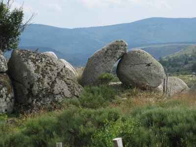 By a small, discreet path descending along the 'Ravin de l'Évadé' (Ravine of the Escapee) — which is actually more like a very pleasant and unspoiled small valley —, we bypassed the imposing Pic Cassini. We then headed due south across the vast altitude pastures and rocky masses to reach the village of Bellecoste, where we had passed the day before. Taking the direction of Mas Camargue via a good pastoral path, we went to meet the GR7, which we followed to the old Tarn bridge. It is there, lulled by the murmur of the water, that we picnicked in the shade of the Scots pines bordering the river.
After this restorative meal, we continued on the GR7 to the hamlet of L’Aubaret. The vegetation there was radically different from the sparse one crossed in the morning: in the middle of the dark spruce forests and fragrant fir trees, one would have almost thought oneself suddenly transported to the great outdoors of Canada.
There, we branched off onto the GR68, the tour of Mont Lozère. It was very hot at the beginning of this summer afternoon, and this stretch on a paved road (fortunately very short-lived) was not the most pleasant, the sun's reverberation being strong. After crossing the village of La Vialasse and passing the few isolated houses of Pierre Froide, we reached the refreshing banks of the Pudissime stream. We went up it due north to Mas de la Barque, crossing old peat bogs where the rare sundew (a small carnivorous plant) grows. Without a truly marked path, only the soothing sound of the water on our left served as a natural landmark. We were delighted to finally rediscover the coolness of the undergrowth to finish this long loop.
 Discovery of the Voie Régordane and the medieval town of La Garde-Guérin
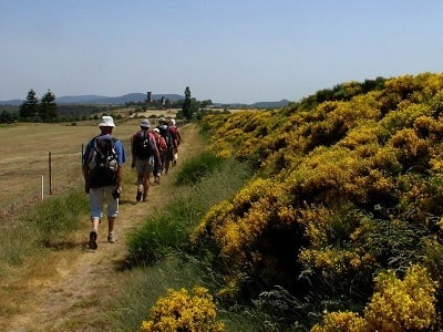
On Friday morning, we hit the road again with our full backpacks. First plunged into thick and mysterious mist, then under a slightly cloudy sky, this was a real godsend for walking compared to the strong heat of the previous day. The GR wound its way through the forest, revealing carpets of ferns, to the Rabusat pass before boldly following the ridge line. Very beautiful panoramas, opening on both sides of the valleys, embellished our progress. We walked sometimes through fields of purple heather on the south-facing slopes, sometimes in the middle of an ocean of yellow gorse on the north-facing ones, enjoying remarkable biodiversity.
After crossing the alleys of the old town of Villefort, a historical crossroads, we walked along the banks of its large reservoir lake and passed over the imposing dam, swept that day by a violent wind. A little further on the plateau, we reached the old Roman road — the famous Chemin de Régordane (current GR700) —, a major ancient trade and pilgrimage route linking the Massif Central to the Mediterranean, which we never left again. Here and there, superb visual escapes plunging onto the blue waters of the lake aroused our most total amazement.
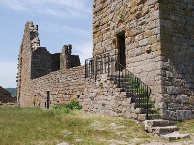
 In the course of the afternoon, we made a long stop to visit the small village of La Garde-Guérin, a beautifully restored jewel, which has managed to preserve the spirit, the architecture, and the authentic atmosphere of the Middle Ages, with its cobbled streets and sturdy houses.
La Garde-Guérin is a former fortified village, remarkably situated in the immediate vicinity of the Voie Régordane (GR700). This strategic guard post overlooks the Chassezac gorges in a dizzying way, a spectacular canyon carved into the rock, nearly 400 meters deep.
The traveler sees it from afar, built at an altitude of nearly 900 meters on an arid sandstone plateau often swept by capricious winds. This plateau rests on a massive base of granite rocks, in the maze of which the Chassezac torrent has carved impressive gorges, a real paradise today for birds of prey and canyoning enthusiasts. Benefiting from an exceptional geographical and military situation, the village dominates the entire surrounding landscape. To be fully convinced of this, one only has to go to the Pré de la Tour (where the old watchtower stands) or to the landscaped viewpoint of the Chassezac gorges: from here, one can embrace the whole region with a glance, right up to the Ardèche mountains, without the slightest visual obstacle.
Let us recall that the historical route of the Chemin de Régordane led pilgrims to the tomb of Saint-Gilles, in the Gard department. The former neighboring priory of Prévenchères moreover depended on the abbey of this same southern city. To secure this vital trade route (wine, salt, goods), the nobles of the region founded a chivalric order. The maintenance costs of the path and the local hospital were to be covered by the various revenues and tolls collected by the community of these knights, called the 'Pariers'. At the end of the 14th century and in the 15th century, new bourgeois families acquired these 'paréries' and settled down in the shelter of the ramparts of La Garde-Guérin. During this long transition period, these seigniorial shares frequently changed hands, leading to the gradual disappearance of the lineages of the former noble pariers, with the exception of a handful of diehard members.
 Saturday's walk, the last day of our journey, was certainly the shortest of our stay (only 15 to 16 kilometers to reach La Bastide-Puylaurent) but it proved extremely pleasant. The sun was back, illuminating this ancestral path which wound its way amidst a profusion of wildflowers and fluttering butterflies. On the large rock slabs of the Voie Régordane, which we found again near the hamlet of Le Thort, the deep ruts dug long ago, century after century, by the heavy iron-hooped wheels of Roman carts and medieval wagons, remained surprisingly and perfectly well-marked in the stone, testifying to the intense past traffic.
Shortly after our midday meal, the Cévennes climate, always unpredictable, reminded us of itself: the sky suddenly darkened and heavy black clouds gathered. As a simple precaution, we took out our rain gear — for the very first time since our departure six days ago — and placed them on top of our backpacks, ready to be drawn. Around 4 PM, at a brisk pace, we reached La Bastide-Puylaurent and finally found the L’Etoile Guesthouse without having needed to cover up. Incredible luck! Barely half an hour later, as we were coming out of a well-deserved hot shower, we heard torrents of water crashing violently on the trees in the courtyard: we had truly had a narrow escape!
From this wonderful week of loop hiking, we only keep excellent and vivid memories: the raw beauty and the incredible diversity of the landscapes crossed, from the ruggedness of the granite to the deep Cévennes valleys, the richness of the historical heritage, and of course, the beautiful encounters made on the trails and around the guest tables... And finally, all our apologies to the magnificent wild hind that we disturbed, quite in spite of ourselves, while she was resting peacefully hidden in the tall gorse, on the slopes above Bellecoste...