


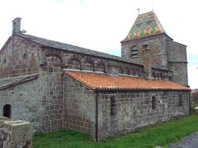
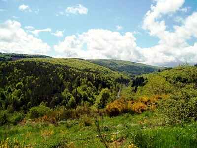
The Margeride in Lozère is a medium-altitude granite massif, offering a landscape of extensive plateaus and rounded hills, often compared to a northern steppe. The flora here is characteristic of acidic soils, dominated by coniferous and beech forests, interspersed with vast heathlands and peat bogs. The history and heritage of this region are marked by the harshness of the climate and traditional rural life, as evidenced by the granite farms with slate roofs. The fauna is emblematic of isolated massifs, featuring wolves, deer, and numerous birds of prey. It is also on this territory that the famous Beast of Gévaudan roamed in the 18th century, adding a legendary dimension to this site of wild and preserved nature.
 In the heart of the Massif Central, the Margeride forms a remarkable ridge line, almost always rising above 1,400 m, from the borders of Cézallier and Cantal in the north to Moure de la Gardille in the south. It is a vital center for the dispersion of waters: these flow east toward the Loire via the tributaries of the Allier river, west toward the Garonne via the Lot and Truyère, and south toward the Ardèche via the Chassezac.
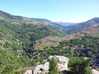
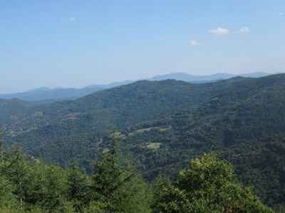
Its general appearance is not that of a jagged mountain; its peaks barely exceed 1,500 m (1,552 m at Truc de Fortunio, 1,551 m at Signal de Randon, both located in the southern part of the massif). However, it is indeed a high land, maintaining elevations above 1,000 m everywhere, compact and cut into tiered plateaus. The central and highest step, generally referred to as the Mountain (elevation above 1,300 m), hardly exceeds 6 to 8 km in width except at its two ends where it expands. It appears in the form of high surfaces and heavy, convex interfluves, locally carved by depressions (alveoles) of various shapes and sizes: very vast in the north at Paulhac or La Besseyre-Saint-Mary, smaller at Chanaleilles, La Villedieu, or Froidviala, and sometimes reduced to simple half-depressions perched above the edge (Saint-Privat-du-Fau and Les Ducs to the west; Bugeac and Madrières to the east).
 The peripheral plateaus are formed by a series of compartments. The altitudes there are lower and the flat interfluves are more numerous, although the detailed dissection is highly advanced. Small tectonic basins with clear geometric boundaries are locally interspersed (Le Malzieu, Saint-Alban). The contrast between the topographical landscapes of the mountain and those of the plateaus is stark, with the contact materializing through large cliffs that have a generally straight outline, oriented north-northwest/south-southeast.
The lithological framework of the Margeride is relatively simple.
Most of the massif consists of porphyritic granite intruding into old metamorphic formations, which are visible at both its northern and southern extremities. A leucogranite (fine-grained acidic granite) and a medium-grained granite rich in black mica (biotite) make up the rest. The entire structure is intersected by a few veins, predominantly of quartz.
However, opposed to this petrographic simplicity is a long and complex geomorphological evolution. The Hercynian chain was reduced to a large, flat surface by the end of the Paleozoic era; sedimentary deposits from the early Jurassic serve as milestones allowing for the local identification of this post-Hercynian surface around Lake Charpal, in the southern part of the massif. The summits of the flat interfluves in the region of Saint-Sauveur-de-Peyre and the Plateau du Roi derive from this. Everywhere else, this post-Hercynian surface was rearranged at the beginning of the Tertiary era. It is the flattening resulting from this arrangement that is best read in the current landscapes of the Margeride. It bears superficial formations that provide indications of the paleoclimatic conditions prevailing at the time: old alterites rich in kaolinite-type clay and microconglomerates with a siliceous cement.
 The following period, the Oligocene, was characterized by significant tectonic activity that resulted in an intense fracturing of the region. While the fractures sometimes took on Hercynian directions (northwest/southeast and northeast/southwest), most were independent of this old framework, following the meridian direction found throughout the center of the Massif Central. This led to the individualization of basins that gradually filled with various deposits: highly indurated red sandstones from the Rouget basin, mottled sandy clays, and green clays topped by fossil-bearing lacustrine limestones. The large current units of the Margeride model then began to take shape, although they did not reach their final volume until later.
In the second half of the Tertiary, tectonic movements continued in the form of a general uplift. The Margeride then acquired its current volume. During this time, the western low plateaus locally retained detrital materials deposited by very wide rivers with anastomosing channels; these rolled materials were mostly quartz, but the presence of chert and silicified limestone from the Causses indicates that, at that time, a topographical continuity still united the Grands Causses and the Margeride. Pliocene deposits, on the other hand, no longer contain pebbles from the Causses, leading to the conclusion that the Margeride was now topographically separated from them: from this moment onward, the large relief masses occupied the places we know today.
 The current topography was developed through the sinking of the hydrographic network into these surfaces. The fine-meshed tectonic grid was subsequently exploited by differential erosion: as a result, the surfaces of the Margeride are broken into a multitude of basins separated by rocky volumes. These decametric or hectometric scale forms are called alveoles. The fragile tertiary deposits have been partially cleared, giving the basins the appearance of large hollows with straight edges and bulging bottoms (as seen in Le Malzieu).
The cold Quaternary periods left their mark in several ways on the landscapes of the Margeride. The high altitudes and the current harshness of the climate suggest that the massif must have been covered with ice; in fact, demonstrating the glaciation of the Margeride has always been difficult, probably due to a lack of petrological markers. It is only in the southern part of the Mountain that a cluster of arguments has been gathered: shapes resembling small cirques, scoured alterites, overturning of tors, fluvio-glacial deposits, and erratic boulders. In light of these arguments, it is generally accepted that glaciation did occur in the southern Margeride, taking the form of a small ice cap that was thin, relatively immobile, and consequently not very erosive.
However, the cold Quaternary episodes primarily resulted in intense actions in periglacial environments. The granitic sands, formed during the Tertiary and the interglacial phases of the Quaternary, were subjected to the severe cold. At certain times, they slipped down the slopes, producing scoured, layered, and stretched sand formations. Elsewhere, heterogeneous formations were created, consisting of angular blocks of various sizes mixed with sands and silts, owing their formation to gelifluction; these are referred to as block streams or geliflucted sands.
 These formations, inherited from cold episodes (probably Würmian) and abundant in the mountains, disappear on the Margeride plateaus. It was long debated whether this should be seen as the result of a paleoclimatic boundary, implying the mountain was much colder than the plateaus. It appears this is not the case; periglacial formations certainly existed everywhere, as some remnants still show, but they were almost completely destroyed on the plateaus by anthropogenic erosion resulting from centuries of intense agricultural exploitation.
Locally, in the elevated southern part of the massif, true "rivers of stones" also owe their origin to the harsh conditions of the Quaternary: these are accumulations of granite blocks of all sizes flowing in long tongues. Along these tongues, raised mounds form, and the entire structure ends with a steep front. Numerous in the valleys of Palais du Roi and the Plateau du Palais du Roi, these rocky tongues are likely comparable to the dynamics of rock glaciers observed today in high mountains, testifying to rigorous and relatively dry periglacial conditions.
 While the overall set of cold-origin formations only slightly modified the geometry of the slopes, they nevertheless marked the landscapes by structuring the soils. These soils determine the distribution of lands managed and used by humans: where they are thick and relatively free of rocks, plowing was possible; conversely, on the high ridges bristling with protruding rocks, the plow could never establish itself. Almost everywhere, it was necessary to painstakingly clear stones, removing block by block the coarse materials spread by the cold dynamics of the Quaternary.
Despite the severity of its natural conditions and its isolation, the Margeride is a region with a long and dense history of human occupation. What strikes one most today is its distance from major urban centers. Clermont-Ferrand, to which the entire northern part of the Auvergne turns, and Montpellier, the capital of the Occitanie region (which includes Lozère and thus a large part of the Margeride territory), exert an urban influence that remains very discreet here. Is this why the Margeride is such an original ensemble, perhaps the one region in the entire Massif Central that has best managed to preserve its identity, its landscapes, its agricultural society, and its traditional rural economy?
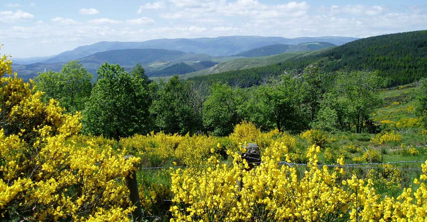
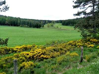
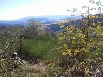
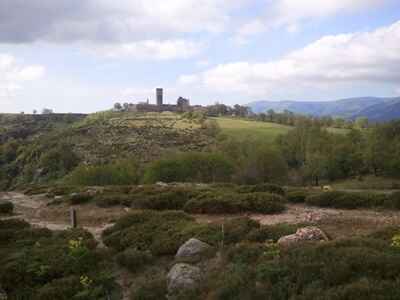
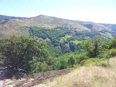
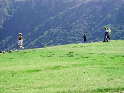
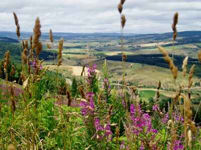
Regardless of the route taken through the Margeride, the rural landscape appears remarkably homogeneous. Three images immediately stand out to any observer: the clear pine woods or the denser spruce forests that close off the horizon; the heaths with broom, heather, or grazing lands located on the higher grounds; and finally, lower down, the checkerboard of small cultivated or grassed plots that reveal the fragmentation of a peasant land constantly being divided. This landscape, ultimately very readable, is organized around two fundamental elements. The first relates to physical geography: it is the clear contrast between the "Mountain"—this heavy ridge that, around 1,400 m, carries forests and pastures—and the plateaus, spread out on either side at more forgiving altitudes, where cultivated lands and settlements are concentrated. The second element, drawn from human geography, centers on the village (or hamlet, to use classic geographical terminology, though we deliberately keep the local term here): it is from the village that all land occupation and regulation of the territory is orchestrated.
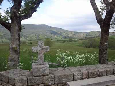
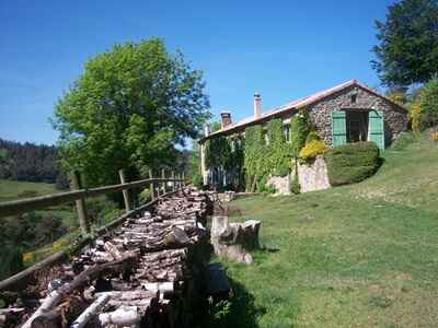
 The population is distributed among these elementary and numerous units that all resemble one another, with their modest but solid peasant houses beautifully built of granite—homes that could make many city dwellers dream of a rural retreat. Elegant but somewhat severe in appearance, the farm and dwelling are a true reflection of the Margeride. Often, the villages still retain their communal oven, fountain, sometimes their forge (where draft animals were shod), and, in the Saugues region, their assembly house where the béate (a secular sister or community teacher) resided. A short stop in one of these rural cells quickly reveals the strength of the community bonds uniting peasant families. This housing, which powerfully retains the imprint of the past, is an excellent indicator of how a society functions.
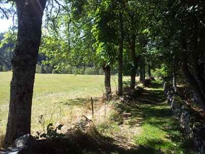
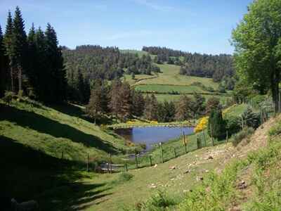
 Organized according to the relief and gravitating around the village, the rural landscape deserves a closer look. Near the dwellings extend the cultivated fields, their boundaries sometimes marked by rows of trees. Small in size, they follow the slope, occupy the flat areas and gentle undulations of the plateaus, and border, thanks to small valleys, the mowed pastures that are blanketed in daffodils come spring. Locally, the plots are enclosed by low stone walls or barbed wire attached to sturdy standing granite blocks. All of this constitutes the private peasant land of each family, which historically housed their numerous offspring. Above this inhabited space, the cultivated land merges into a landscape where, as previously noted, Scots pine woods, pastures, and—on the highest peaks—spruce forests and heathlands monopolize almost the entire space. With rare exceptions (state forests or large private estates), this high-altitude land is the undivided property of all the inhabitants of the village cell. These spaces, intended for collective use, are referred to as sectional heaths or forests.
The landscape thus reveals an authentic agro-pastoral system based on the cohesion of a small rural community. While this model existed elsewhere, here it holds the immense advantage of still being perfectly readable in the ancestral arrangement of fields, meadows, and woods. In contrast to the Chaîne des Puys, stifled by urban pressure and overtaken by fallow land, or the Livradois, which is heavily forested and whose agricultural society no longer controls the territory, the Margeride retains many traditional aspects. It is as if its peasantry remained numerous and organized enough to "hold" the land.
 However, the order of things is never immutable, even in a highly isolated environment like the Margeride. Let us hasten to decipher this landscape to untangle its threads: those that connect us to the past and those that outline the present. It is, of course, the close association of plowing and grazing that reflects life in ancient times. Due to a particularly strong historical demographic pressure, the Margeride was intensively cultivated. Rye and potatoes occupied fields up to very high altitudes. The remaining territory was abandoned to the common herd, which, in fine weather and under the guidance of a village shepherd, roamed the highest pastures where the plow could not venture. The grazing lands were collective, while the private fields hosted the herd in rotation (at night or during harsh seasons) and therefore could not be enclosed. This system of land management was, by its very nature, profoundly democratic.
The scarcity of large estates and wealthy landowners facilitated this organization. Often, the poorest individuals—those who owned no land—could entrust a few animals to the shepherd, even if regulations theoretically stipulated (as in many regions) that the right to pasture on the commons was proportional to the land owned, meaning the actual capacity to accommodate the common herd in winter. Society was very uniform. Old cadastral maps show how limited everyone's possessions were, with land pulverized among a multitude of owners. Herds were modest; not so long ago, a farm housing four or five cows and a few sheep was the norm.
Families always had many children; this explains both the inevitable fragmentation of property and the vital importance of plowing, even on the poorest soils, to ensure subsistence for all.
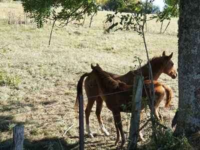
 Cattle breeding relied on the Aubrac breed: small, light-coated animals with unfailing robustness. It was undoubtedly the most rustic breed in the entire Massif Central, used for animal traction while also providing meat and milk. The traditional system relied on one main product: beef calves sold at three or four months of age, accompanied by secondary products like milk or a few sheep. Ultimately, the final yield was very thin, making the collective space indispensable for survival. Agricultural activity was often supplemented by temporary emigration to the plains of Auvergne or Languedoc, intensive gathering (lichens, mushrooms, blueberries, narcissus) which, through hard labor, provided supplementary income, and home textile work for employers from the Nîmes region.
Moreover, the southern part of the Margeride long maintained close ties with the lowland Languedoc regions through transhumance. Immense flocks of sheep, traveling up the ancient drovers' roads (drailles), occupied the highest summer pastures that the local cattle, too few in number, left vacant.
Even though an evolution became noticeable from the 19th century onward—with the collapse of rural textile work and the subdivision of commons (often distributed equally so as not to disadvantage the poorest)—traditional economic and social life has persisted in the Margeride much longer than elsewhere. Several factors explain this resilience.
 Social cohesion is the first pillar. It is extremely strong at the village level, maintained by the community system described previously, and supported (until recently in the Saugues region) by the presence of the béate, a lay figure who instructed, cared for, and taught catechism to the community members. The Margeride, at the gates of Protestant lands, remained a bastion of Catholicism where religious practice was intense, acting as a true social cement. Geographical isolation also limited external interventions, particularly urban ones. No other way of life or spatial organization could truly gain a foothold in the Margeride. Social and economic life is organized locally around the cantonal capitals perched on the plateaus on either side of the mountain's backbone: Saugues, Grandrieu, Saint-Chély-d'Apcher, Le Malzieu, Saint-Alban-sur-Limagnole... These small towns or bustling villages concentrate all essential services, especially on lively market days. Here, calves, lambs, and butter were sold. Calf markets, often weekly, reached their peak after World War II with the boom in this type of production. Even if these markets are declining today, they durably reinforced the role of these nerve centers. Preserved from hyper-urbanization, this type of close-knit relationship has forged the identity of regions like Saugues or Saint-Chély.
 Finally, to better understand these continuities, one must emphasize the high birth rate that long prevailed within families, ensuring the transmission and longevity of ancestral properties. Certainly, rural exodus hit the Margeride hard, just like all the poor highlands of Auvergne. Rural inhabitants left in droves for the Languedoc cities, the centers of the Auvergne plain (Le Puy-en-Velay, Brioude), Clermont-Ferrand, and especially Paris, thereby relieving farms of many mouths to feed. But unlike other regions, the birth rate remained high enough to guarantee that one child always stayed behind to take over the farm. This demographic vitality and visceral attachment to the land explain why the landscapes have remained so well maintained. It was not until the 1968 census that a true rupture was observed, with a marked population decline in many rural municipalities that were stripped of their vital forces and mechanically became less fertile. While the men and women of the Margeride have emigrated, the consequences of this exodus are radically different from those in the Livradois: the soil here has remained cultivated, and the property, though fragmented, is still very much alive.
Yet, beyond these persistent traits that weigh heavily on the destiny of the Margeride's rural world, real transformations are occurring. What does the landscape tell us about these mutations? The slow reconquest of trees—whether through spontaneous woodland expansion or planting—on both sectional and private lands reflects the gradual retreat of ancestral agro-pastoral practices. The development of meadows (once confined to humid valley floors) at the expense of plowed fields, as well as the extension of pastures, signify a simplification of the agricultural system. The village's communal buildings lose their function, the béates have disappeared... But—and this is one of the great originalities of the Margeride's human environment—it is not a collapse, but rather a slow, measured mutation that allows many ancient traits to survive, such as the collective herd (occasionally) and, above all, the very small property size.
 Agriculture in the Margeride is inevitably evolving towards specialization. However, far from reproducing a stereotyped model, it retains many unique characteristics. In the race for progress, intensification, and mechanization, the Margeride started with a certain delay. This late transformation often occurred at a measured pace. While the size of farms has increased, it remains reasonable: twenty to twenty-five hectares often constitute the base area of a modernized farm, supplemented, of course, by the potential reserve of unshared communal lands. Expansion primarily occurs through leasing, as land ownership changes remain delicate. Small landowners, deeply attached to their heritage, are reluctant to sell. The land market is therefore restricted, and prices soar far beyond the actual agronomic value of the soil: the Margeride simply is not for sale! The land remains firmly held by locals; the arrival of outsiders is, unlike in other regions of the Massif Central, almost non-existent.
 This partially explains the slow pace of change. Added to this are the constraints imposed by the physical environment: the harsh climate and the relative poverty of high-altitude soils significantly limit the choice of agricultural production.
Under these conditions, the transformations can appear incomplete. The traditional production of beef calves is gradually fading, facing competition from better-positioned regions (like Limousin), new farming methods (intensive farming), and the booming market for "eight-day calves" (three to four weeks old). The adoption of more productive breeds to the detriment of the old rustic Aubrac strain has also contributed to this shift. Only a few die-hard farms remain faithful to the ancestral system. Livestock farming is now massively oriented towards dairy production, relying on new breeds (Abondance, Prim'Holstein) and the improvement of meadows. Milk is sold to family dairies or cooperatives, often located outside the region. As for the calves, sold at three or four weeks, they are sent to specialized fattening centers or to Italy. In a way, these pasture improvements bring the Margeride closer to other Auvergne highlands that have abandoned their old systems to fully dedicate themselves to specialized cattle farming.
Does this mean, however, that the agricultural Margeride has lost its soul and its specificities?
 We mentioned the sometimes unfinished aspect of these mutations. This is particularly evident in the preservation of sheep farming alongside cattle breeding. Many farms keep two herds, hesitating to take the leap into total specialization. Sheep provide an indispensable supplementary income and help valorize the poorest lands, notably the sectional pastures that would not suffice for a dairy herd requiring rich meadows for abundant production. It is also worth noting that the gathering tradition remains alive in certain sectors: blueberries, mushrooms, lichens, and narcissus are still collected. While this produce is rarely processed on-site (it is sent to distant canneries or perfume factories), it nonetheless provides—at the cost of mobilized family labor—significant income, just as in the past. The local prohibition of gathering frequently enforced against outsiders is clear proof of this.
 What a curious land the Margeride is, so intimately mixing the weight of tradition with the imperatives of modernism! The partial maintenance of beef calves, the persistence of the sheep herd, and the survival of gathering are all nods to the past. Conversely, the rise of dairy production, the practice of industrial crossbreeding, and the conquest of meadows illustrate profound change, as does the advancement of the forest, which now covers more than a third of the territory.
The Margeride is undeniably evolving, but agriculture remains its primary activity, and its economy stays structurally dependent on the outside world: neither milk nor gathered goods generate a true local processing industry. Although timber is harvested, it sees little local value addition; the numerous sawmills, while providing jobs, mostly deliver raw or semi-finished products, with specialized woodworking and carpentry businesses remaining rare.
Certainly, the Margeride has not experienced the dramatic collapse seen in some other Auvergne countrysides. Nevertheless, it finds itself at a decisive turning point. The scarcity of non-agricultural employment and an aging population are major challenges that risk accelerating the spread of wasteland and forests. But for now, the Margeride retains all its originality: that of a rugged and isolated land, where the meticulously sculpted landscape still reflects the solidary functioning of the rural society of yesteryear, and where cautious agricultural modernization has not managed to erase the deep soul of its peasants.
Discovering the Margeride is ideally conceived in two stages, dedicated respectively to its northern and southern halves. In both cases, it is highly recommended to cross the massif from end to end to fully grasp the reliefs and the logic of human occupation. Saint-Chély-d'Apcher serves as an excellent starting point for both of these loops.