


In 1515, the village of Génolhac covered a very limited area. It was largely confined within the protective walls of its ramparts, only just beginning to expand outward during this period, primarily to the north.
The village was entirely surrounded by fertile agricultural land, thriving vineyards, golden cereal fields, and lush meadows. Along the evocatively named "Merdarier" river, numerous ancient watermills (the "moly") were established. We can still easily identify the gourgues—small holding basins designed to build sufficient water pressure and flow. This hydraulic force drove the horizontal wooden wheels, which in turn rotated the heavy upper millstones over the fixed bedstones (the "dormante").
Our Grand'rue (Main Street) was originally known as the "straight street". It served as the primary thoroughfare for the famous "Voie Régordane," entering and exiting the town through two monumental gates. Even today, the lower part of the Grand'rue ends at "Piedeville" (the foot of the town), while the northern district, located beyond the bridge over the Gardonnette, is traditionally known as the "cap de ville" (head of the town).
It is worth noting that Place des Ayres, located in front of the current pharmacy, was once fully dedicated to the threshing of grain—a vital communal craft in which both men and women played an essential role.
Our renowned Place du Colombier was originally a vast open meadow owned by the Dominican Convent (situated opposite the current tobacco shop).
Finally, the castle and its protective enclosure, complete with a cemetery, church, and tower, can still be clearly traced. This entire complex was also fortified with thick walls and deep moats. Nearby lay the private garden of the Bishop (who resided in Uzès). As we stroll through our winding, picturesque alleys today, we can truly appreciate the smallness and narrowness of these medieval dwellings, occasionally discovering beautiful vaulted passageways leading to hidden gardens.
In the Middle Ages, likely between the current Café du Midi and the Bouissonade alley, stood a seigniorial pigeon house (colombier). The neighboring field took the name "Champ du Colombier". It passed through many hands, including those of the "Patriarche," an aristocratic family, before being acquired by the Dominican Fathers (or "Preaching Brothers") in 1472. Every year, after the harvests, the inhabitants of Génolhac enjoyed the special privilege of gathering there to dance, play ninepins, and partake in other respectable games. In 1654, the land was officially ceded to the citizens of the town.
House No. 42 on Grand-rue
This remarkable façade, carefully stripped of its plaster in 1979, provides a true history lesson spanning seven centuries. It also strongly supports serious historical hypotheses regarding the significant wagon transport that took place along the GR®700 Régordane trail. This house was likely one of the most opulent in Génolhac, and today it remains the richest in inscriptions, sculptures, and architectural traces of the past. It features four human heads, four animal heads (possibly sheep), a set of ancient inscriptions, and a central motif located above the current entrance door—all intricately carved into sandstone. Additional inscriptions can be found in the entrance corridor. Historical records show that this grand house belonged to Peire Argenson and Joahan Quarante between 1500 and 1520. Manuscripts from the 17th century indicate that the façade was later reconstructed by Pierre Bondurand La Roche.
House No. 7 on Grand-rue
Antoine del Ranc was a "peyrolier" who manufactured "peyrous"—making him a coppersmith (a very noisy profession!). He lived almost directly opposite the current town hall between 1510 and 1530. In 1533, when a new district was subdivided and created further south (past the Mallet store), he built his house and had a commemorative plaque engraved. He also crafted "ferrats," cylindrical copper buckets used for transporting and storing water (unlike the peyrous, which were placed directly on the fire).
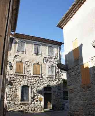
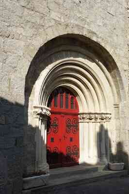
Under a large, patched-up arch, two twin round-arched doors are arranged according to a widely used 16th-century regional style. Many similar examples can be found in Génolhac, Villefort, Vielvic, and La Garde-Guérin, characteristic of what is often called "Régordane architecture". In the 18th century, homeowners removed the mullioned windows and created new openings with low-arched lintels to suit the fashion of the day. It was during this time that parts of the large arches were destroyed to make way for wide, rectangular openings resembling garage entrances. The 19th century completed this architectural degradation by knocking out the two small twin round arches, replacing them with a single rectangular door.
The Pastry Shop
Here, you will find a superb 14th-century twin trefoil window, elegantly adorned in the center with a lily and a beautifully decorated capital featuring carved leaves. This is believed to be the work of the "Compagnons de France," as there is no other similar stonework in the region. One can easily trace the reuse and modifications of the façade over the centuries: changes in floor levels, the blocking of the pointed twin portals, and the narrowing of the windows to avoid a local "tax on openings". It was only in 1978, during a facade restoration, that this hidden marvel reappeared. The restoration work then continued under the vigilant eye of Dr. Jean Pellet.
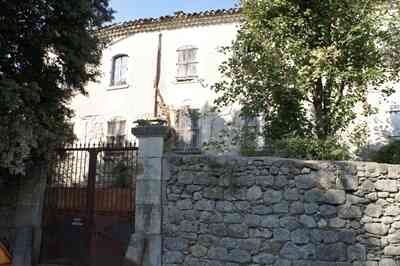
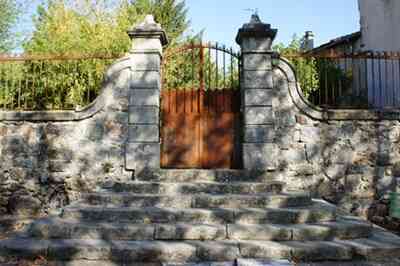
The Rédarès was once a sprawling farmhouse, with various outbuildings constructed during different eras. An ancient inscription mentions a "François Gervex" (the 'G' is either damaged or poorly engraved) alongside the date 1741. This Gervex family (later known as Gervais) originated from Marouls, near Saint-Étienne-Vallée-Française. One branch of this lineage lived in Rédarès during the 17th century, and another remains present today in Belle Poile. Yet another branch settled in Fesc, near Vialas. Between the buildings of this active farm lay the "Ayre" (the traditional grain-threshing area).
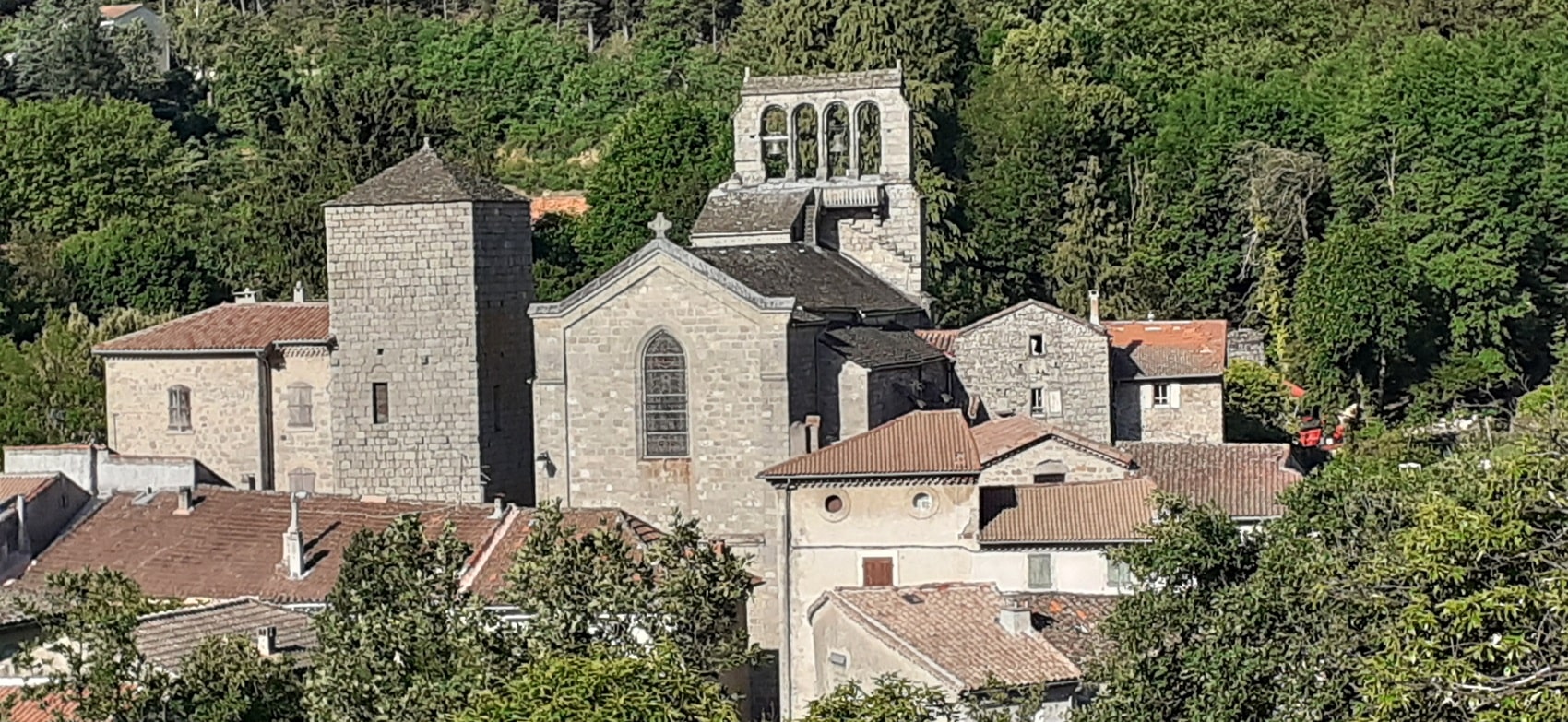
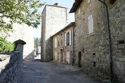
As we continue our stroll along Rue Soubeyranne, we come across the imposing castle tower. This square structure played a vital role: its upper level allowed the toll collector, acting as a representative of the lord, to effectively monitor the merchant convoys traveling along the Régordane route. Meanwhile, the lower levels were used to store provisions or hold prisoners. Like several other defensive towers in the region, it featured restricted access, requiring a ladder to reach the first floor, thereby greatly enhancing its defense during an assault.

Nearby stands the Church of Saint Pierre, discreetly positioned behind the tower and slightly set back from the bustling village center, surrounded by other buildings. This place of worship boasts a rich, eventful history, deeply intertwined with the violent religious conflicts that shook the Cévennes over the centuries. It has endured devastating fires, numerous expansions, and the gradual addition of side chapels. Its iconic bell-gable (clocher à peigne), characteristic of local architecture, was added at the end of the 16th century by the Vicomte de Polignac, co-lord of Génolhac, eager to compensate for the symbolic damages caused by Protestants during those troubled times.
Established in the 12th century, the Church of Saint Pierre underwent many transformations due to the destruction and remodeling caused by the Wars of Religion. Its structure features a single nave, accompanied by four side chapels, all elegantly covered with semicircular vaults. Furthermore, its bell-gable, typical of local churches, was erected at the end of the 16th century on the initiative of the Vicomte de Polignac, who was deeply marked by the religious conflicts of his time.
The bell-gable of the Cévennes is a true architectural emblem of this southern French region, and its history is intimately linked with that of Protestantism. In the Cévennes, bell-gables are frequently associated with Reformed churches. During the 16th century, the rapid rise of Protestantism led to the construction of churches that distinctly stood out from Catholic architecture, both in form and function. The Cévennes, emerging as a fierce bastion of Protestantism, beautifully blended architectural traditions with the practical needs of the community.
The era of the Wars of Religion (16th-17th centuries) was incredibly harsh. Churches were frequently destroyed or drastically altered, but the bell-gables endured to symbolize the unyielding resilience of the Protestant community. Following the devastating revocation of the Edict of Nantes in 1685, these buildings were often hidden or camouflaged to escape persecution. Constructing bell-gables thus became a powerful way to demonstrate a lasting, unshakeable identity, even in the face of profound adversity.
Architecturally, the bell-gable is remarkable for its slender, elegant structure and its distinctive shape, which resembles a comb due to its series of open arches. These towers are usually built of meticulously dressed stone and feature several open arcades. These openings not only add a graceful decorative touch but also allow the heavy bells to ring out unobstructed. While the design is generally simple and highly functional, it reflects a rugged beauty, with particular attention paid to intricate details. The gables are often adorned with geometric motifs and vary in height, but their primary purpose remained constant: to provide the best possible acoustics for the ringing of the bells, which paced and guided everyday community life.