


In a bygone era, vacationing in Génolhac was a popular activity for city dwellers seeking nature and rest. The town, located in the heart of the Cévennes, offered an idyll setting for holidays, with its mountainous landscapes, rivers, and forests. Vacationers could stay in hotels, boarding houses, or bed and breakfasts. They could also rent gites or holiday homes.
By the end of the 19th century, Génolhac and its surroundings became a popular destination for the residents of Alès and Nîmes in search of freshness. While temperatures can rise to unbearable levels in the cities, the high altitude of Génolhac, surrounded by lush forests and grand landscapes, attracts many summer visitors eager to escape into a soothing natural setting, perfect for walks, fishing, and picnics.
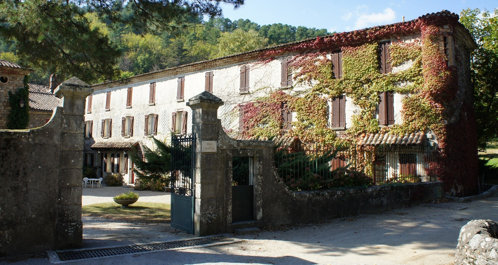
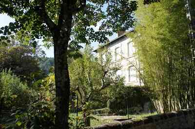
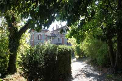
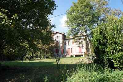
The magnificent residences lining Génolhac bear witness to a prestigious past. Dotting the landscape, these carefully built villas offer breathtaking views of Mont Lozère and the surrounding valleys. Many of these houses were designed with balconies and terraces where families could gather to enjoy an outdoor meal, cradled by the birdsong and the murmur of the rivers.
These homes were often adorned with lush gardens, passionately maintained by their owners. The peaceful atmosphere of Génolhac was also enhanced by the scents of wild flowers, which bloomed throughout the summer. Mushroom picking is popular around Génolhac, especially during autumn. The region is rich in forests and biodiversity, making it an ideal environment for finding different species of edible mushrooms such as Porcini, Chanterelles, Blackberries, Lactaires, and Pieds-de-Mouton.
City dwellers gathered in the cafes and the village square for a game of pétanque. Events such as local festivals, craft fairs, and lively markets punctuated the summer, offering visitors the opportunity to taste local specialties and discover Cévenol craftsmanship.
The development of infrastructure, such as railway access, played a key role in the popularity of Génolhac. The construction of the "Le Cévenol" railway line at the end of the 19th century, connecting major cities to mountain villages, facilitated the arrival of those seeking to flee the heat.
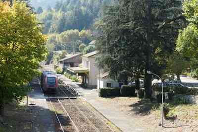
The Cévenol line was inaugurated in 1880, in a context where the railway was in full expansion in France. The authorities' desire was to open up rural areas and promote tourism in the Cévennes, a mountain range bursting with breathtaking landscapes. The creation of this railway line aimed to facilitate access to isolated villages while offering travelers the opportunity to discover the beauty of the Cévenol landscapes.
Initially, the journey from Nîmes to Génolhac represented a practical solution for the inhabitants, but also for the city dwellers of Nîmes and Alès who wished to flee the unbearable heat of summers in the city. The train crossed picturesque areas, running along rivers, climbing through forests, and offering impressive panoramas of the surrounding valleys. With the advent of the train, the number of tourists increased considerably. Hotels, boarding houses, and gites quickly developed around the Génolhac station, attracting a clientele in search of freshness and adventure.
By car via the winding narrow D906 road, visitors could enjoy picturesque journeys through the Cévennes, passing by the Château de Portes and Chamborigaud. Today, the spirit of vacationing in Génolhac endures, even though times have changed. The residences dotting the region continue to attract those looking for a second home to enjoy a cool summer at the foot of Mont Lozère, recalling the traditions of the past.
Travel Guide from the Early 20th Century
Génolhac (470 m; railway; Hostellerie de la Route du Mont Lozère, May-Oct., 16 rooms, tel. 2), 953 inhabitants and a small summer resort, on the Gardonnette, between mountains covered with chestnut trees and rushing with crystal-clear waters.
Around Génolhac
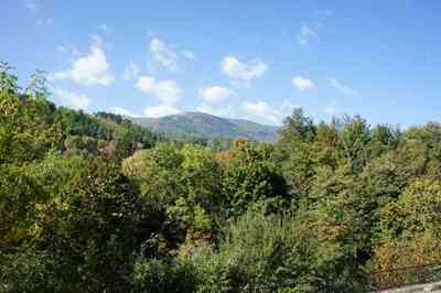
1° Mont Lozère: 16 km northeast of Génolhac to the crest of the Tête-du-Bœuf via a very picturesque but quite difficult and poorly maintained forest road, which passes by the Malmontet tower. At the Tête-du-Bœuf, from where the ascent of the Roc de Malpertus can be made in 1 hour, you join the beautiful route from Villefort to Le Bleymard via Mont Lozère.
2° Gorges de l'Homol (to the West): beautiful sites, waterfall.
3° Gorges du Rieutord and Camisard caves (to the West), via Vialas.
4° Valleys of the Luech and the Gardonnette (beautiful 32 km circuit): follow route N. 106 to Chamborigaud, go down the gorge of the Luech to Peyremale and return to Génolhac by ascending the valley of the Gardonnette. 4 km downstream from Génolhac, feudal castle of Feras, above the left bank of the Gardonnette.
 5° Château de Brésis (to the Northeast; 6 km on foot, 10 km by road), in the valley of the Cèze.
From Génolhac to Florac: upper Tarn valley (48.5 km West via route N. 598; motor service). Follow the road to Nîmes for 1.5 km, then route N. 598 which branches off to the right. Small pass of Rize, between the Homol and the Luech. The road ascends westward up the valley of the Luech and crosses its tributary, the Gourdouze.
Vialas (608 m), a village well situated above the confluence of the Luech and the Gourdouze, on the granite slopes of the Gourdouze spur (1,326 m), below the chestnut woods. Numerous walks and excursions: 15 minutes away, argentiferous lead mines, abandoned since 1909; to the North-Northwest, at the hamlet of Gourdouze, view extending to the sea; to the West, gorges of the Rieutord and Camisard caves, at the hamlet of Tourières.
The road rises on the left bank of the Luech and crosses the lateral ravine of the Rieutord via switchbacks. Beyond Soleyrols, the climb steepens. Saint-Maurice-de-Ventalon, dominated to the South by the signal of Saint-Maurice (1,355 m). Col de la Croix de Berthel (1.088 m), where you cross the axis of the Cévennes to descend into the Tarn basin via the Alignon valley. In the Vernets beech woods, you can still see a granite pulpit of the Pastors of the Desert, and below it the Baptéjadou fountain, where they baptized. The road emerges into the Tarn valley, which you cross 2 km upstream from Pont-de-Montvert.