


 When the Cévennes National Park was finally created in 1970, its perimeter borrowed what was considered the limit of the last Würm glaciation.
The boundaries deliberately avoid inhabited valleys and confine the protected space to high plateaus, bare or wooded mountains where one can travel along balcony roads or watershed routes. The park spans the departments of Lozère and Gard, slightly encroaching on Ardèche. It disregards geological partitions to showcase the magnificence of everything that has grown—flora or architecture—on schist, granite, or limestone. The Cévennes National Park combines unique features: it is the largest park in France and also the only one located in mid-altitude mountains.
Regardless, the beauty of the Cévennes resides in their deeply humanized landscapes. Landscapes that have been shaped and animated by human hands for centuries and centuries.
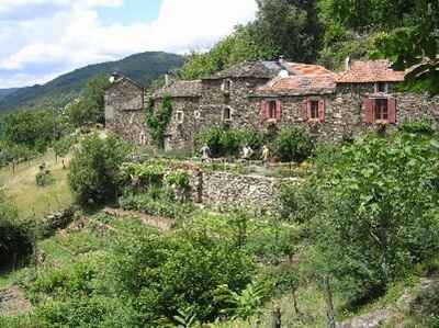 If the Cévennes National Park is not quite like other parks, it is primarily for this reason. Along with Port-Cros, they are the only two in France to have permanent residents in their central zone—600 today in the Cévennes compared to 430 in 1971. Under the harsh climate of the Cévennes mountains, a resilient population has always clung on. A tough population, herding livestock along the ancient paths (drailles), maintaining terraces, cultivating chestnut or mulberry trees, or extracting coal from the mine galleries.
A population descended from the Camisards and maquisards, remaining proud and protective of its solitude and secrets. The descendants of generations of resistors did not, of course, accept without a struggle the "grasp" of the State over their Cévennes through the creation of the Cévennes National Park by decree on September 2, 1970. The threats to customary freedoms sparked a fierce opposition, yet troubled by the woes of desertification. Most municipalities had lost five-sixths of their population between 1920 and 1970.
To avoid the suicidal choice of abandoning the mountains, part of the Cévennes population ultimately rallied under another banner: that of the national park, but a park they wanted to be cultural. The signed contract indeed aims to reconcile genuine protection of nature with respect for the rural economy. In a quarter of a century, the national park has, for example, successfully managed to work with farmers. The public establishment purchased nearly 5,000 hectares to rent to volunteers who agreed to work on their farms by signing environmental plans.
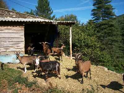 This more balanced management of natural environments, including the less productive ones, has notably helped save rustic breeds such as Aubrac cows and raïol sheep. The "Mazenot contracts"—work contracts for residents who maintained paths, restored terraces, irrigation channels (béals), or cleaned fire-sensitive areas—also contributed to building lasting ties between the farming population and the park teams.
On Mont Lozère, one can even meet farmers happy to have been able to continue practicing their livestock farming profession with pride without being offended by having also been, in their own way, "gardeners of the landscape."
When thinking of development in a region like the Cévennes, tourism also comes to mind. While it is difficult to escape this new industry, it is equally challenging to reconcile management imperatives and natural balances, respect for architectural heritage, and quality.
From the start, the national park—whose objectives include welcoming and informing the public—must also curb the perverse effects of this attraction to the Cévennes nature. The park's territory, as vast as it is, does not prevent certain spots like the summit of Mont Aigoual or the gorges of the Tarn and Jonte from being overrun, and the wildlife and flora "disturbed" by tourist attendance estimated at about 800,000 visitors per year by the mid-1990s. The implementation of stricter regulations, more severe marking of accessible areas, and education remain the only tools available to park agents. And they sometimes seem quite inadequate.
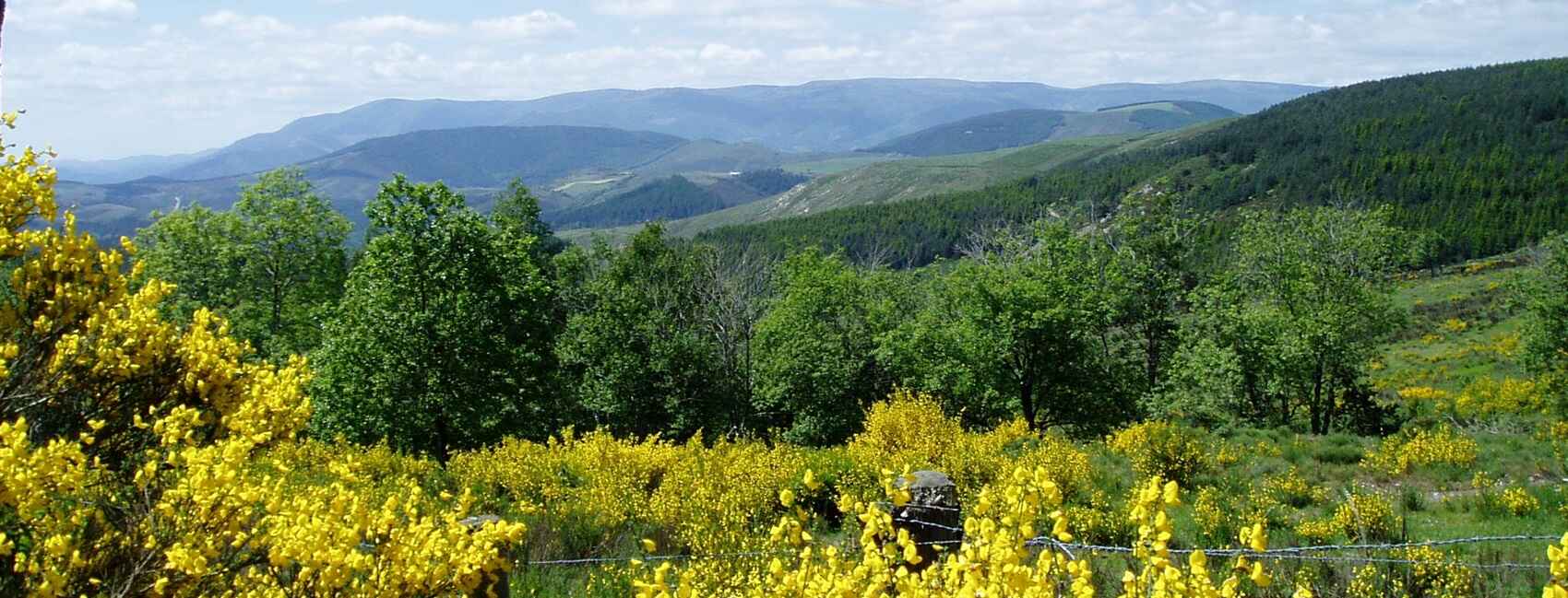
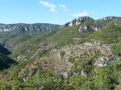
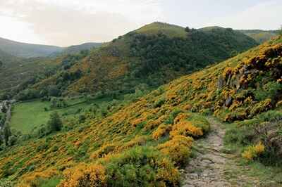
 But the richness of the Cévennes landscapes easily explains this enthusiasm. In just a few dozen kilometers, one can indeed pass from Mont Lozère, a granite world exposed to winds, to the Causses, limestone plateaus veined with avens and caves, then to the Aigoual massif, reforested since the last century, and finally to the narrow schist valleys of the Cévennes once cultivated. This diversity, combined with the juxtaposition of three climates—Mediterranean, oceanic, and continental—as well as the presence of four vegetation levels, allows for an extremely varied flora to develop.
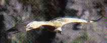
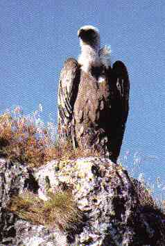
Such an environment naturally favors the presence of a diversified fauna as well. Especially since the national park actively pursued a policy of reintroducing species that had disappeared from the region for several decades until 1995. Deer, roe deer, capercaillies, and beavers have thus re-established themselves in the Cévennes massifs. And we must, of course, mention the griffon vultures (over 230 by the end of 1997) and the monk vultures—about 20 individuals—that have recolonized the gorges and cliffs of the causse.
This reintroduction operation, which has gained worldwide reputation, has become a beautiful story for the thousands of curious visitors attracted by the raptors returned to their homeland. The adventure has been showcased since spring 1998 at the Vulture Observatory (Belvédère des Vautours), built at Le Truel. One can witness the result of nearly twenty years of scientific work conducted on the ground with the Intervention Fund for Raptors (FIR).
 The law of July 22, 1960, and the decree of October 31, 1961, set the conditions for creating French national parks. The first in the world, Yosemite National Park, was born in the United States in 1864. The creation of a park occurs in two phases. The first, a long—sometimes very long—consultation process with all interested parties, must lead to a compromise between the interests of the parties involved. Then, the theoretical boundaries and regulations of the future park are finalized, and the project is submitted to public inquiry. Subsequently, the Prime Minister decides to create the park by a decree in the Council of State. National parks are funded by the State and managed by public establishments under the authority of the Ministry of Land Planning and the Environment. Their directors are appointed by order of the minister in charge of the environment.
The primary vocation of national parks is to protect natural heritage. To do this, they rely on the regulations set by their creation decree. This applies only in the "central" zone. In the so-called "peripheral" zone, parks must promote sustainable development in consultation with elected officials and associations.
Their main aims are: to ensure biological diversity; to make this heritage available to the public; to contribute to the sustainable development of the territory by promoting activities, such as traditional agriculture, that support it; to foster behaviors respectful of nature and its balances. The central zones of the six national parks in mainland France—there is also one in Guadeloupe—represent 0.65% of the national territory.
 The name Cévennes, derived from the Hebrew Giben or the Celtic Keben, means mountain in both languages. This double etymology, both religious and national, a common root of all Greek and Latin names for the Cévennes, likely has a primitive root in the ancient idioms of India. The Cévennes chain, about a hundred leagues long, connects the Pyrenees to the Alps. From its northern plateau, its peaks, which sometimes rise to a height of a thousand fathoms, form a gigantic staircase whose steep steps continuously descend southward, down to the black rocks that support Agde and Brescou, and then merge with the beach sands and the stormy waves of the gulf.
Most are ancient volcanoes whose lava, flowing down the lateral slopes, descended in fiery flows, on one side down to the depths of the gorges of Forez and Velay, and on the other down to the quaking bed of the Rhône. But their craters, now extinct and covered with forests, no longer pour out on their slopes, dressed in meadows, anything but countless clear springs, which form, by merging, several considerable rivers. To the west, the Loire, the Allier, the Lot, and the Tarn rush toward the Ocean; to the east, the Erieu, the Ardèche, the Cèze, and the Gardon flow into the Rhône; finally, in the south, two small rivers, the Hérault and the Vidourle, flow into the Mediterranean. In Vivarais, especially, more troubled by the volcanoes, the crests, torn into vast sections of crenellated walls, in colonnades, in cones, resemble citadels of basalt in ruins which, intermingled with woods, meadows, caves, torrents, and waterfalls, create landscapes of a wildness that is sometimes horrifying, sometimes graceful, and almost always delightful.
 Let us position ourselves in the middle of the Cévennes chain; let us ascend to Lozère. It is the geographical center of this history, the wild seminary from which the most numerous and famous desert pastors emerged, and the always bubbling center from which uprisings spread to the surrounding provinces. From this summit, the eye can almost survey the theater, in bird's flight, or at least distinguish the vast horizons. There are three that envelop it like three belts.
The first, that of the Cévennes proper, is formed by the Tarn, the Rhône, the Hérault, and the sea. The second, where the events, too narrow in their cradle, overflow into the neighboring provinces, is bounded by Cantal, the courses of the Erieu and Drôme, of the Lot and Garonne, the Pyrenees, the Alps, and the Mediterranean. Lastly, the third, where people and events get lost in exile, encompasses all of Western Europe. Thus, leaving aside a few passing insurrections that get lost in the valleys of Rouergue and Dauphiné, our main territory includes six dioceses: three along the Rhône (Viviers, Uzès, and Nîmes); three parallel to the west (Mende, Alès, and Montpellier). Mende and Viviers to the north; Alès and Uzès in the center; Montpellier and Nîmes in the south. These six dioceses now form the four departments of Ardèche, Lozère, Gard, and Hérault.
 The diocese of Viviers, composed of three hundred fourteen parishes, is divided into two regions, extending parallelly from south to north: the high Vivarais over the Cévennes summits, and the low Vivarais along the Rhône. The high Vivarais is subdivided into northern mountains, or Boutières, and southern ones, or Tanargues. The Boutières, from where the Erieu flows, are a group of gigantic granite sugarloaf mountains, whose bare peaks, jagged ridges, and horrible precipices offer the eye, in the distance, the image of a world crumbling and perishing from age. Only chestnut groves, hemp fields, and pastures germinate on their barren ridges. They form the entire fortune of these poor mountaineers, who live off chestnuts and dairy, spin their hemp and wool, and tan the hides of their herds.
The Tanargues are the highest Cévennes peaks; Mézenc, their king; Gerbier-de-Jonc, the great crater of the meadows. These mountains, covered with almost eternal snows and vast forests, hold the sources of the great rivers and, consequently, the finest pastures and the largest herds. Their valleys, more grandiose, more picturesque, more fertile, produce all kinds of cereals and fruits, except for grapes.
The low Vivarais is composed of two main basins, separated by the Coiron chain: to the north, that of the Erieu, backed by the Boutières; to the south, that of the Ardèche, at the foot of the Tanargues. These mountains, degenerated into steep hills, descend towards the Rhône, presenting their steep slopes to the east, where mulberries, olive trees, and delicious grape clusters grow. The livestock here consists of silkworms and bees.
The most mentioned places in its chronicles are Tournon, Chalençon, Vals, Privas, from where Louis XIII and Richelieu were repelled by Montbrun, who paid for this glory with his head (1629), Vallon, with its immense caves, and Saint-Jean, where the ancient pious inhabitants, taking refuge in the crater of Montbrul, dug, in the vast pores of its gigantic scoriae shaped like towers, a multitude of small cells, and, like evangelical bees, drew their alveoli even from the very vents of the volcano.
 In the 12th century, Vivarais received the doctrine of Valdo, who took refuge in these mountains, and in the 16th century, that of Luther, from the mouth of one of his disciples, known by the symbolic name of Machopolis. Indeed, at this time of great struggles of the human spirit, each head was a fortress of intelligence, each tongue a sword of thought. Protestantism established itself in almost all its parishes, and in several islands of the Rhône, including Lavoulte and Pousin, similar, as their names indicate, to the brood of a bird that, pursued on land, would have hidden its nest in the reeds of the river, often rolled by the waves.
The diocese of Mende, composed of one hundred seventy-three parishes, is entirely within Gévaudan. Lozère cuts a third off to the south: this is the high Cévennes proper. This mountain, resembling a great undulating wall, separates the high Catholic Gévaudan from the lower, almost entirely Protestant region, and divides their populations who, although of the same blood, have in their genius the difference and antipathy of their rival religions. Let us turn our backs to Gévaudan, which stretches over the mountains of Margeride, the monastic Aubrac, and the Palais-du-Roi, the palace of winter, a morose tyrant who, from his throne no less stormy than that of monarchs, is every year precipitated by the sun. Behind us, the feudal and monastic Mende, isolated from the world, hides in an abyss like in a sepulcher. It lies at the foot of Mount Mimat, whose summit carries, like an eagle's nest, the cave of Saint-Privat. A hermit still inhabits it and believes he is, by living thus, the successor of this first apostle of Gévaudan.
 Now, the high Cévennes are all before us, to the south, pressed confusedly together like a flock herded between the two Tarn and the two Gardon rivers. These four torrents form, by their closely located sources and their confluences, a vast diamond, whose four towns or villages mark the corners: Florac to the north, Ners to the south, Genouillac to the east, and Saint-André-de-Valborgne to the west. However, the mountains that overflow to the north of this enclosure of torrents do not fill it to the south, stopping at Anduze and Alès, before the junction of the two Gardon. The high Cévennes appear to us as a confused mass of deeply torn mountains by the torrents, and whose bare and bristling granite ridges surround the three vast limestone plateaus of L'Hôpital, L'Hospitalet, and Causse: the first covered with forests, the second with pastures, and the third with cereals.
In winter, their peaks are battered by impetuous winds and snow whirlwinds; in summer, they are subject to mist, hail, and thunder. Five or six hundred towns, hamlets, and sheepfolds are scattered in their gorges, suspended over the torrents, perched on the rocks, whose steep paths, winding from one to another, are accessible only to the agile hoof of the mule. Let us travel along the two sides of the diamond, up to its northern angle. The Tarn, descending from the plateau of L'Hôpital, shaded by the forest of Faus-des-Armes (beeches of the battle), waters, two leagues lower, Pont-de-Montvert, three hamlets thrown between three torrents and connected by two arches.
 The Tarnon, which emerges from Aigoual, bathes Vébron, a large town, and Salgas, a feudal mansion flanked by four enormous towers. It receives the Mimente, whose waters, colored like blood after storms, mix with difficulty with its own, blonde like murky oil, and pass under Florac. Florac, a small walled city, built on a slope at the foot of Causse, whose eastern end, bristling with tower-shaped rocks, resembles the ruins of a citadel. From their base gushes forth, bubbling, an abundant and clear spring, which gives the city, which it washes, the name of Flower of Water (Flos aquaticus). Soiled by its filth, it flows into the Tarnon, and a little further down, with it, into the Tarn, at the Pré du Seigneur, which so many torrents cannot quench, as the proverb says, so vast it is.
Let us ascend the Mimente, this torrent of violets (mimosensis), and through this door, penetrate into the interior of the high Cévennes. Here is first Salle-Montvaillant, Saint-Julien-d'Arpaon, then Cassagnas and its caves. The torrent has its source at Bougès, whose northern peak, covered with a forest called Altefage (alta fagus), is crowned by three ancient beeches. At its feet, to the north, lies Grizac, the birthplace of Pope Urban V. Let us wander through this inextricable labyrinth of mountains and forests. Among this infinite multitude of hamlets, only two towns are somewhat noteworthy: Barre-des-Cévennes, to the west, and, to the east, Saint-Germain-de-Calberte. From Barre and from Saint-Germain flow two small torrents whose courses mimic the bifurcation and the sinuosities of the two Gardon rivers, which embrace the high Cévennes. The western one waters Le Bousquet-la-Barthe, Moissac, Sainte-Croix, Notre-Dame-de-Valfrancesque or de la Victoire, so named for a victory won by Charles Martel over the Moors. The Frankish prince founded a chapel to the Virgin on the battlefield, still strewn with weapon fragments, named the Ferroulant. The stream that bathes it joins the eastern torrent which flows down from Saint-Étienne, a walled town, after which these two tributaries form a small Gardon, which takes its name from Mialet where it passes to flow lower down into that of Anduze. Meanwhile, the two main Gardons, born, one from Anduze, at the camp of L'Hospitalet, the other from Alès, near Champ-Domergue, cross, the first, Saint-André-de-Valborgne, whose name expresses the horror of its site; the second, the Collet-de-Dèze, and descend impetuously, forming the southern belt of the high Cévennes, which they separate from the diocese of Alès, where they will reunite.
 Created by decree on September 2, 1970. Central zone: 91,279 hectares, 52 municipalities (Lozère and Gard), Permanent population: nearly 600 souls. Peripheral zone: 229,726 hectares. 117 municipalities (Lozère, Gard, and Ardèche) and 41,000 inhabitants. Park budget in 1998: 31.8 million francs. 66 permanent employees, about a dozen non-permanent employees, and twenty seasonal workers.
Twinned since 1984 with the Saguenay National Park in Quebec. It joined in 1985 the international network of biosphere reserves, launched by UNESCO. The Cévennes reserve is twinned with that of Montseny in Catalonia.
Mid-mountain park: Mont Lozère culminates at 1,699 meters. Three climatic influences (oceanic, Mediterranean, and continental); geological diversity (limestone, granite, and schist). More than 1,600 plant species: 35 protected species and 21 species unique in the world. The forest has colonized 58,000 hectares in the central zone. 89 species of mammals, 208 of birds, 35 of reptiles and amphibians, and 24 of fish. The national park has reintroduced the deer, roe deer, beaver, griffon and monk vultures, and the capercaillie.
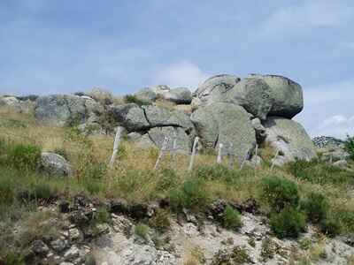 Mont Lozère is fundamentally a granite mass that rose from the bowels of the earth some 280 million years ago. The high plateaus present "summits" with cold and leached soils, and flats with thicker soils cultivated by man. But the first impression is summarized as chaos of collapsed granite blocks either on a lawn where the spikenard—a grass—fescue, blueberries, and heather grow, or in heaths with brooms in flamboyant yellows during flowering, above which hover raptors tracking rodents, reptiles, and insects.
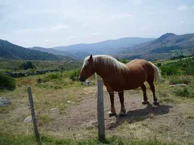
Flat landscapes, battered by a winter almost as harsh as at the Arctic Circle, crisscrossed by streams that join in the valleys. The waters of the Tarn thus flow peacefully amidst pastures and peat bogs. Up to 1,300 meters altitude, herds of cattle, increasingly of the Aubrac breed, graze near hamlets and traditional farms kept active. The poverty or richness of the pastures has always depended on Mont Lozère on the management of water. Irrigation played a considerable role there. Traces of the béals—channels—several kilometers long can still be found, which allowed water to be led to houses, to irrigate meadows, and to turn mills.
Another distinguishing feature of Mont Lozère is the presence of peat bogs. Nearly a thousand have been counted, some covering several dozen hectares (Sagnes peat bog). These acidic "pools," heirs of the glacial era, allow mosses, sedges, or the sundew (a carnivorous plant) to develop. Frogs and migratory birds such as sandpipers and lapwings also appreciate the peat bogs which, by absorbing large volumes of water to restore it fairly gradually, regulate its cycle at their level too.
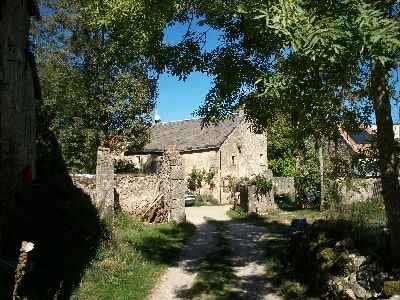
The northern slope of the Bougès mountain hardly differs in its configuration from Mont Lozère. Its southern slope, on the other hand, takes on more Mediterranean accents with schist hamlets and chestnut groves.
In these regions, the evolution of vegetation largely reflects the history of pastoralism and, conversely, the presence of the forest. Thus, the beech and fir forests that populated Mont Lozère in the Gallo-Roman era were progressively destroyed by the herds. But since the early 20th century, the moor, pines, and birches are beginning to reconquer the abandoned pastures. The ONF (National Forestry Office) also favors the planting of beeches and firs. Wild boars, deer, and roe deer have colonized these forests. And on the northern slope of Bougès, the national park has reintroduced the capercaillie, which had disappeared for two centuries.
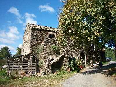
 To better get to know this region, the Cévennes National Park offers visitors the opportunity to make a first stop at the Mont Lozère ecomuseum, whose central point is located in Pont-de-Montvert.
Hiking in the Cévennes
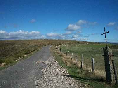
The Cévennes offer a royal choice to walkers. More than 2000 kilometers of marked trails dotted with stopover gîtes and bed and breakfasts (each year, the national park publishes an updated sheet) and sometimes inns are available to enthusiasts.
- The long-distance hiking trails: the GR®7 and its variants GR®70 Stevenson Trail, GR®71 and GR®72, the GR®6 and its two variants, the GR®60 the trail of the great draille and the GR®62, and finally the GR®43 and GR®44.
- The long-distance hiking circuits; parallel to the GRs, they constitute routes around the main massifs: tour of Mont Aigoual GR®66, 78 km; tour of the Cévennes GR®67, 130 km; tour of Mont Lozère GR®68, 110 km; Tour of the Causse Méjean country GR, 100 km.
- Landscape discovery trails, lasting a few hours and accessible practically to everyone, have been created by the national park. A guide to the park's hikes is on sale in the information centers.
- Nature interpretation trails, with explanatory tables.
- Guided trails of the national park: in summer, departing from information centers and upon prior registration, they allow, under the guidance of park staff, a better discovery of the region.
 The main resources of the territory around 1950 were: beef breeding in the granitic and basaltic mountains; sheep breeding in the limestone mountains with summer transhumance; cereals in the Velay plain and on the Rouergue plateau; chestnuts and marrons in Vivarais and Rouergue; early vegetables and fruits in the Rhône valley; vines in Bas-Languedoc; Roquefort cheese.
For industry: steelworks in Saint-Étienne and its satellites in the Gier valley; ribbon making in Saint-Étienne, Bourg-Argental, Annonay; spinning and weaving in Mazamet, Castres, and Lodève; leatherwork in Millau and Annonay; lace from Le Puy-en-Velay. Finally, silk, which, dependent on Lyon, occupied part of the activity on the entire eastern slope of the Cévennes. But just as the difficulty of finding shepherds led to the progressive decrease in sheep flocks, similarly, the high cost of labor, which followed the disappearance of family businesses, led to the rapid decrease in silkworm nurseries. The factory production of artificial silk took over, while completely modifying, this once so vibrant industry.
Vocabulary. — A certain number of words from the geographical glossary, of Languedocian origin, are in common use: truc, isolated summit; suc, suchet or suquet, rounded summit; puech, py, puy or pi, often a volcanic dome; baou, baousse, small summit; bar, barre, barrier summit, from the Celtic barr, closure; caylard, cheylard, from kaïr, steep rock; cham, summit; claps, clapas, rockfalls; peyre, stone (la Peyro Plantado, planted stone, not as a sacred menhir but for useful marking in the "sibères" or snowstorms); serre, serreyrède, jagged barrier mountain, sierra; causse, limestone plateau; can, a very small causse veneered on granites; avens or tindouls, holes and water absorption chasms in the Causses; baumes and spélunques, caves; béal, béalière, small irrigation canal; lavogne, in the Causses, an open-air cistern collecting rainwater for the flocks to drink; foux, sorgue, spring, resurgence of waters from the limestone plateaus; ratchs, whirlpools in the rivers; planiol, calm basin due to water retention; mas, house; casaouet, cazalet, chazelle or tchazelle, round dry-stone hut with a conical roof; draille or draye, transhumance path, located on the watershed ridges.
 The last griffon vultures were killed in the 1940s... Thirty years later, a handful of naturalists bet on reintroducing these raptors into the Jonte gorges. Despite natural difficulties and local reluctance, the operation succeeded. It is hailed worldwide. More than two hundred vultures now soar around the Causse Méjean.
 The story of a few nature enthusiasts.
Above the Jonte, the great air gliders soar with the patience of the azure. Carried by the warm air. Nature puts on a show in Lozère. For the pleasure of walkers in the gorges, the slow dance of the griffon vultures caresses eternity. An anthropomorphic and poetic illusion, however. For during four decades, the limestone cliffs echoed only with the absence of the great raptors. The last "bouldras" had been exterminated in the 1940s, gradually eliminated by hunters' lead or strychnine intended for foxes, wolves, and other carnivores. But the folly of some was repressed by that of others. Killed by men one day, the birds were saved by men another day.
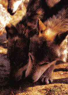
The territory of the Cévennes National Park has therefore not been the scene of excessively strong protests so far, and this despite a proactive policy regarding reintroduction. It would have been otherwise if the lynx had been reintroduced into the region... The question arose a few years ago. The national park refused to commit to this path. However, many naturalists do not exclude seeing the lynx and perhaps the wolf spontaneously reappear in the Cévennes, in the Gévaudan where a beast far too human terrorized generations since the 18th century. The dreaded felines have already gained ground in the Alps and the wolves have crossed the Italian border to settle in the Mercantour... Regulating animal populations.
In 1995, this threat is however not the primary concern of the managers of the Cévennes National Park, who readily agree that reintroduction methods have been refined and that the scientific monitoring of animals replaced on a territory that must suit them has become more precise. Yet, all is not well in a world spared by these large predators. It is then necessary to advance on a delicate issue: game damage. Damage caused by hordes of wild boars and bands of deer (the latter were reintroduced by the park), causing serious harm to farms and forest stands. Healthy and prolific animals, which have multiplied in recent years in certain parts of the Cévennes, but also in many regions of France. An increase due to that of the forest environment, to agricultural abandonment, and which occurs at the expense of the hare and the partridge.
 Officials of the public establishment wrote it in La Lettre du parc: it is "a real ordeal for the Cévennes." They therefore decided to act in an exemplary manner by involving all stakeholders in solving this problem. Because anger swells when dozens of wild boars plow cultivated plots, destroy bancels (cultivated terraces) or béals..., when roe deer graze on protected plants or broadleaved species useful for biodiversity. Farmers, foresters, and nature protectors indeed have reason to fuel their resentment against hunters who would not be capable of applying hunting plans and would have made the wild boar a "king game" with which they like to fill the freezer.
To try to thwart this overdensity of animals in certain places, the park has therefore wanted to play the consultation card. The overall objective of the measures taken was to "manage the large fauna by integrating all the actors and the interests concerned." For the wild boar, for example, the hunting period was extended by one month, regulation culls were instituted in areas closed to hunting—17% of the surface area of the central zone of the park—to flush out reproductive females, so-called administrative drives were organized, hunters were required to keep a shooting log...
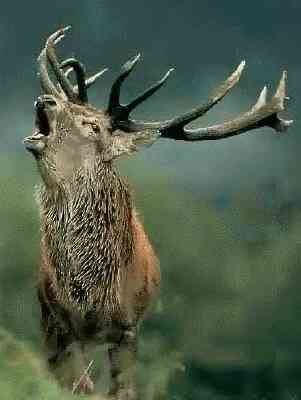 To return to the numbers of the early 1990s for red deer and roe deer, it was also necessary to regulate the populations. There again, hunting plans were increased, regulation culls were implemented, but also started to better monitor the evolution of populations massif by massif, by measuring the impact of deer on the flora. It is still a question of making silviculture take a turn by favoring natural regeneration, by maintaining thickets of herbaceous and woody plants to hinder access to the seedlings and increase food for the deer... Convincing the foresters and in particular the ONF (National Forestry Office) to review their methods is not the easiest thing.
This game "ordeal" is an opportunity for the park to affirm or reaffirm certain principles of its action. One of the main objectives is obviously to safeguard ecological balances by favoring the evolution of environments, but without forgetting to take into account the presence of man. In other words, there can be no squeamishness around the issue of animal regulation.
This explosion of wild boar and deer populations undoubtedly played a part in precipitating the decision to take a "pause" in the policy of reintroducing wild species. In 1995, the director of the park, Guillaume Benoît, asserted that they were at a turning point. "We no longer have a reintroduction project, we will not put capercaillies back into nature."
The last animals reintroduced will have been the capercaillies (six hundred individuals until 1994). The manager explains that this is the end of an emblematic approach. "Our real job is to reason in terms of habitats and no longer just in terms of species." Explanation: the capercaillie, for example, cannot be satisfied with just any forest. And it does not appreciate at all, for example, the hordes of mushroom pickers. We cannot therefore think of reintroducing it if we cannot offer it an environment that suits it. The successor to Guillaume Benoît, Gérard Moulinas, installed in February 1998, is not expected to go back on this option, faithful to the European concept of Natura 2000.
One must finally be convinced; in our latitudes there is no longer and can no longer exist any shred of virgin nature. Would this even be the case in an integral reserve of a few hectares? In a French-style national park or in a protected area, the path of the animals that one would like to be wild always crosses at a given moment that of men. For worse or for better, as the fate of a colony of griffon vultures proves... "Le Parc National des Cévennes", Louisette Gouverne, Nathalie Locoste, Actes Sud Édition