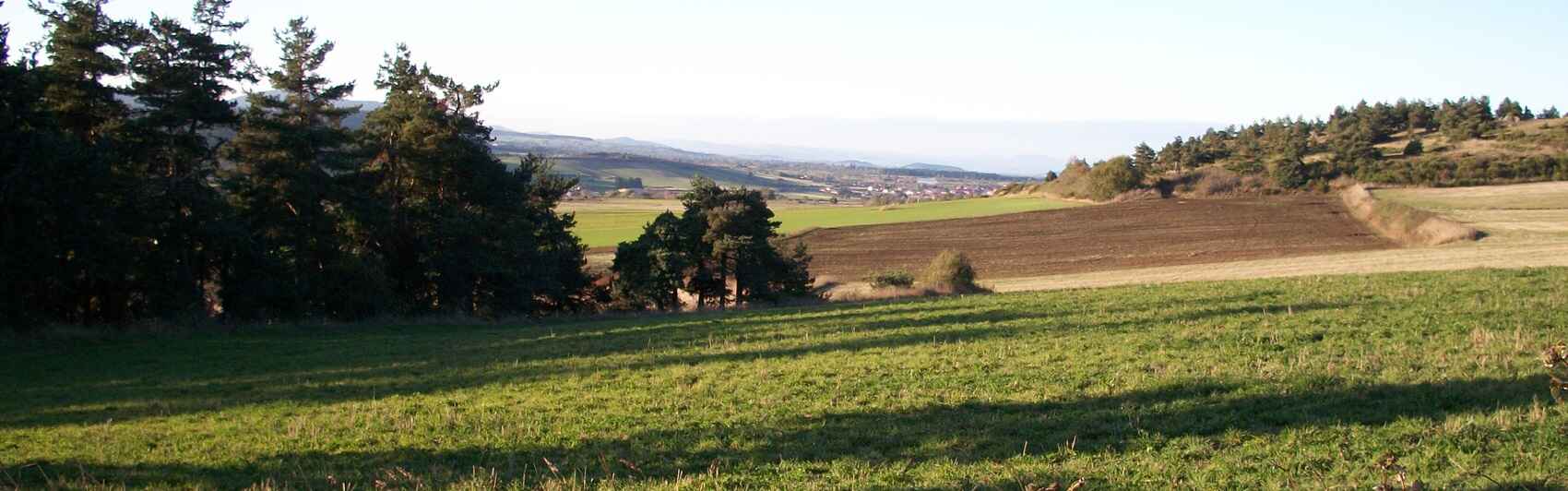
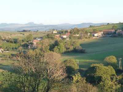
The Velay is dominated by volcanic plateaus, from which emerge cones and domes called "sucs", as well as basaltic reliefs carved by erosion. Its flora is typical of plateaus, with beech and fir forests, moors with broom and heather, and emblematic crops like the Le Puy green lentil. Farming is mainly bovine, contributing to the production of characterful cheeses. The heritage and history of the Velay are marked by the figure of Saint James of Compostela, of which Le Puy-en-Velay is a major starting point. Local architecture is distinguished by the use of volcanic stone and slate roofs (lauzes), especially in traditional farms and Romanesque churches.
 A spectacular volcanic geology
Arranged on either side of the Loire Valley, the high plateaus of Velay offer landscapes of great variety. Here, the usual morphostructural layout of the Massif Central is found: a metamorphic and granitic basement, intersected by small tertiary tectonic basins, locally topped with a volcanic cover.
Topographically, the diversity is even greater: the highly dissected and multifaceted relief of the Chaise-Dieu plateau contrasts with the vast flat expanses of the basalt flows; the gorges of the Allier and Loire in the basement contrast sharply with the broad valleys that cross the chains of tectonic basins; the volcanic structures and peaks surprise with the steepness of their slopes.
 Although the historical unity is undeniable, well-centered around the town of Le Puy-en-Velay, the geographical regional limits are less clear: one imperceptibly passes from the Chaise-Dieu plateau to that of Livradois in the north and, towards the south, from the Mézenc massif to the high Ardèche; the Langeac and Brioude basins resemble the Limagne d'Issoire; the only two sharp boundaries are the Allier valley to the west, facing the Margeride, and the abrupt edge above the Rhône slope.
Three natural regions, with distinct characteristics, clearly stand out: to the west, the Devès; to the east, the eastern Velay, sometimes referred to as the Mézenc plateau; in the center, the Le Puy basin.
 The architecture of the western Velay is extremely simple: a high plateau, between the Allier and the valleys of the Loire and the Borne, serves as a pedestal, at an altitude of around 1,000 m, for an alignment of volcanic structures called the Devès chain, named after the main summit (1,421 m). This is a crystalline horst (granitic and gneissic), clearly visible in the Fix-Saint-Geneys area, which was covered by basalt flows from Villafranchian strombolian cones. Much older than in the Chaîne des Puys, the cones are worn and the craters barely visible, but the structures can still be clearly read, distinctly dominating the plateaus.
From the same age, explosion craters also characterize this volcanism: they create circular depressions occupied by lakes (Lake Bouchet) or marshy and peaty formations (Limagne Marshes). The heavily weathered surface basalt flows bear andosols with great agronomic qualities. The cones no longer have the equilibrium slopes of their beginnings: while they still have steep slopes that sharply contrast with the high flat surfaces of the basaltic plateaus, long concave connections link them to these plateaus, allowing crops to climb halfway up the slope.
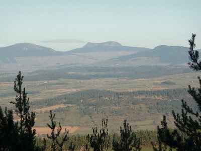
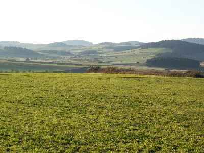
Similar aspects are found in the eastern Velay: flat spaces created by overlapping basalt flows that slope from 1,200 m to less than 1,000 m to the north and west, a few explosion craters like that of Lake Saint-Front or the Chaudeyrolles depression, but the originality here comes from the presence of high volcanic structures (reaching 1,753 m at Mont Mézenc), the existence of small basins like that of Saint-Julien-Chapteuil, deep and narrow valleys, and the suddenness of the contact with the rugged terrain that transitions to the Rhône valley.
 The great massifs and the Le Puy basin
Three phonolitic massifs rise abruptly above the whole:
- To the north, from Saint-Julien-Chapteuil to Yssingeaux, the Meygal-Lizieux massif. To the west, it is formed by about ten small isolated peaks, with rounded shapes, arranged in North-South alignments; from Mont Jaurence to Mont Plaux, from Rand to Mont Chanis; to the east, the Meygal and Lizieux are more significant, formed by a wide pedestal, dominated by pyramid-like peaks with steep slopes and bare rock; popular language refers to them as "sucs".
- In the center, the Roches plateau between Fay-sur-Lignon and Saint-Front appears as a massive lava dome.
- To the south, the Mont-Mézenc-Gerbier-de-Jonc complex where isolated peaks (Gerbier-de-Jonc, Roche-Tourte, Roche du Bachat) rub shoulders with heavier forms resting on a kind of platform as at Mont Mézenc-Alambre; to the east, in the large amphitheater of valleys descending towards the Rhône, the peaks have even steeper flanks forming large cones (Suc de Touron, Roche de Borée) or pyramids (Rocher de Pradoux, Suc de Sara).
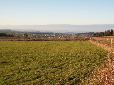
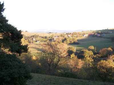 Between the high plateaus of the Velay stretches the Le Puy basin. At the confluence of the Borne and Loire valleys, this poorly cleared basin, whose altitudes are always above 600 m, is cluttered with mounds and plateau elements of various shapes. The Loire valley widens very strongly here before becoming deeply encased in gorges between Peyredeyre north of Chadrac and Lavoûte-sur-Loire. Aside from the lower Dolaison valley in which the modern city of Le Puy-en-Velay is developing, the only truly extensive flat spaces are to the east between Saint-Germain-la-Prade and Blavozy as well as towards Lantriac where they join the Saint-Julien-Chapteuil basin.
Elsewhere, tiered plateaus with steep edges dominate, with summits so flat they have been called "plains" (plaines): this is the case for the "Chambeyrac plain", the "Rome plain", and the "Chadrac plain"; above these flat elements are a few convex-topped mounds called "gardes", such as the "Garde d'Ours" near Taulhac. In the middle of the most open depressions rise volcanic plugs such as the one on which the Polignac castle was built or the famous Corneille rock (known as the Virgin) and Aiguilhe rock which served as the original site for the city of Le Puy. The basin extends, locally, into deep, steep-sided valleys, dominated by cornices and ending abruptly upstream, like a blind valley (Ceyssac, Dolaison, or Riou valleys).
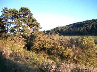 The geomorphological history of the Velay blends with that of the Massif Central: the flattened Hercynian basement was fractured and uplifted during the Tertiary before being largely covered by volcanic terrain. From the Eocene, a tectonic basin was created in the Brive-Charensac-Blavozy region, a basin filled with relatively coarse detrital materials of the arkose type; sedimentation continued with variegated sandy clays and green and pink marls with gypsum intercalations; it ended with limestones dated to the Lower Oligocene.
During the Miocene, sporadic and violent flows, quite similar to flash floods occurring in modern arid regions, dispersed clayey-sandy alluvium containing pebbles of quartz, granite, and even flint. They can sometimes be observed trapped under the basalt flows. Tectonic instability continued until the Villafranchian, during which two infilling episodes can be observed: the oldest shows a dominance of fine materials, sands, and clays; the most recent also contains clays but additionally presents beds of coarse sands and conglomerates; these deposits were themselves tilted.
From the Upper Miocene until the beginning of the Quaternary, the region experienced large-scale volcanic episodes. To the east, the volcanism is initially characterized by the stacking of numerous flows that cover the high granitic blocks and give them a flat appearance; further north, in the Emblavès basin, there are small basaltic flows and trachy-andesitic domes; in the Boutières region, a complex strato-volcano was built, affected by a caldera which would largely explain the Boutières amphitheater; the most original landscapes are given by phonolitic intrusions in the form of heavy domes (Alambre, Mézenc), lava domes (Meygal-Lizieux), protrusions (Rocher de Borée, Gerbier de Jonc), or ring structures (Rocher des Pradoux, Suc de Sara); finally, a late explosive episode complicated the whole by creating an alignment of maars (Saint-Front, Chaudeyrolles).
 Glaciations and climatic upheavals
In the Le Puy basin, the volcanism is even more original, taking the form of breccias contemporary with the first Villafranchian infilling. Placed at the bottom of a lake, these breccias were later freed from the soft sediments that surrounded them to form necks, real peaks that give the basin its well-known character.
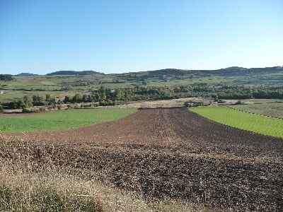
The paleoclimatic conditions in the Velay were never cold enough to allow a significant, continuous glaciation to exist. Certainly, the start of a glacial valley has been recognized in the upper Lignon valley, but it seems that the remains of an ancient debris-covered glacier are the only unquestionably glacial deposits. They are located in the Entraygues valley, at the eastern foot of Mont Mézenc. Composed of coarse, heterometric, and angular material, this long accumulation, stretched at the bottom of the thalweg, endowed with a sudden termination, closely recalls the debris-covered glaciers observed in the Alps.
On both sides of Mont Mézenc, when the ridge line is above 1,300 m, the top of the Rhône slope is cut by small amphitheaters, suspended above the main thalwegs: they correspond to the reshaping of the valley heads by cold processes where snow and ice could play an effective erosive role. This phenomenon was favored by snow over-accumulation; the violent wind that raged on the high plateau swept the snow which accumulated in massive cornices at the top of the Rhône slope (the phenomenon is still observed today every winter).
 The region was mainly marked by periglacial conditions, particularly during the last cold period, and the resulting deposits still condition the broad outlines of the geography today. For a long time, researchers' attention has been drawn by the existence on the slopes in particular, of vast sheets of rubble named "chiers", "chirats", or "clapiers" in the local language. In fact, several types of periglacial formations fringe the phonolitic massifs of the upper Velay: the highest parts and the steepest sectors of the flows bear beautiful sheets of frost-shattered scree; the rock, highly susceptible to frost shattering, was split into flat slabs of all sizes, but generally decimetric; as they are or re-cut, they were used as "lauzes" (slate roofs) to make the rustic roofs of the oldest houses in the region.
 On most of the slopes, the blocks thus broken by frost were mixed with a clayey and silty matrix that allowed them to flow slowly downwards during thaw periods. They form large coatings that can be described as geliflucted because of their mode of emplacement. In the valleys and notably the ones best supplied with snow, these coatings take on the appearance of real mass infillings, which can reach several meters high, up to 5-6 m; they end abruptly and can be marked by irregular ridges and lobes.
The most surprising of the formations encountered here look like rivers of stones, real corridors of blocks and rubble, stretched over hundreds of meters, even exceeding a kilometer, with a width not exceeding a few tens of meters. The thickness, of a few meters, shows an accumulation of heterometric blocks, the largest on the surface, the smallest at the base, well interlocked with each other, without a fine soil matrix. Numerous transverse ridges mark these stone rivers which end in an abrupt front, at constant altitudes, 1,000 to 1,100 m for the Meygal (1,100 m at the Roches massif, 1,300 m at Taupernas-Lauzière-Montfol). Among the placement hypotheses, the most sensible seems to be the one that assimilates these stone rivers to a kind of rock glacier whose material moved thanks to an interstitial ice cement (permafrost). These are forms that have long been inactive, which explains their poor state of preservation, especially when compared to those of the high Southern Alps. However, these formations are rich in lessons; they testify to a cold and dry environment, with local permafrost, conditions that were those of the upper Velay more than 18,000 years ago.
 Rural society and farming traditions
The great variety of physical and geographical conditions translates poorly in human terms; the Velay indeed presents an undeniable unity. On the margins of Auvergne, in contact with the Vivarais facing the Rhône valley and the Mediterranean, it is practically identical to the Haute-Loire department and is organized around its "capital" Le Puy-en-Velay, a historically active commercial and industrial city, which radiates over all the highlands that surround it.
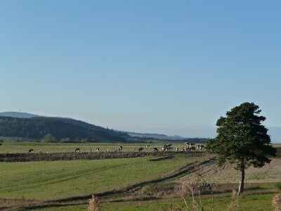
The rural world recalls the Auvergne regions of the East and South: it is a partitioned environment, historically organized by small farmers; the large estate is rare. Plowing and mixed farming (polyculture) are very widespread there. The deep-rooted peasant influence brings to mind the Livradois and the Margeride. Despite the altitude, no fine pastoral system has developed: there is nothing comparable to the Cantal, nor even to the Monts Dore. It must be said that we are here in a less humid region, in a position of relative shelter: natural grass grows less well, plowing is more "encouraged", even at fairly high altitudes; the crops of cereals, potatoes, turnips, and cabbages largely exceeded 1,000 m in the last century, reaching their maximum cultivation limits in the Massif Central (1,400 m around Les Estables) on the high plateaus of the Mézenc to the east.
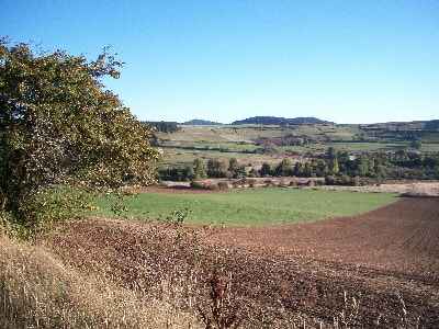
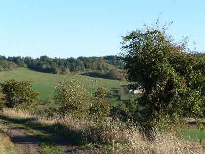 Traditionally, a bit of everything was produced, enough to feed the often large family. The land is always very fragmented, the small property shared among heirs; the field, surrounded by low dry-stone walls, sometimes bordered by a few trees, is often tiny. The house is of modest size. We are here in an environment of small peasantry although the Velay has not experienced densities as high as those of the nearby Livradois.
Despite significant rural exodus, the demographic peak has often been late. Farms grew slowly and loyalty to small-scale polyculture remains in some parts of the Velay. Tradition lingers on these high plateaus.
If the population remained quite high for a long time, if people were able to make a living, it was because they had recourse to supplements alongside small-scale farming: seasonal emigration existed as elsewhere. Young men were hired for agricultural work in the South of France or the Rhône valley. But this movement is in no way comparable to that of the "merchants" of the Cézallier or the Cantal, which brought ease and sometimes wealth.
Working from home was much more decisive: the image of the lace-makers (dentellières) is identified not only with the city of Le Puy, but with the entire Velay. In every farm, women had their "carreau" (lace pillow) and worked for a city merchant during the long winter evenings; even if the income was modest, it was a welcome addition. This spread of crafts in the countryside undoubtedly recalls the Livradois (where Ambert provided custom work). Today, the last rural lace-makers have disappeared, but efforts are being made to relaunch this activity as cultural heritage even if fashion changes and wages, which are quite low, are hardly encouraging. The fact remains that lacemaking played a significant economic and social role in the region's history.
 The decline of polyculture and the religious soul
Finally, let us not forget that agriculture had at its disposal, if not in all the Velay at least in the West and the center, a specialty production which, at the cost of intensive and exhausting labor, could be economically interesting: the green lentil ("Lentille Verte du Puy"), whose name remains attached for the general public to that of the Velay.
The cultivation developed within the framework of small family polyculture. Requiring a lot of care and a tremendous amount of artisanal hand labor. But, in the context of an agriculture of the past which did not account for the cost of labor in its cost prices, the production could be highly profitable in good years. However, lentil cultivation barely resisted modernization: from 4,000 hectares in 1955, it dropped to just 900 in 1980.
Haute-Loire, which, before the Second World War, delivered nearly three-quarters of the lentils produced in France, currently provides less than 10%. The drop is strong despite the establishment of a strict professional organization. The lentil is now produced elsewhere, mainly in the large plains of the south of the Paris Basin. The local situation is fairly easy to explain: too demanding in terms of personnel, the cultivation hardly accommodates the reduction in workforce due to the rural exodus. Conversely, the mountain farms have not expanded enough to practice massive mechanized cultivation.
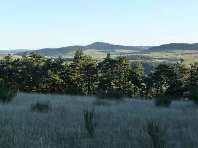 Small, labor-intensive properties, farming pushed very high in altitude and, by contrast, the weakness of pastoral life, seasonal emigration, lentil production, the endless winter nights of lacemaking: all these elements sketch the contours of the rural Velay. We should not forget the extraordinary social cement constituted by religion. As for the neighboring Margeride, it is undoubtedly the proximity of Protestant lands that explains why one of the unyielding bastions of the Catholic faith was forged here in past centuries. Religion still plays a very large role in daily life and many children attend private Catholic schools. It must be recognized that there is a powerful factor of unity here. But at the same time, the Velay presents a highly nuanced face to the traveler.
Beyond the notions of a harsh highland, small peasantry, and partitioned environment, physical diversity exists. In the center, the Le Puy basin is a small "plain" in the heart of the mountains. To the west, the Devès tables are an endless landscape of plowing. To the east stretch the great, wild solitudes of the Meygal and the Mézenc. Finally, the North, the Yssingelais, has an original figure with its centuries-old tradition of small industry. The proposed hiking itineraries will allow you to grasp and experience some of these multiple, fascinating aspects.
Black Glaciers, Debris-Covered Glaciers, Rock Glaciers. Unlike the large stratovolcanoes of Auvergne, the Velay experienced very localized glaciation. In the eastern Mézenc, only small cirques contained tiny glaciers from which escaped short tongues of ice, quickly covered with rock debris. We speak of a "black glacier" or "covered glacier" to designate such phenomena (an example of which has already been described in Aubrac). These debris-covered glaciers indicate a climatic context in which the share of ice decreases in favor of slope contributions (blocks provided by frost shattering): they are intermediate forms between glacial forms and periglacial forms. In their place today remain tongues of rubble which correspond to the old debris cover hiding the ice. Debris-covered glaciers can be distinguished from true rock glaciers observed very widely in the eastern Velay (Mézenc, Meygal) but also in southern Margeride. These are clusters, tongues, or lobes of blocks that were bound by an interstitial ice cement (permafrost) allowing the whole mass to flow. They indicate a harsh periglacial environment.