


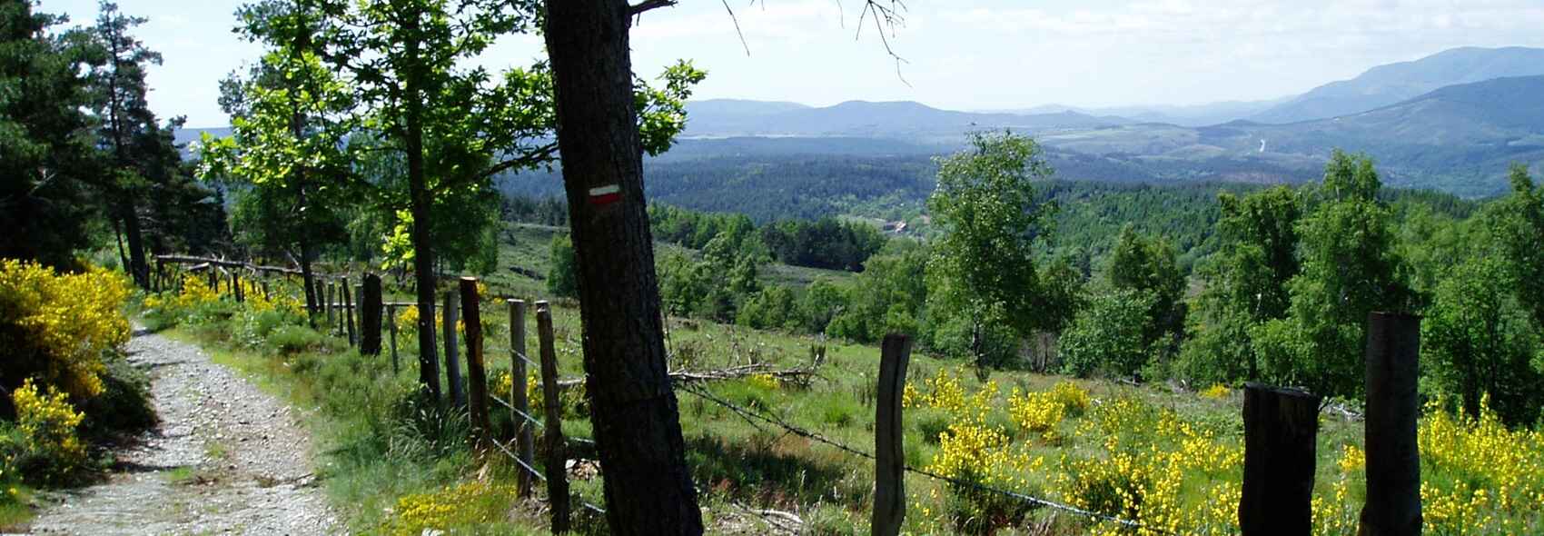
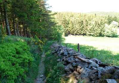
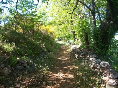
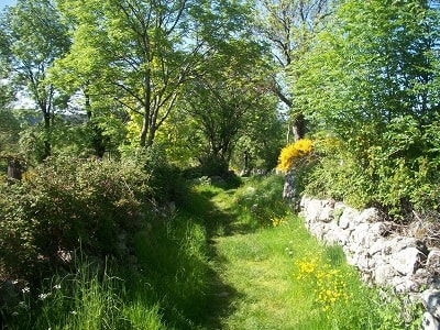
Major communication routes once crisscrossed the Gabale region, and the most significant among them are well worth mentioning. The most renowned is the Régordane (GR®700). As the main artery of the pagus Cabalicus, it established connections with the East via the southern provinces of Gaul—notably Provence and Narbonnaise—as well as with the central provinces of Arverne and Velay. This great route played a crucial role in the formation and development of Langogne. Its existence predates the Roman conquest, though the Romans significantly improved it by constructing bridges over rivers, laying large paving stones, placing milestones to mark distances, and erecting stelae dedicated to the god Terminus to delineate territorial boundaries.
The Régordane began at the port of Saint-Gilles on a branch of the Rhône, which was heavily trafficked at the time by boats, galleys, and ships of all kinds—Phocaean, Roman, and Levantine vessels arriving from Carthage, Rome, Athens, the Bosphorus, Palestine, or Egypt. It passed through Nîmes, followed the Gardon, and reached Portes via Alès. It then climbed the Espinouse, crossed the Ventalon pass, bypassed Mont Lozère, and arrived at Vielvic, followed by l'Estrade near Villefort. From there, it headed towards Bayard, La Garde-Guérin, Le Thort, and the Mercoire forest, slipping past Les Choisinets and Le Mas-Richard toward Langogne. It crossed the Langouyrou via a ford, traversed Langogne, climbed Le Cheylaret, and cut across the slopes of Mont Milan to reach Fontanes before heading toward the oppidum of Condres. After crossing the Allier and continuing along the river's left bank, it followed the ridge line overlooking the Monistrol-d'Allier valley, hastening toward Brioude, the gateway to the Arverne territory.
As it crossed the Gévaudan, the Régordane connected several remarkable locations: Vielvic (vetus vicus), a junction between the Languedoc, Helvian, and Gabale regions; Bayard, a crossing point over the Altier river, initially by ford and later by a Roman bridge; and La Garde-Guérin, an eagle's nest and former bandit stronghold brought to heel by Bishop Aldebert du Tournel around 1150. It subsequently became a peaceful residence for "pariers"—guides and protectors who escorted travellers in exchange for a toll. Further along lies Mercoire and its abbey of Cistercian nuns, which served as a relay for pilgrims and travellers, and Langogne, a Benedictine city featuring a Roman bridge and numerous diverging paths. Mont Milan and Condres served as the final protective oppida of the Gabale lands. Near this last point, the route intersected with the via Bollena—which likely later became the via Agrippa—before crossing the river over a Roman bridge to head towards Brivate (Brioude).
The original name "Régordane" appears to derive from rec or reg (river) and ourdan (path), which together form reg-ourdan. Indeed, its route follows numerous rivers and streams: the Gardon, Altier, Langouyrou, Chapeauroux, and Allier. Some authors have mistakenly claimed that the name originated from the Emperor Gordian, though no serious evidence supports this theory. Another, more picturesque hypothesis derives it from the Occitan word regard, a term for a lamb born out of season. These animals, born after the summer grazing period and unable to chew the tough late-summer grass, had to return early to the sheepfold, thus inspiring the name "Regord-ane". For completeness, it should be noted that the muleteers who frequented this cami were called "Regordans" or "Regordians". Illustrious figures have travelled this road: Julius Caesar, on his way from Narbonnaise to the Arverne territory or Aps; around 1162, Pope Alexander III, travelling from Maguelone to Paris; and three kings of France: Saint Louis in 1254 returning from Aigues-Mortes, Philip III the Bold in 1283, and Philip IV the Fair in 1285. Later, the Constable Du Guesclin followed it to reach Châteauneuf-de-Randon.
A Path for Merchants and Muleteers
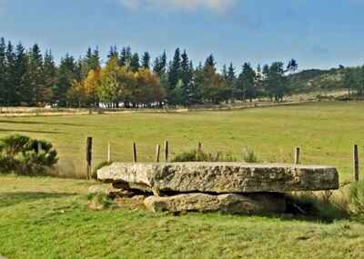
The "Régourdans" transported cloth, wine, salt, and various other goods from Languedoc to Le Puy-en-Velay along this millennial route of transhumance and trade. The path was lined with dolmens, rock inscriptions, and messages whose meanings remain deeply mysterious today.
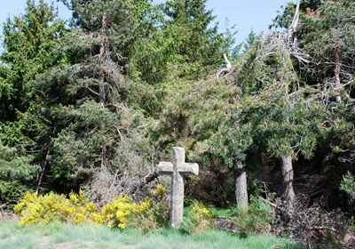
A Sacred Path for Pilgrims
Pilgrims travelling to the tomb of Saint Gilles or to the Black Virgin of Le Puy followed the Régordane. This route connected to the Ways of Saint James via the via Podiensis (GR®65) at Le Puy-en-Velay and the via Tolosana (GR®653) at Saint-Gilles. Dotted with sacred sites, it was also lined with a chain of hospitals and lazar houses; Pradelles still preserves one of the last four standing vestiges in Europe. Great spiritual figures, such as Pope Urban V, Adhémar de Monteil (Bishop of Le Puy and papal legate), and Raymond of Saint-Gilles, walked this sacred path.
An Epic and Historical Route
The Régordane was taken by Julius Caesar when he crossed the Cévennes and served as the stage for the exploits of William of Orange, who liberated Nîmes from Saracen occupation—an epic recounted in the Charroi de Nîmes, one of the oldest chansons de geste. As a true artery of the great movements in medieval history, this itinerary later inspired renowned creators and writers such as Alphonse Daudet, Sergei Prokofiev, and Jouany du Désert.
A Path of Tales and Freedoms
The Régordane witnessed successive challenges to the Roman Church: Arianism, Catharism, and Protestantism. It was a privileged witness to the struggles for freedom of conscience and human rights, embodied by figures like Rabaut Saint-Étienne (the famous pastor from Nîmes) and the Marquis de La Fayette. We must also not forget the Camisard revolt, the Resistance maquis during the Second World War, or the fierce struggles of the Cévennes miners to secure their social rights.
The second major artery in the region is the via Agrippa, named after the Roman general Marcus Vipsanius Agrippa (or the consul Menenius Agrippa). It connected Saint-Paulien (Ruessium), the capital of the Velay, to Javols (Anderitum), the capital of the Gabales, and extended into the Ruthenian territory. Also known as the via Agrippensis, it refers to the vast network of Roman roads established in Gaul during the 1st century BC. Agrippa, entrusted by Octavian with the reorganization of Gaul, designed this exceptional network to facilitate legion movements and trade.
The via Agrippa radiated from the Empire's new strategic settlement: Lugdunum (modern-day Lyon). It was structured around four major roadways: a route towards the Atlantic from Lugdunum to Saintes; a route towards the English Channel and the North Sea, passing through Chalon-sur-Saône, Châlons-en-Champagne, Reims, Beauvais, and Amiens; a route towards the Rhine via Langres and Trier; and finally, a southern route descending towards Arles and Marseille.
Experts disagree on the precise dating of these roads' construction, but all agree they were established under the aegis of Agrippa and Octavian Augustus. Estimates vary between 39/38 BC, 22/21 BC, or 16 to 13 BC. Numerous remnants of the via Agrippa survive in various regions, notably in the Valentinois. Its route through the Rhône valley closely mirrored that of the current Route Nationale 7. In traversing the Massif Central, the via Agrippa left an indelible mark on the landscape, testifying to its vital strategic and commercial importance.
Finally, a third route, the Bollena—which ancient authors such as Ptolemy, Strabo, and Lucan described as connecting Ruessium to Anderitum via Condates (Condres), before heading towards Ad Silanum (near Rodez) through Puech-Cremat in Ruthenian territory—might well be nothing more than the primitive name for the via Agrippa.

The Bollène road, also known by its Latin name via Bollena, was a major artery connecting Lyon to Bordeaux. Established around 43 BC under the direction of Agrippa (who would become Augustus's son-in-law), it played a driving role in commercial exchange and mobility throughout Gaul. Crossing a large part of the Massif Central, particularly the Forez (territory of the Segusiavi), it established itself as one of the most fundamental communication routes in the Gallo-Roman world. Today, precious remnants still dot its path, safeguarding its past grandeur.
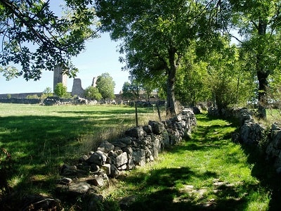
Many other roads and major paths crisscrossed the territory, notably to connect Condres to the oppida of Mont Milan, Châteauneuf, and Grèzes. Sections of "strada"—a local dialect term logically derived from the Latin strata—can still be found in the vicinity of these various entrenched camps.
In parallel, a network of rural paths, known as drailles or drayes, crisscrossed the region. They generally followed the transhumance routes of sheep flocks heading up to the mountains for the summer, while also connecting various habitation centres. One of these drailles started in Langogne, passing through Le Mas-Neuf and Le Mazigon below Pratellae (Pradelles). These places, marked by the stay of Roman legions, have yielded numerous artifacts: coins, medals, and weapons. The draille then headed towards Saint-Chaffre and Mont Anis. Over the centuries, it became a communication route of prime importance, used annually by cohorts of knights, troubadours, and pilgrims from the southern regions, who went up to solemnly offer "the Falcon to the miraculous Virgin of Le Puy-en-Velay".