


Visit to Villefort and its Surroundings at the Time


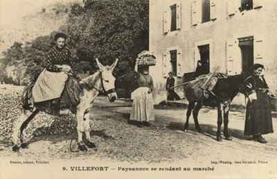
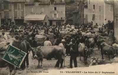
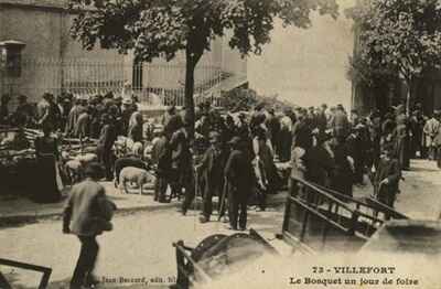
Even then, Villefort and its surroundings were a popular destination for travelers seeking wild landscapes and fresh air. The village developed as a strategic crossroads at the foot of Mont Lozère, attracting visitors with its mountain climate and panoramic views. Early tourists particularly enjoyed hiking on the Régordane Way trails, which offered breathtaking views of the valleys. The construction of the dam and the creation of the artificial lake then transformed the region into a veritable seaside resort in the heart of the Cévennes. Water sports such as sailing and swimming became the driving forces of the local economy from the mid-twentieth century onward. The hotels and inns in the town center welcomed a loyal clientele seeking the peace and cool air of the Cévennes. The viewpoint overlooking the Chassezac gorges offered a breathtaking panorama of nature's power and the rugged terrain of this granite region. The built heritage, with its cut-stone houses and narrow streets, added an authentic charm to the stays of summer visitors. Local fairs and traditional markets offered the opportunity to discover regional products such as honey and chestnuts.
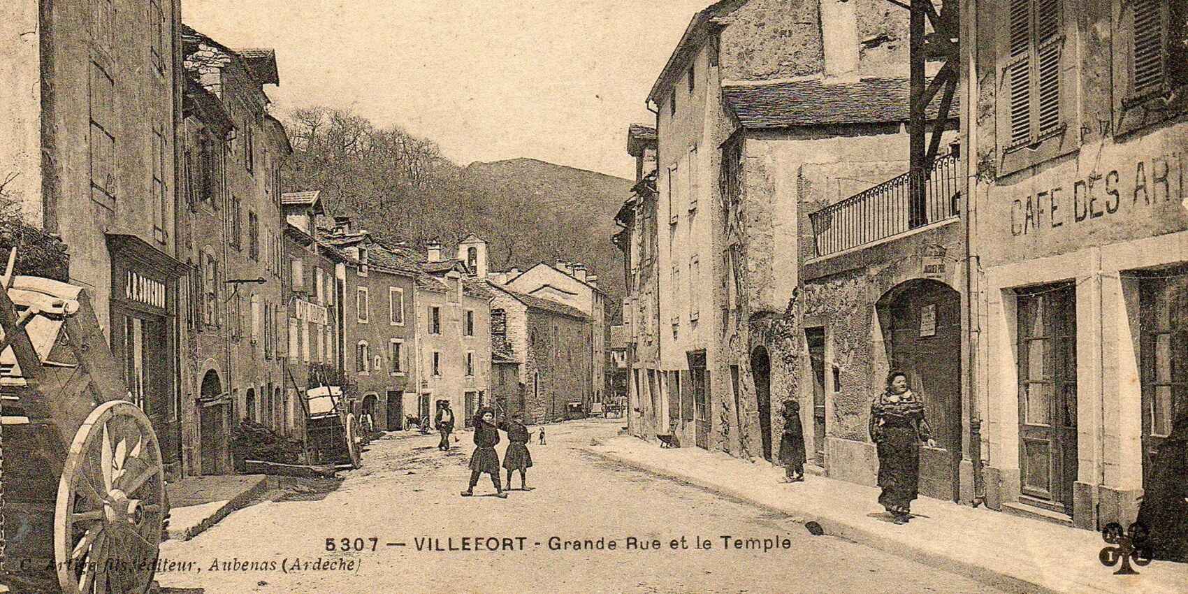
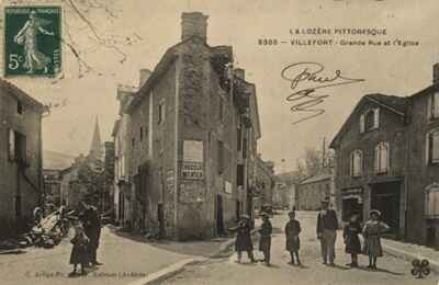
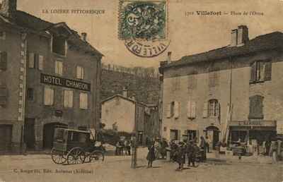
 Villefort (605 m; train; buses to Mende; Hôtel Balme, 32 rooms, tel. 14; Hôtel du Nord, 20 rooms, tel. 12), 868 inhabitants and summer resort, located at the bottom of the Palhères valley, is separated to the north from the Altier valley by the ridge pierced by the Bayard tunnel, and to the south from the sources of the Cèze by the narrow ridge crossed by the Villefort pass. On the church square, there is a house from the 14th century. Villefort, the homeland of Odilon Barrot (1791-1873), is an excellent center for excursions to visit the Mont Lozère massif, the gorges of the Altier and Chassezac, and the Cèze valley.
 Excursions around Villefort:
1° La Garde-Guérin (10 km north via route N. 106).
2° Circuit of Les Vans and Borne (to the east; 51 km). From Villefort to Les Vans, 24 km via route N. 101. From Les Vans to Villefort, 27 km via the road to Borne. One can add a visit to the Païolive Forest to this excursion.
3° Circuit of Mont Lozère (to the west; a superb circuit of 80 km, highly recommended; but a very rugged route, on poor roads, passable only from late May to late September). From Villefort, follow the narrow, winding route C. 66, which leads back to its origin, the wild valley of Palhères: a superb course in a large wooded circus, followed by an ascent to the ridge, through the Armes Wood. Ridge of Tête-de-Bœuf, the eastern extension of the ridge of Mont Lozère, from where one can climb the rock of Malpertus in one hour.
Following the ridge to the west, one soon sees, ahead and to the left, the rock of Malpertus, which has a chimney that facilitates climbing.
The rock of Malpertus (1,683 m) or Pic Cassini, a pile of granite blocks, a first-order trigonometrical signal (corresponding to the signals Guidon du Bouquet, Dent de Retz, Croix de Bauzon, Randon, Puech d'Alleuch, Aigoual), rises at the eastern end of Mont Lozère, which is its most interesting summit: a magnificent panorama extending to Mont Blanc, Ventoux, Canigou, and Puy de Dôme. The rock dominates, to the northwest, the meadows where the sources of the Tarn are formed (approximately 1,525 m).
 From the ridge of Tête-de-Bœuf, leaving a very picturesque but difficult road to the left, which descends to (16 km) Génolhac, one follows the road to Finiels, which is very rugged. Mas de la Barque (1,402 m; fountain), a forest house generally unoccupied. The road passes south of the rock of Malpertus, crossing the ravines that descend to the newly formed Tarn, then the Tarn itself, and winds along the southern slope of Mont Lozère, above the valley. L'Hôpital, a hamlet where a small road branches off to the left, descending to (33 km) Pont-de-Montvert via Villeneuve. The road to Finiels, very picturesque, crosses the Rieumalet ravine. One rejoins the C. 20 road which is followed to the right: if one goes left, one would descend to (37 km) Pont-de-Montvert.
 Finiels, a hamlet followed by a superb winding ascent through bare slopes sprinkled with granite boulders.
38.5 km. Col de Finiels (1,540 m), from where one can discover a huge view, to the north over the Margeride mountains, and to the south over the Causses and Aigoual. Following the ridges to the west, one would reach the signal of Finiels (1,702 m) in 30 minutes, the summit of Mont Lozère, from where the view is hardly more extensive than from the pass itself.
Mont Lozère, very frequented in winter by skiers, is a thick granite formation in the east-west direction, whose center is part of the watershed of the Cévennes between Cèze and Altier (Rhône) on one side, and Lot and Tarn (Garonne) on the other. It steeply drops on its perimeter, but the summit is hardly more than a vast plateau of rolling pastures that barely exceed the highest peaks.
From the Col de Finiels, a track follows the ridge of this plateau, passing at the foot of the signal of Finiels, the signal of Laubies (1,660 m) and the rock of Laubies or Servies (1,561 m; superb panorama), which will join at the Croix (le Maître Vidal, 13 km west-northwest) the forest road to Bagnols (11 km from the Croix to Bagnols).
 From the Col de Finiels, the road descends on the vast granite slopes of Mont Lozère, through the pastures. One leaves to the left a forest road (impassable by car) which, traced below the ridge, would lead to the Croix of Maître Vidal (16.5 km west; 4 hours on foot).
Chalet du Mont Lozère (1,450 m; open all year; dormitory for 40 people), from where one can directly ascend to the signal of Finiels by following the planted stones up to the ridge (follow to the right, poles; about 45 minutes from the chalet to the summit).
One leaves to the left the hamlet of Malavieille. The road descends a schist valley. Le Mazel, a hamlet: a zinc and silver lead mine abandoned since 1946. Le Bleymard (1,069 m), where one crosses the Lot. La Remise, from where one returns to (80 km) Villefort via route N. 101.
 From Villefort to Saint Ambroix through the Cèze valley:
(42.5 km southeast via route D. 51, very picturesque). The route D. 51 branches left onto route N. 106, after passing the Villefort pass, and descends in large loops into the valley of the newly formed Cèze, which it reaches at (5 km) Saint-André-Capcèze. First, one follows the valley floor. Vielvic. One crosses the Cèze at the foot of Brésis castle, an eagle's nest from the 13th century, built on a spur. A little further, the road, leaving the valley floor, rises very sinuously on the steep slopes of the left bank. Aujac. Very beautiful route. In large curves, one descends back into the valley at (31 km) Lalle: coal mines.
Bessèges (381 m; railway; Hôtel du Commerce, 65 Rue de la République, 14 rooms; Hôtel du Luxembourg, 55 Rue de la République, 12 rooms), 5,648 inhabitants, center of the Cèze coal basin, on both banks of the river, between high hills: blast furnaces, foundries, forges, glassworks, etc.
 1 km south, the ruins of the priory of Saint-Laurent from the 12th and 15th centuries.
Bessèges is a good starting point for excursions in the upper Cèze valley and in those of its tributaries, the Luech and the Gardonnette. 5 km upstream, in Peyremale, a picturesque little village situated on a narrow spur overlooking the confluence of the Cèze and the Luech, is the fork of the two roads: one climbs the wild gorges of the Luech, covered in maquis, up to Chamborigaud; the other ascends the right bank of the Cèze and then the picturesque valley of the Gardonnette up to Génolhac.
Route D. 51 descends the left bank of the Cèze and crosses the Ganière near its confluence, at (35 km) Foussignargues. To the right, a bridge leading to Robiac, on the right bank, whose Romanesque church contains a beautiful painting by Sigalon. Molières-sur-Cèze; mines. Meyrannes; ruins of the castle of Montalet, on the right bank. Saint-Ambroix, where one arrives after crossing the Cèze, to the right.
Route N. 106, leaving Villefort, crosses the Villefort pass (655 m), leaves route N. 101 to the left, overlooks the small basin where the Cèze springs to the left, and, describing large curves, runs along the mountainside, dominated on the right by the steep slopes of Mont Lozère, dominating on the left the valley of the Cèze: a very beautiful route.
Concoules (584 m; railway; Hôtel Beauséjour, Hôtel du Mont Lozère), a small summer resort; Romanesque church. The road descends in large curves.
Copyright©etoile.fr