


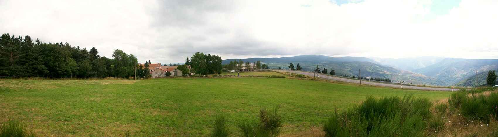
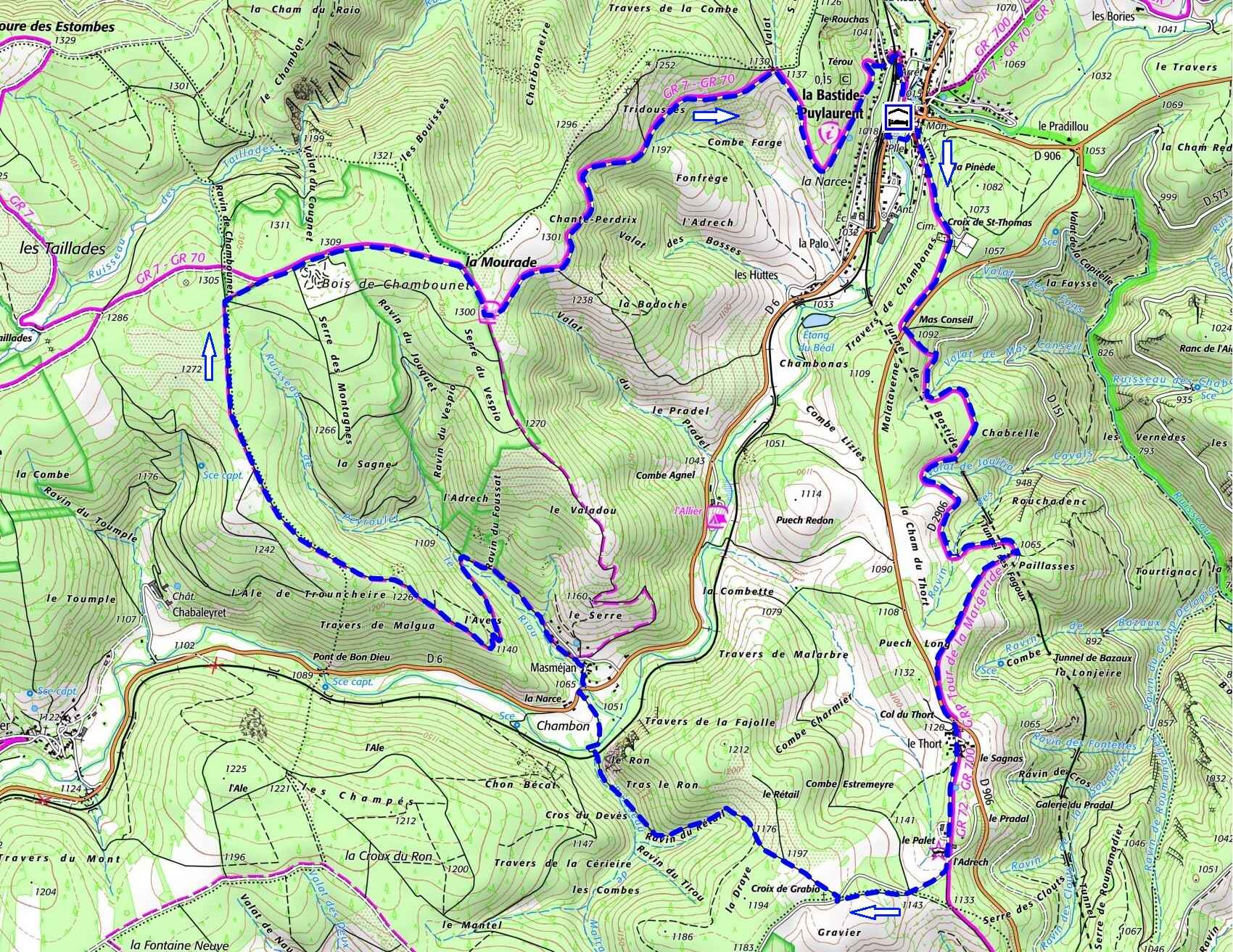
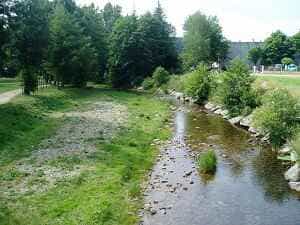
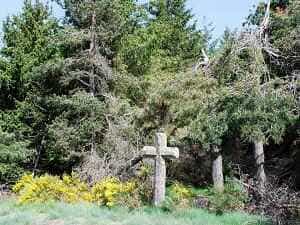
Exiting L'Etoile Park through the gate, turn left and cross the Allier River via the footbridge. Join the back of the church and follow the Regordane trail shared with the GR72, which ascends to the hamlet of Thort located on the watershed line. Next, pass by the Thort dolmen, also known as the Palet de Gargantua, and leave the GR trail markings to climb to the right towards the Croix de Grabio. Take the road just before the cross, which descends to Masméjean. 300 metres before the hamlet, by the Allier River after the small bridge, you'll find an ideal spot for a picnic. After Masméjean, the trail climbs towards the Moure de la Gardille. At the top of the plateau, turn right towards the Allier Valley and La Bastide-Puylaurent by following the Stevenson Trail GR70 and the shared GR7. As you descend, you'll be greeted with a spectacular view of the Ardèche mountains and the Notre-Dame-des-Neiges Abbey in the distance.
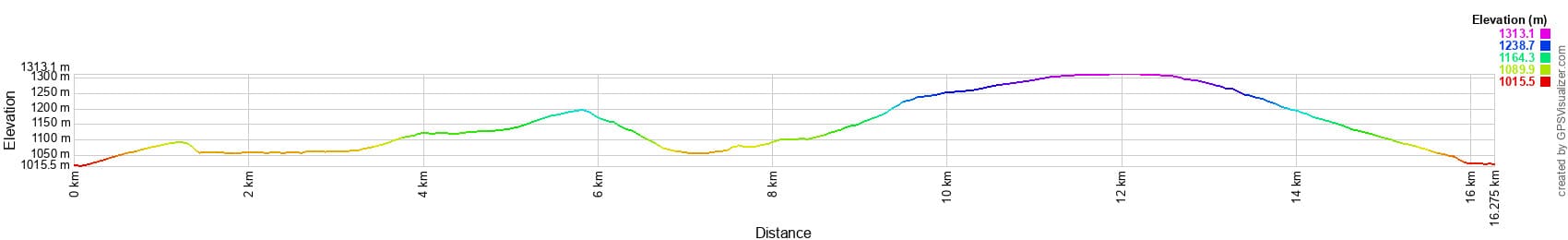

 Distance: 16.3 km, Maximum elevation: 1,328 m, Minimum elevation: 1,014 m, Total ascent: 429 m
IGN Maps: La Bastide-Puylaurent (2738E), Largentière La Bastide-Puylaurent Vivarais Cévenol (2838OT)
Mazon vividly describes the Cévennes muleteers and their equipment, revealing the picturesque and colourful aspect of their outfit and their convoys. These mountaineers, often called "padgels", wore a red wool cap topped with a large felt hat with wide brims that could be adjusted according to weather conditions. Their outfit was distinguished by bright colours: a loose jacket in white cadis, short breeches in green cadis, white gaiters decorated with red garters, a scarlet wool belt and a red tie. They also wore gold earrings decorated with a mule shoe, recalling their profession. The muleteers formed impressive convoys, or "coubles", where each mule, richly harnessed, carried heavy wineskins. The animals wore copper plates — or "phalerae" — on their heads, decorated with red pompoms and a high wool plume. During parades in the sun, these ornaments produced sparkling flashes, adding to the spectacular character of the whole. The muleteers came from villages in the Cévennes such as La Bastide-Puylaurent, La Garde-Guérin, Villefort and Saint-Laurent-les-Bains, embodying the spirit of the mountains in their dress and role.
The Regordane Way, of Celtic origin, has long linked La Bastide, Villefort and Langogne. Used since Antiquity, it ensured communication between Nîmes and Clermont-Ferrand and gained in economic and strategic importance with the Roman conquest in the 2nd century BC. This road facilitated trade, allowing muleteers to transport products such as wine from the south and cheeses from the Massif Central. The Phoenicians also used it to travel to Great Britain in search of tin. From a strategic point of view, the Regordane ran along the eastern border of the Gabal region and was monitored by Caesar's Camp, near Langogne. It also played an important role during the conflicts between the Franks, Burgundy and the Visigoths of Spain in the 6th century. Over time, this road became a major axis, integrated into the Royal Route 106, then renamed the Imperial Route, National Route 106, and finally the Departmental Route 106. From 1835, work modified the route to smooth out certain difficult passages, notably between Saint-Laurent-les-Bains and the adjacent pass, then between the pass and La Bastide, creating the current route of the D4. Around 1880–1885, a diversion of the National Route 106 made it possible to avoid the climb of Thort, this section joining the D4 as it enters Lozère. More recently, the C.D. 906 was redeveloped to follow the historic route of the Regordane at Thort, thus reconnecting with its ancestral course.
The Thort dolmen, also known as the "Palet de Gargantua", is a megalith located along the Regordane route, an ancient passageway linking the south of France to the Massif Central. This dolmen is a fascinating testimony to human presence and ancient cultural practices along this historic route. It is formed of large upright stones making up a burial chamber, topped with an imposing slab evoking a monumental table, which earned it the nickname "Palet de Gargantua". Local legends often associate these megaliths with giants, and the mythical character of Gargantua, popularised by Rabelais, is frequently invoked to explain these imposing structures — the large slab is interpreted as a stone disc thrown by this legendary giant. The Thort dolmen probably dates back to the Neolithic period, around 5,000 years ago, a time when such monuments were often used as collective burials. Its position near the Via Regordane bears witness to the importance of this route for commercial and cultural exchanges over the centuries. The "Palet de Gargantua" is fully integrated into the heritage and collective imagination of Lozère. Easily accessible to hikers and enthusiasts of megalithic heritage, the Thort dolmen is one of the highlights of the Regordane route, offering a link between the past and the present in a unique setting.