
26km hike at La Bastide-Puylaurent
4km / 11km / 14km / 15,5km / 16,3km / 19km / 21,5km / 23,2km / 24km / 26km
Google Maps - Google
Earth

Distance: 26km, Elevation maximum: 1475m, Elevation minimum: 995m, Elevation gain: 502m
IGN Maps: La Bastide-Puylaurent (2738E). Le Bleymard (2738O). Largentiere la
Bastide-Puylaurent Vivarais Cevenol (2838OT).
Print this hike: PDF - JPG 
From L'Etoile at La Bastide-Puylaurent to Allenc (32km).
With a car: take the road D6 towards Mende via les Huttes, Masmejean, the castle of Chabaleyret, Chabalier, Chasserades, the viaduct of Mirandol, les Chazeaux, Belvezet, Montbel, le Col de la Pierre Plantee (N88) and Allenc via the D27. (Google Itinerary)
With the train: La Bastide-Puylaurent to Allenc (SNCF timetable).
From Allenc to the road D71 between Belvezet and le Cheylard l'Eveque: no markings : (Recommended
detailed map : IGN 2738 O 1/25000). Bring a picnic; no food or supplies on the way! (the 11 june 2004 this pathway was done in 7h 00- ascent 900m, descent 900m)
Railway station of Allenc. We cross the level crossing and by taking a trail on the left overlooking the road, we go up towards the village, and still on
the left, we discover the church and its bell-gable with six arcades overlooking some splendid flagstone roofs (the religious edifice was built at the romanesque period). Head straight in front,
towards L'Altaret and le Mazel. Turn slightly left on a grass covered trail right after the bridge. By turning over, we can admire one last time the village of Allenc. Some green markings make their
first appearance.
Take the first path on the left. Follow carefully the grass field on its left side and reach within a few minutes a white path slighlty overhanging. Take it until reaching a small
road, which will lead you to the small village of Larzalier which we can catch a glimpse of afar, with on its left, its cement anti-snowdrift tunnel. At the bottom of the small valley we cross on a
level crossing and follow the small road going slightly up towards Larzalier; small village on the south side of the causse of Montbel.
In the calm small village of stone houses and flagstone roofs,
there is a granit ferradou (the local name for the cattle crush; which was mainly used to shoe the cattle). Another level crossing between the tunnel and the ancient railway station (Trains do not
stop at Larzalier anymore since several years; alike Daufage on this same railway between La Bastide-Puylaurent and Mende; which peaks over 1200 metres of
altitude and in winter the weather is quite harsh on the rails). Here is the plateau du causse de Montbel, chequered by pasturelands and resinous trees planted with the gardener's line. The white
path that we follow is straight until the horizon, crossed by the mountain of Gardille.
At the first intersection, continue straight on and enter in a resinous wood. When getting out of this wood,
continue straight on. On the left, afar, can be seen the village of Montbel which gave its name to the causse which we are crossing. Continue straight on once again ! Find the yeallow markings
PR. Cross the road D6 and take the grass-covered path between two gates towards a white house. Cross another road; the D206. At the indication panel go towards Les Baraques and Combecibran. On our
left, in a background of flowering brooms, is the small village of les Salesses. At the top of the small slope, and by turning around to catch our breath, there is a vast view over the causse de
Montbel and its village on the right and on our left, the village of Belvezet. We cross the two hamlets of les Baraques and Combecibran.
Once past this last one, the small road stops and our
itinerary takes a superb path, zigzaging between two two small rock walls, crossing a stream on an old stone bridge and going slighlty up to an intersection of four paths. We continue in front until
reaching the road D71 which we will follow on the left for less then 100 metres. It is at this point that we find the GR®7 and the track who goes to
Le Fraisse. Follow the GR®70 Stevenson trail South to La Bastide Puylaurent.
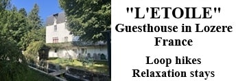
Old romantic Hotel, L'Etoile Guest-House is a mountain retreat in the South of France. With a
beautiful park along the Allier River, L'Etoile Guesthouse is located in La Bastide-Puylaurent between Lozere, Ardeche and Cevennes. Many hiking trails like GR®7, GR®70 Stevenson trail, GR®72, GR®700 Regordane way, Cevenol, GR®470 Allier river, Margeride. Many hiking loops. The right place to relax.
Copyright©etoile.fr


