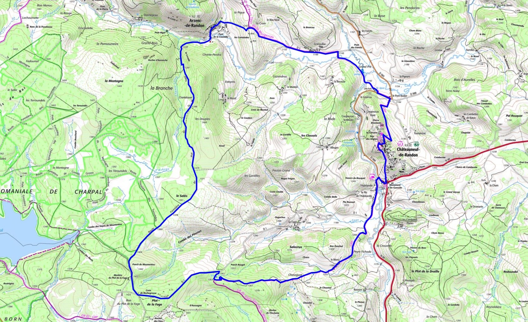
Distancia: 21,7 km
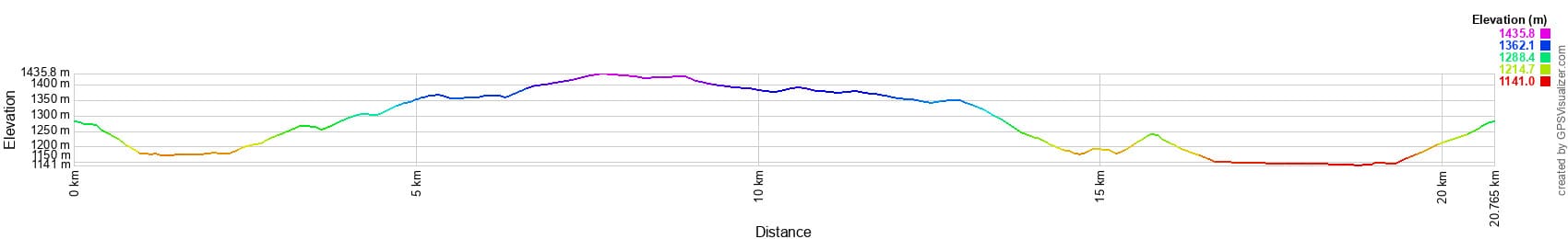
Altitud máxima: 1431 m
Altitud mínima: 1141 m
Desnivel acumulado: 470 m
Mapas IGN: Châteauneuf-de-Randon (2639E), Grandrieu (2737O), Le Bleymard (2738O)
Altitud máxima: 1431 m
Altitud mínima: 1141 m
Desnivel acumulado: 470 m
Mapas IGN: Châteauneuf-de-Randon (2639E), Grandrieu (2737O), Le Bleymard (2738O)