16,6 km vandring i St-Laurent-les-Bains i Ardèche16,6 km Wanderung in St-Laurent-les-Bains in der ArdècheSenderismo de 16,6 km en St-Laurent-les-Bains en ArdècheEscursione di 16,6 km a St-Laurent-les-Bains in ArdècheΠεζοπορία 16,6 χλμ στην St-Laurent-les-Bains στην Αρντές16,6 km vandring i St-Laurent-les-Bains i Ardèche

16.6 km hike in Saint-Laurent-les-Bains

16,6 km vaellus St-Laurent-les-Bainsissa Ardèchessa16,6 km fottur i St-Laurent-les-Bains i Ardèche.
Randonnée de 16,6km à Saint-Laurent-les-Bains16.6公里的徒步旅行在阿尔代什的圣洛朗莱班Пеший тур на 16,6 км в Сент-Лоран-ле-Бен в Ардèche.
16,6 km wandelen in St-Laurent-les-Bains in de Ardèche.

Google Maps - Google Earth

IGN Hike of 16.6 km in Saint-Laurent-les-Bains


Elevation Profile of the 16.6 km Hike in Saint-Laurent-les-Bains


16.6 km Hike in Saint-Laurent-les-Bains 1 16.6 km Hike in Saint-Laurent-les-Bains 2 16.6 km Hike in Saint-Laurent-les-Bains 3 16.6 km Hike in Saint-Laurent-les-Bains 4 16.6 km Hike in Saint-Laurent-les-Bains 5

qrcode-gpx

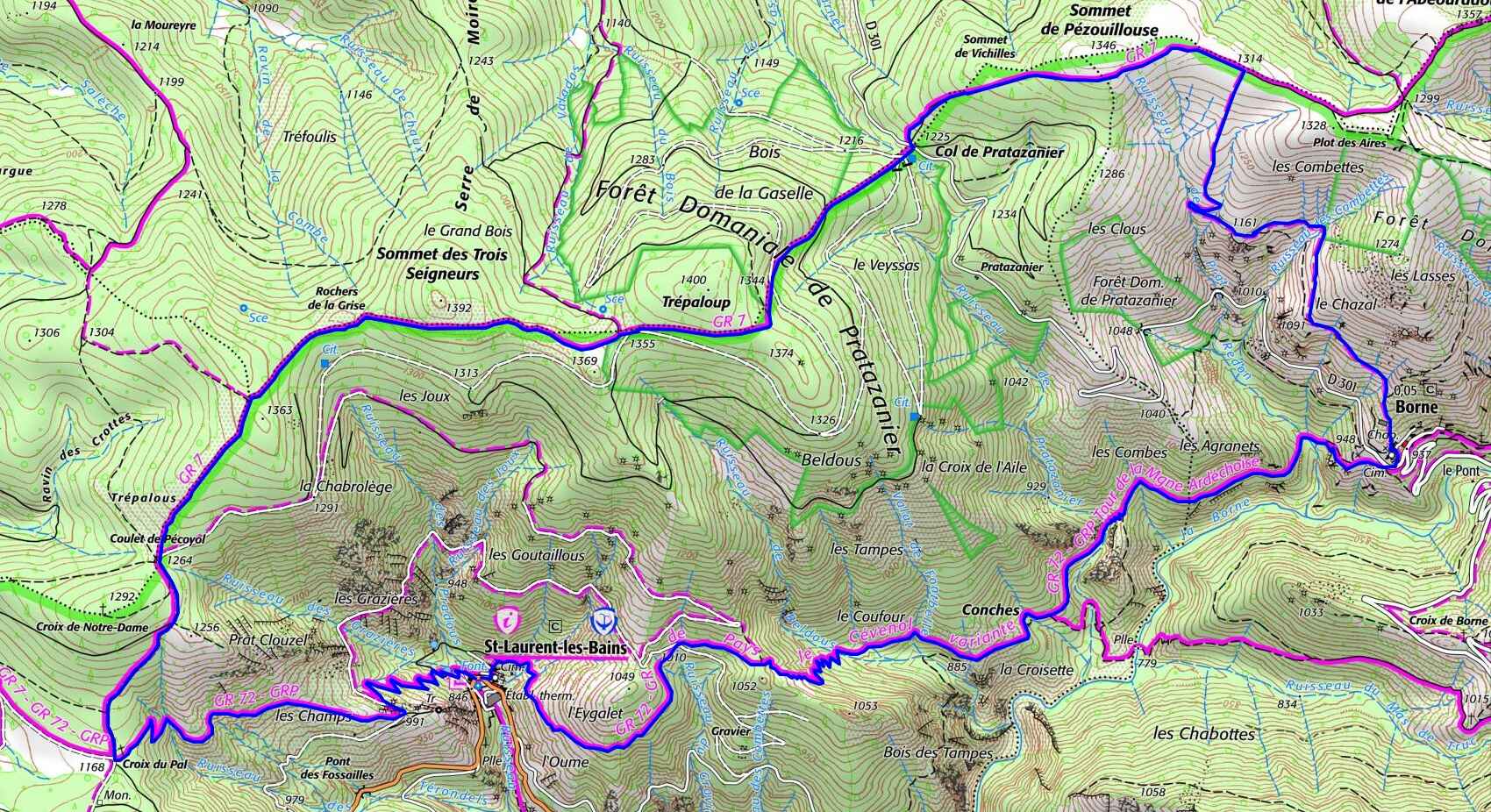
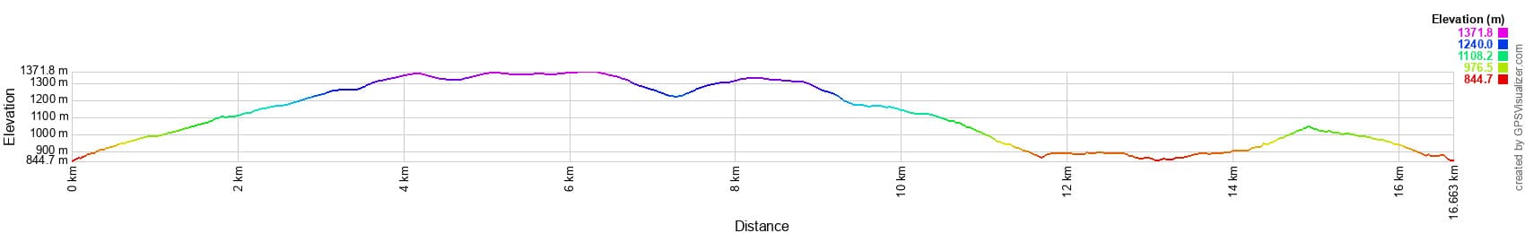
Distance: 16.6 km, Maximum altitude: 1368 m, Minimum altitude: 849 m, Total elevation gain: 860 m
IGN Maps: Largentiére la Bastide-Puylaurent Vivarais Cévenol (2838OT)


L'Etoile Guest-House between Cevennes, Ardeche and Lozere in the South of France

Former holiday hotel with a garden along the Allier, L'Etoile Guest House is located in La Bastide-Puylaurent between Lozere, Ardeche, and the Cevennes in the mountains of Southern France. At the crossroads of GR®7, GR®70 Stevenson Path, GR®72, GR®700 Regordane Way, GR®470 Allier River springs and gorges, GRP® Cevenol, Ardechoise Mountains, Margeride. Numerous loop trails for hiking and one-day biking excursions. Ideal for a relaxing and hiking getaway.

Copyright©etoile.fr