
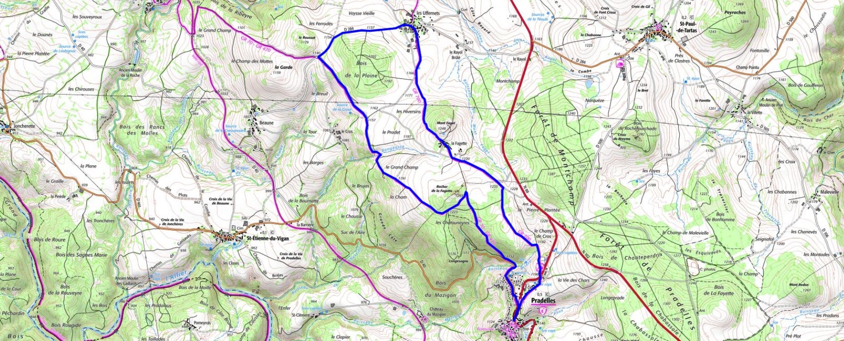

 Distance: 11.5 km
Maximum altitude: 1,234 m
Minimum altitude: 1,141 m
Total elevation gain: 196 m
IGN Maps: 2737SB - LANGOGNE GRANDRIEU.
Distance: 11.5 km
Maximum altitude: 1,234 m
Minimum altitude: 1,141 m
Total elevation gain: 196 m
IGN Maps: 2737SB - LANGOGNE GRANDRIEU.