|
Hiking and staying in the Cevennes |
 Under the cloak of a starless night, I found myself wrestling with sleep. My feet throbbed with a dull ache, a souvenir from yesterday’s journey that had stretched on for what felt like an eternity. As I had shared with you, I had been accompanying Philippe, our Brazilian companion Anna (a tourism student from New York interning here), and two other couples to the ancient fortress and town near La Garde-Guerin.
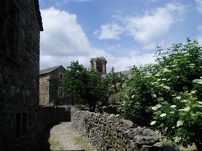
Our expedition led us to the old church in Puylaurent, a structure I believe was once part of La Bastide Puylaurent. The church, viewed from the outside, was a fascinating blend of architectural styles. One side bore the resemblance of a Greek sanctuary, while the other could have easily been mistaken for a Danish Romanesque church. The harmonious integration of the church with a neighboring house made it a sight worth beholding.
After paying our respects at the church, we found ourselves standing before a dam, straddling a river whose name eluded us. Was it the Allier? No, that didn’t seem right. The French couples pondered, studying the signs and maps as we stood there. After much deliberation, we concluded that we were at the Chassezac, a river I would encounter again in the subsequent stages of my expedition.
 The first leg of our journey, however, was by car to La Garde-Guerin. We navigated through minor roads to the highway, D907, heading towards Villefort. We passed through Prevencheres and even a golf course. Philippe and the others had described La Garde-Guerin as if it were merely a tower. I had envisioned something akin to Polignac outside Le Puy en Velay, a place I had yet to visit but had glimpsed from the twin rocks there, le Rocher de Corneille and the rock with St.Michel’s chapel on.
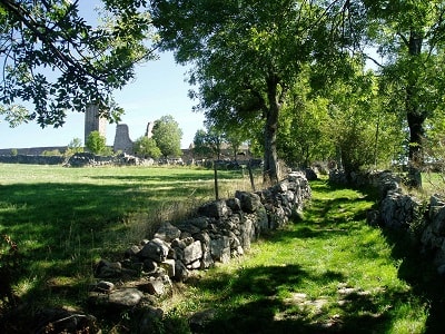
The tower offered a breathtaking view, strategically positioned on the Voie Regordane, the only real road from Paris to the Mediterranean Sea, as Philippe informed me. Even today, one cannot overlook the relatively small tower as it stands tall and proud. The well-preserved medieval town surrounding the tower left a profound impression on me. Unsurprisingly, a part of our group spent a considerable amount of time exploring the area in greater detail.
However, another part of our group was eager to embark on a walk back to La Bastide-Puylaurent. They invited me to join them, armed with a map and compass, confident in their ability to navigate the way back. But I preferred to walk alone. When they extended their invitation, Philippe had left to meet the other couple and Anna, and my bag was locked in the car. Later, after I had been sitting and waiting in the warm car, I asked Philippe if it was possible to find the way back without a map. He thought it was possible but not easy. It seemed from the incomplete maps he had in the car that I just had to walk north, and it couldn’t be that difficult. The route was marked as GR®72. Yes, I forgot all these guidelines, I believe, for else it would never have gone so wrong.
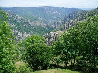
 Before I left, Philippe asked whether I knew the route signs, and I confirmed that. For I thought that there were only red and white marks, and if there were other marks it would appear with more signing. Therefore it turned out a little strange when I some time after was on my own and a yellow mark seemed to indicate that the route turned down in the gorge of Chassezac (Canyon). But so many cars were there, and a path led to the gorge, so it had to be the direction of the route. The cars perhaps belonged to the golf course nearby, for I did not see a single person down there, and the route ended like a cul de sac, so I found myself on some great rocky stones after a very hard descent.
And I, damned, continued on the ‘path’, though the landscape which more left the picture of a deserted area in Canada or Alaska, and it cost many efforts, not only to walk down there but also to walk along the gorge, and definitely to ascend from it, which I did. The slopes were steep and were not as gradual as the serpentine path on my way down, and I was happy when I finally caught the road in a heat which could almost frie an egg and in a bath of sweat.
 When I had begun walking on the road I had most in mind to continue on the highway to La Bastide-Puylaurent, and as I came to the town Albespeyres near Prevencheres and a Gite d’ etape “La Butinerie” I almost considered to walk in there and spent the night there, although it was only half past two at that time, not more than two hours since I had parted from Philippe, but which two hours ! I had only had one break apart from the many breaks of respiration on my way up from the gorge of Chassezac. But after the village, the signs directed me back to the gorge, on a much more convenient gravel road and not as the usual stony paths. I went through a tunnel under the railway, and met a family who went in the opposite direction, so it couldn’t be such a hard area.
After the railway the river followed, and then there was a bigger signpost I should have studied a bit more. It actually mislead me, because it did not lead to La Bastide-Puylaurent but to Prevencheres, I as mentioned didn’t recall, and then there was a sign there “Val et gorges de l’ Altier”, which I unfortunately read as “Val d’Allier”, the river outside the place I stayed. This meant that I walked in the direction east, where I, as mentioned, should have continued in the direction north.
I had the idea for a long time that the path just would turn around the mountain I walked close to, and then the main direction would be the same. But it did not, so I became more and more irritated. In the end I left the path but only to return, still in the wrong direction. I had lost the orientation and did not know where I were. I came to the village le Roure when it was half past four, and some hikers had written on the town sign the direction and distance to la Bessiere, and I regarded that for more reliable than the official signs along the path which continued to confuse me. After the village a path uphill lead to the viewpoint les Chalmettes, I have not been able to find on a map but which was called that and is placed south of la Bessiere.
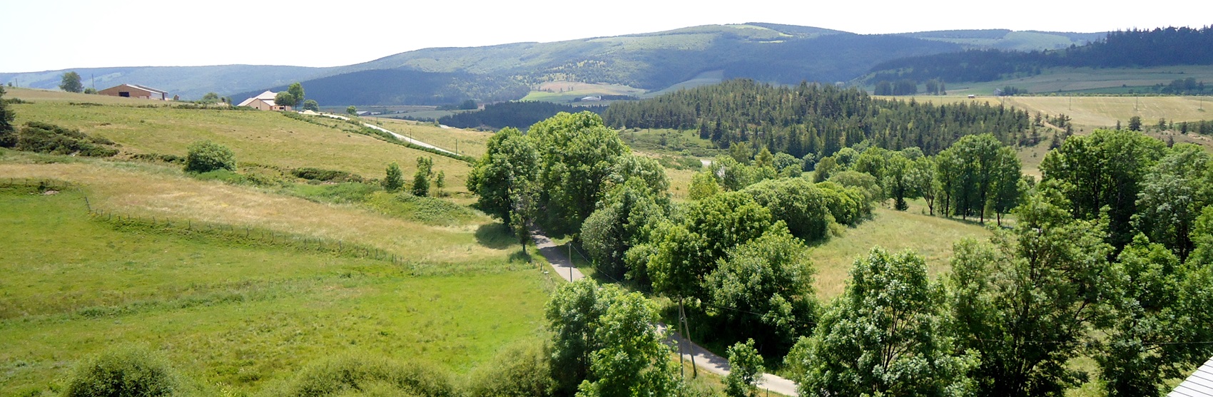
 At les Chalmettes there was fortunately a tap (or a faucet), and it was to find an oasis in the desert. At this point I could also look down a valley, where I hoped to find La Bastide-Puylaurent, Villefort or another town I could connect something with, but below there was a quite different town, situated deep down with a very significant lake, it seemed like, in the middle of the town. It turned out to be the very small town of Pied de Borne, which almost is built together with Sainte Marguerite-Lafigere and therefore seems big when you watch it from above.
La Bessiere lay to the north, but it was also the only direction if I didn’t want to go down to the town. I hoped to find a map of the area but found only a very local map. First a little further at a religious monument, I found a better map. La Bastide-Puylaurent was mentioned in the corner above right, and I got the name of the town, I had just seen from the hill. If I continued along the road, I would almost come back to la Roure which I did not want to see again, so I chose to walk across the fields in the direction of north-east until I reached a forest area. When I had reached that I went in the direction north but came to a steep rocky wall down. I had for a long while not had a break, in fact not since la Roure, and now not one hour had past but two, so I had a short break in the forest, but quickly I left with my bottle of water in my hand. After the break I had the choice of a road with a bar on my left hand and a road without a bar on my right (straight ahead was the dead end north direction).
 I should have chosen the road with the bar, for it would have lead me down to GR®72 and La Bastide-Puylaurent but I chose the other one. The path was again a dead end but it seemed to be possible to descend from this wall, and I hoped to come down to the valley. A valley can sometimes, however, be very differently. There are valleys where a stream flows, another where there is space for a road, a railway and perhaps some houses. But then there are also such valleys or gorges full of rocky stones over a perhaps smal stream which fights to come down there, where a river runs. And in this way was excactly the valley I came down to. It was not like the valley earlier on the day but definitely not to a sunday’s walk for disabled people.
The valley, more of a gorge, was a formidable obstacle. Yet, the promise of shade on the other side beckoned me forward. As I ascended the hill, the sun's relentless heat began to wane, replaced by the cool comfort of the shadows. A well-trodden path lay ahead, winding its way through the rugged, sculptured landscape. I yearned for a camera to capture the raw beauty, but alas, I had none. My location remained a mystery, lost amidst nature's grandeur.
 In the heart of this wilderness, my longing for civilization grew. And so, I embarked on my return journey. Navigating the serpentine trails, I descended into the quaint, almost deserted village of Les Baumes. There, I encountered two women, their smiles reminiscent of nuns in their serene abode. I could have asked to borrow their phone, as Philippe had promised to rescue me if I were lost. But the lure of the road was too strong, and I pressed on.
Beyond the village, a weathered kilometer stone pointed the way to La Bastide-Puylaurent. The distance, once clearly marked, was now barely discernible. I estimated it to be 8 km, but a chance encounter at a dam with a man enjoying the view revealed it was 12 km away. He kindly offered me a ride for 7 km, leaving me with just 5 km to walk. He hailed from Les Fagoux, across the Born river. I wondered if the route from Les Fagoux would have been shorter.
The road ahead was a winding serpent, slithering its way up the mountain. I found myself wishing for a more direct path, perhaps through a tunnel or over a bridge. As I neared La Bastide-Puylaurent, the distant hum of traffic, the rhythmic clatter of a train, and the tolling of a church bell filled the air.
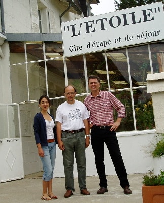
The town's signpost was a welcome sight, but the final stretch to L'Etoile Guesthouse seemed insurmountable. Just then, a familiar couple who had been navigating the route with a map pulled up beside me. They kindly offered me a lift.
That evening, gathered around the table with others, was a delightful end to the day. By Svend